
A few showers Wednesday; strong storms late Thursday
Temperatures go from seasonable to hot
Go Deeper.
Create an account or log in to save stories.
Like this?
Thanks for liking this story! We have added it to a list of your favorite stories.


Southern Minnesota sees a few spotty showers and storms Wednesday. The next statewide storm system moves in Thursday night, bringing a risk for severe weather. Temperatures are on the rise, and hot weather returns by the weekend.
Wednesday’s forecast
Most of the state started Wednesday in the 50s, with just a couple 40s in central and northern Minnesota. Highs will be predominantly in the 70s again, which is seasonable in the northern half of the state and a couple degrees below average for southern Minnesota.
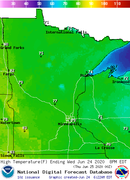
The weather will be unstable enough in southern Minnesota for occasional showers, and possibly a couple isolated storms in the afternoon.
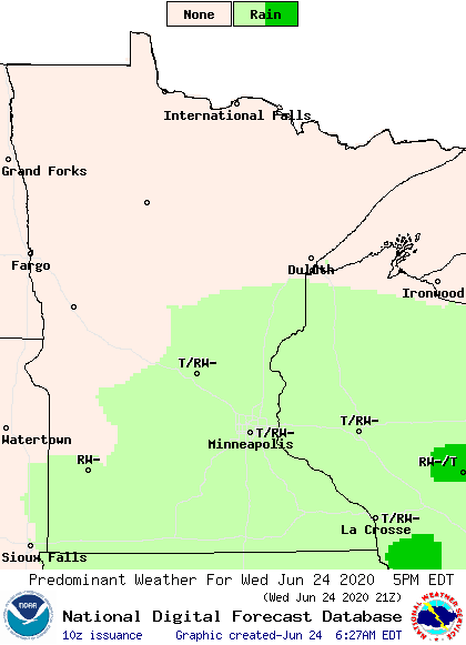
Strong storms are not expected, and any activity winds down through the evening. Northern Minnesota is likely to stay dry and mostly sunny.
Turn Up Your Support
MPR News helps you turn down the noise and build shared understanding. Turn up your support for this public resource and keep trusted journalism accessible to all.
The next storm
Thursday should be dry and sunny for most of the state, until late afternoon, when a few showers and storms start moving into western Minnesota ahead of the next storm system.
As the showers and storms spread Thursday evening and into the overnight, there is a risk for severe weather, especially for the southwestern corner of the state. Damaging winds, hail, and even isolated tornadoes are possible.

The entire state can expect mostly cloudy skies, with scattered showers and storms through the day Friday, before everything clears out west to east by late Friday.
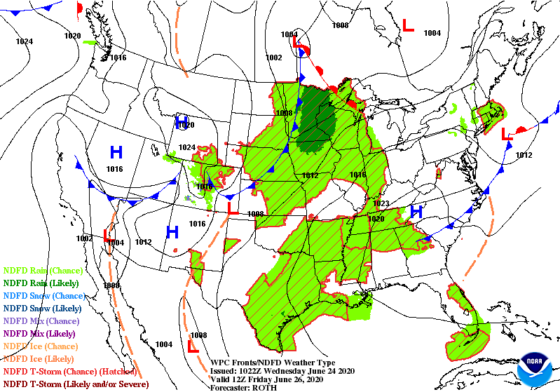
Most of the state should see at least a quarter inch precipitation, with higher amounts along with stronger storms.
The weekend turns drier again, with only spotty chances for afternoon showers or storms.
Temperatures rise
By Thursday, most of the state is back in the 80s. Temperatures may dip briefly back into more 70s Friday due to the clouds and wet weather, but overall, the heat ramps up through the weekend, with a few 90s possible by Sunday.
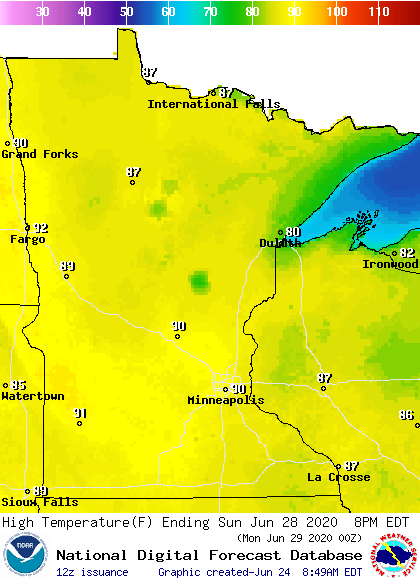
The hot weather isn’t limited to Sunday. All of next week is likely to have above-average temperatures.
Programming note
You can hear my live weather updates on Minnesota Public Radio at 7:48 a.m. Monday through Friday morning.

