
Hot and stormy weather returns
Western Minnesota is under a severe weather risk
Go Deeper.
Create an account or log in to save stories.
Like this?
Thanks for liking this story! We have added it to a list of your favorite stories.


Hot weather returns across much of Minnesota Thursday, and the heat will help fuel severe storms as a weather system begins to push across the state.
Thursday’s forecast
Thursday is starting off dry and sunny, with temperatures ranging from a few 40s in northeast and central Minnesota, to a few 60s in southern and western portions of the state. Afternoon highs will be noticeably warmer than recent days, with much of the state in the 80s, and a few 90s in southwest Minnesota.

A potent storm system is moving toward the state, which brings showers and storms into western Minnesota by afternoon. The wet weather spreads across the state Thursday evening and into the overnight.
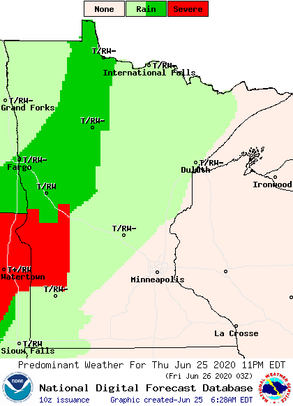
Fueled in part by Thursday’s hot weather, a few severe storms are likely, especially in western Minnesota from late this afternoon through the early overnight period.
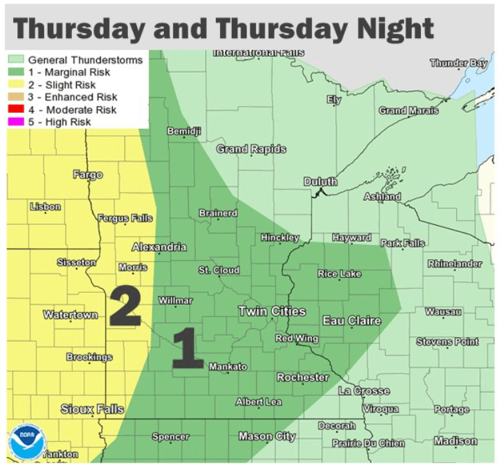
Damaging winds and hail are the biggest concern, but isolated tornadoes are also possible.
The system moves out by late Friday, but the heat continues this weekend. That extended forecast will be updated around 9:30 a.m.
Programming note
You can hear my live weather updates on Minnesota Public Radio at 7:48 a.m. Monday through Friday morning.
Turn Up Your Support
MPR News helps you turn down the noise and build shared understanding. Turn up your support for this public resource and keep trusted journalism accessible to all.

