
Summery warmth this weekend; shower chance in some areas Sunday p.m.
Sticky dew points on Sunday
Go Deeper.
Create an account or log in to save stories.
Like this?
Thanks for liking this story! We have added it to a list of your favorite stories.


If you enjoy summery warmth you’ll probably like our weekend forecast.
Our average Twin Cities high temperature on June 27 is 82 degrees. Our Twin Cities metro area temps will probably top out in the upper 80s Saturday afternoon. Most of Minnesota and western Wisconsin will have Saturday highs in the 80s:
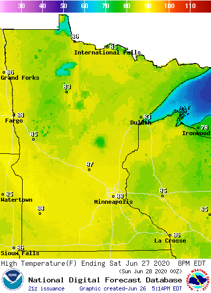
There could be a few 70s up along the North Shore of Lake Superior.
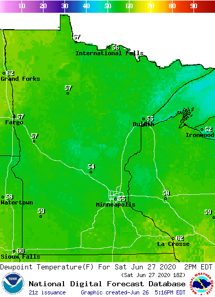
Saturday dew points will be fairly comfortable, in the 50s:
Turn Up Your Support
MPR News helps you turn down the noise and build shared understanding. Turn up your support for this public resource and keep trusted journalism accessible to all.
Winds will be light in most locations on Saturday.
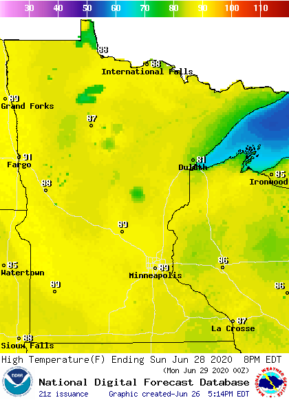
Sunday highs will reach the upper 80s in many areas and I wouldn’t be surprised if a few spots in southwestern Minnesota top 90 degrees:
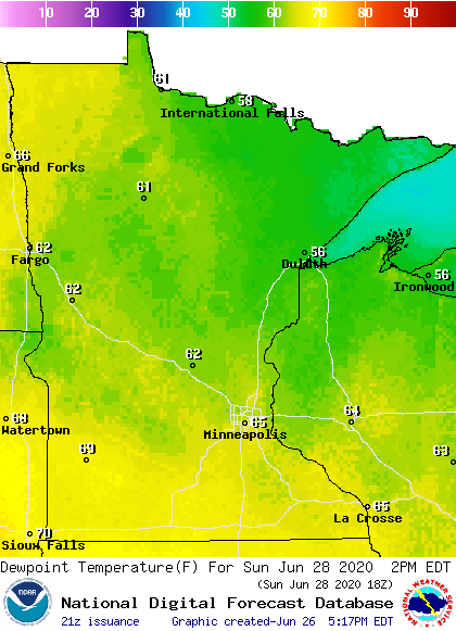
Dew points in the sticky 60s return by Sunday afternoon:
Breezes pick up by Sunday afternoon, with gusts reaching 15-22 mph in some locations:
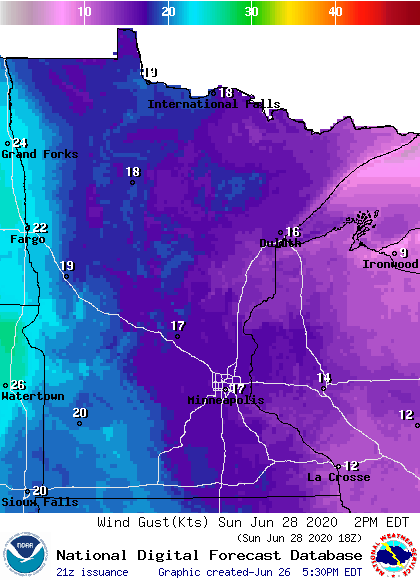
Plotted gusts are in knots, with 17 knots equal to almost 20 mph.
Back to temperatures, Twin Cities metro area highs are projected to reach the lower 90s Monday and Tuesday, followed by upper 80s Wednesday through Friday.
The warmth may linger well into July. The NWS Climate Prediction Center shows a strong tendency toward above-normal temps in Minnesota and Wisconsin from July 4 through July 10:
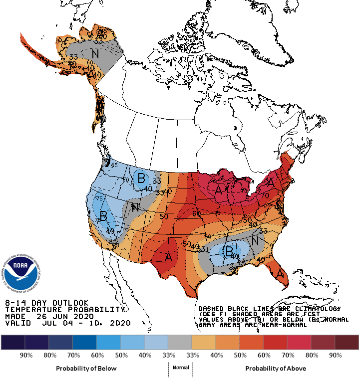
We’ll see if that pans out.
Sunday rain chance?
Some forecast models show a chance of scattered showers and a thunderstorm in parts of Minnesota and western Wisconsin Sunday afternoon and Sunday evening.
The National Oceanic and Atmospheric Administration’s North American Mesoscale (NAM) forecast model shows the potential rain pattern Sunday afternoon and Sunday evening:
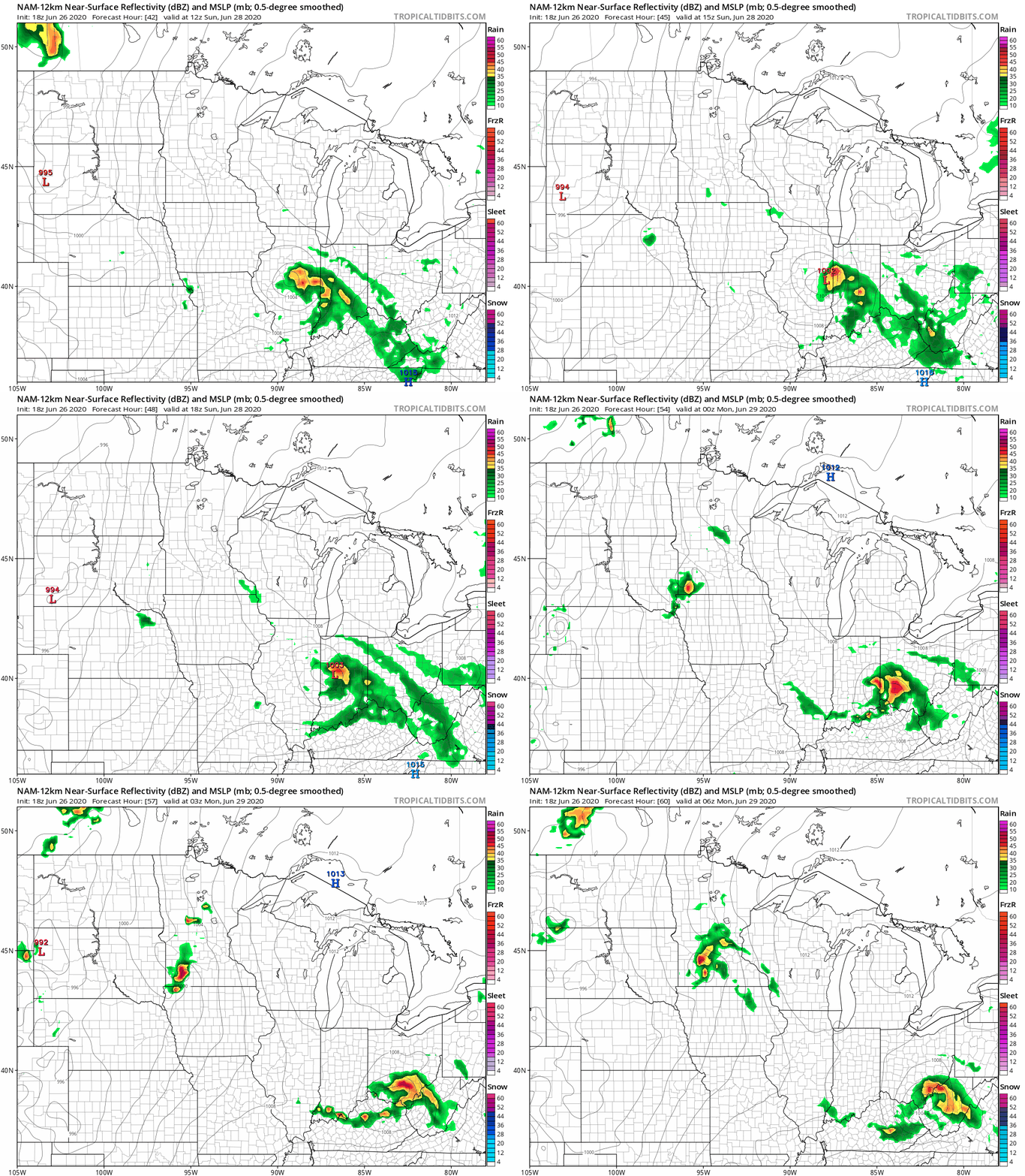
The final image in the loop is after sunset on Sunday and additional showers and thunderstorms are possible overnight Sunday night.
I hope that you enjoy your weekend!
Programming note
You can hear my live weather updates on MPR News at 7:35 a.m., 9:35 a.m. and 4:35 p.m. each Saturday and Sunday.

