
Hot, humid and stormy for Monday
Severe weather is possible for southern Minnesota
Go Deeper.
Create an account or log in to save stories.
Like this?
Thanks for liking this story! We have added it to a list of your favorite stories.


Monday will be another hot and humid day, with scattered showers and storms, especially for southern Minnesota. Occasional severe storms and periods of heavy rain are likely.
Monday’s forecast
Monday is starting warm and humid, with most of the state in the 60s and 70s. It will stay very muggy through the day, with most of the state seeing highs in the 80s.

We’ve already seen showers and storms across Minnesota since Sunday evening, including areas of heavy rain, and widespread rain continues Monday morning in the southwestern corner of the state.
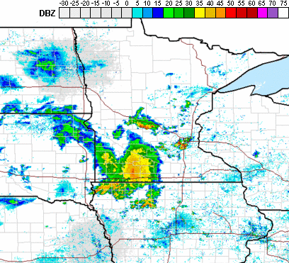
A cold front moving across the state will not bring much temperature relief to Minnesota but will serve as added instability to cause potential severe weather. Although scattered storms are possible through all but perhaps northwestern Minnesota, storms are most likely across southern Minnesota, where the front sits by Monday afternoon and evening.
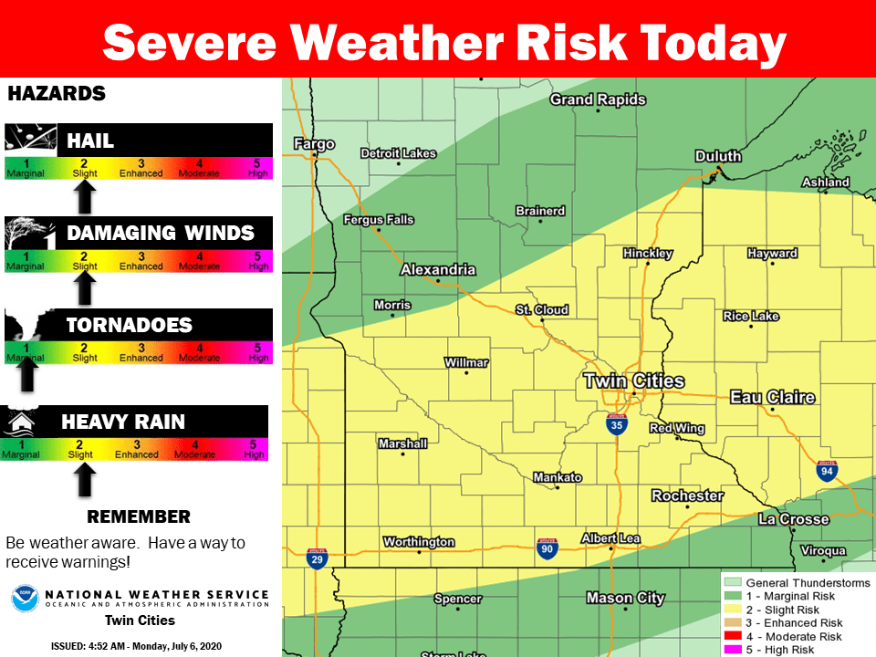
Hail and damaging winds are the biggest threat, however isolated tornadoes are possible. Storms could also produce heavy enough rain in some areas to cause flash flooding concerns. Much of southern Minnesota can expect a half-inch to and inch of rain through Monday night, with higher amounts under heavy rainstorms.

The weather stays active through midweek with more severe weather possible. That extended forecast will be updated around 9 a.m.
Programming note
You can hear my live weather updates on Minnesota Public Radio at 7:48 a.m. Monday through Friday morning.
Turn Up Your Support
MPR News helps you turn down the noise and build shared understanding. Turn up your support for this public resource and keep trusted journalism accessible to all.

