
Severe t-storm watch for portions of southern Minnesota until 8 p.m. Saturday
Go Deeper.
Create an account or log in to save stories.
Like this?
Thanks for liking this story! We have added it to a list of your favorite stories.


The severe thunderstorm watch has been cancelled for many Minnesota counties, but it continues until 8 p.m. Saturday in far southern Minnesota:
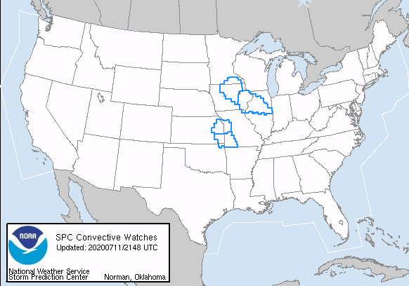
The Twin Cities metro area will have a chance of scattered showers and thunderstorms Saturday evening, with the best thunderstorm chances in southern Minnesota and spotty thunderstorms also possible in central Minnesota.
Spotty severe weather was reported Saturday afternoon in parts of Minnesota.
There was a confirmed tornado touchdown at 1:07 p.m. Saturday about 14 miles southwest of Detroit Lakes, Minnesota.
Between 1:30 and 2:30 Saturday afternoon there were several reports of large hail in Sibley county and Renville county, including tennis-ball size hail 3 miles SSW of Stewart in Sibley county.
There were reports of numerous trees blown down in Madison Lake (Blue Earth county) at 3:40 p.m. Saturday.
Additional severe weather reports can be found here.
You can hear updated weather information on the MPR network, and you’ll see updated weather info on the MPR News live weather blog.
Turn Up Your Support
MPR News helps you turn down the noise and build shared understanding. Turn up your support for this public resource and keep trusted journalism accessible to all.

