
Warm and humid; thunderstorms spread across Minnesota Friday night
Severe weather risk overnight
Go Deeper.
Create an account or log in to save stories.
Like this?
Thanks for liking this story! We have added it to a list of your favorite stories.


Our average Twin Cities high temperature is 84 degrees this time of year. We’re expecting Friday afternoon highs in the upper 80s to around 90 in the metro area and much of Minnesota and western Wisconsin:

There will be some low to mid 80s in northeastern Minnesota.
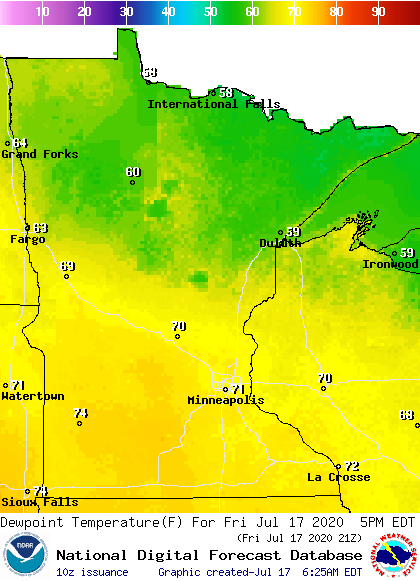
The comfortable dew points of the past couple days are leaving us. Friday afternoon dew points reach the lower 70s in the Twin Cities and much of southern Minnesota and western Wisconsin:
Thunderstorm chances increase Friday night
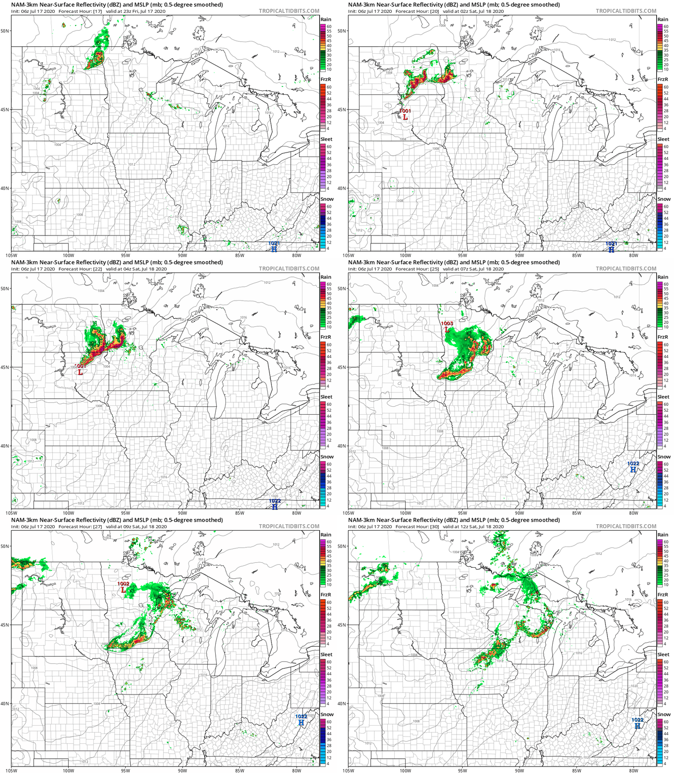
Minnesota and western Wisconsin could see a few spotty showers and thunderstorms Friday afternoon. More significant areas of thunderstorms develop in northwestern and west-central Minnesota Friday evening and spread to cover much of Minnesota and western Wisconsin as we go through the overnight hours of Friday night.
Turn Up Your Support
MPR News helps you turn down the noise and build shared understanding. Turn up your support for this public resource and keep trusted journalism accessible to all.
NOAA’s North American Mesoscale forecast model shows the potential rain pattern Friday evening and through the overnight hours of Friday night:
The thunderstorms could bring damaging winds and large hail to many locations. The main batch of t-storms in the Twin Cities will probably hold off until after midnight.
You can hear updated weather information on the MPR network, and you’ll see updated weather info on the MPR News live weather blog.
Severe weather outlook
There are many colors on the National Weather Service Storm Prediction Center’s severe weather outlook for Friday and Friday night:
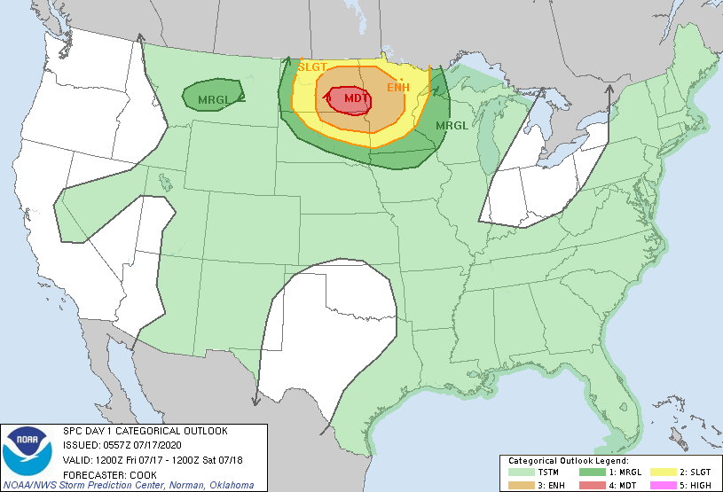
Friday night in the SPC outlook ends at 7 a.m. Saturday.
There is a moderate severe weather risk in the red-shaded area in southeastern North Dakota and a small part of northwestern Minnesota. The beige-shaded area that covers parts of northern Minnesota has an enhanced risk of severe weather. The yellow-shaded area that includes the Twin Cities has a slight risk of severe weather Friday night, meaning scattered severe thunderstorms are possible.
Here are the SPC risk categories:

Here’s a note from the Twin Cities NWS concerning the severe weather risk:
This Updraft blog will be updated by around 9:30 a.m. with info on the excessive heat watch for Saturday and weekend thunderstorm chances.

