
Cooler weather through Wednesday, then the heat returns
Showers and storms Tuesday include a severe weather risk
Go Deeper.
Create an account or log in to save stories.
Like this?
Thanks for liking this story! We have added it to a list of your favorite stories.


After Tuesday’s showers and storms clear out, comfortable weather returns Wednesday. Then the heat and humidity are on the rise again by the weekend.
Tuesday’s forecast
Showers and storms spread across the state overnight Monday, and much of the state is wet Tuesday morning.
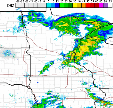
After a line of showers and storms passes through southern Minnesota Tuesday morning, including the Twin Cities, any activity the rest of the day is likely to be much spottier for the southern portion of the state.
Heavier rain is most probable in central and northeastern Minnesota, where more of the day stays wet, and many places could see over an inch of precipitation, with some totals above 2 inches.
Turn Up Your Support
MPR News helps you turn down the noise and build shared understanding. Turn up your support for this public resource and keep trusted journalism accessible to all.

There is also a chance for severe storms with this system, especially for eastern Minnesota, including heavy rain, high winds, and possibly isolated tornadoes.
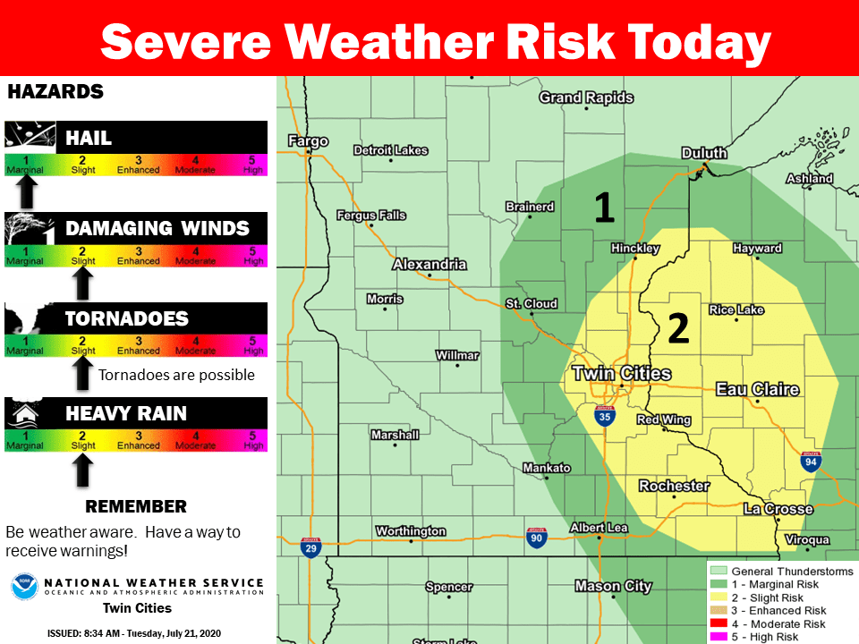
The rain clears out for most of the state by Tuesday evening, although spotty showers and storms could linger in northern Minnesota, especially the Arrowhead, through the night.
Meanwhile, because of the cloud cover and rain, highs stay below average, predominantly in the 60s and 70s.

It is also somewhat breezy, and the wind flow off of Lake Superior is causing a high rip current risk, including around the Duluth area.
Wednesday and Thursday
Quiet and comfortable weather returns Wednesday, with mostly sunny skies, lower humidity, and highs mostly in the 70s.
By Thursday, temperatures and humidity start to creep higher, and more of the highs will make it into the 80s. A few showers and storms are likely to push into western Minnesota by late Thursday, then spread across more of the state overnight. There is a risk for severe storms as that activity moves into Minnesota, we’ll monitor that risk as the system gets closer.
Extended forecast
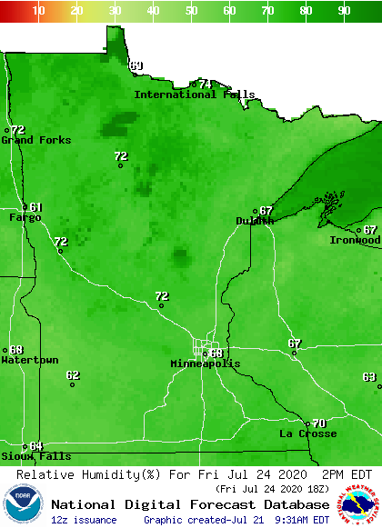
By Friday, temperatures and humidity rise even more, bringing another heat wave that lasts through the weekend. Here is the relative humidity expected by Friday:
That heat and humidity also contribute to occasional periods of showers and storms from Friday through Monday.
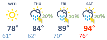
Here is the Twin Cities forecast through Saturday, showing that warming trend and the precipitation chances (the precipitation chance on Thursday is for late Thursday night):
Programming note
You can hear my live weather updates on Minnesota Public Radio at 7:48 a.m. Monday through Friday morning.

