
A cooler day before heat and humidity return
Parts of the state could see isolated severe weather Friday
Go Deeper.
Create an account or log in to save stories.
Like this?
Thanks for liking this story! We have added it to a list of your favorite stories.


After one more day of cooler-than-average weather, temperatures and humidity rise into the weekend, as storm chances also increase.
Wednesday’s forecast
Wednesday started off cooler than average with most places in the 50s, and a few 40s in northern Minnesota.
Highs stay below average, but comfortable, with the majority of the state in the 70s and humidity remaining low.
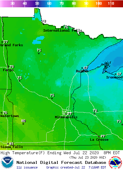
The cooler weather Wednesday is somewhat appropriate, because we’ve hit the point in summer where our average temperatures are starting to lower. The average July 21 high for the Twin Cities is 84 degrees; the July 22 average is 83 degrees.
Turn Up Your Support
MPR News helps you turn down the noise and build shared understanding. Turn up your support for this public resource and keep trusted journalism accessible to all.
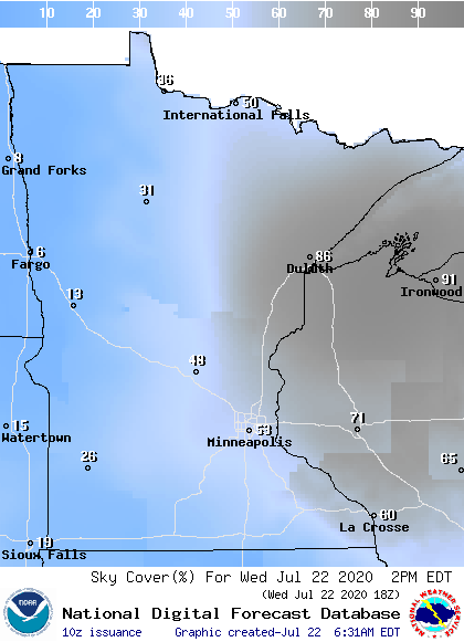
There have been a couple very light areas of showers and drizzle in the Arrowhead that will end by late morning Wednesday. However, even with the precipitation ending, northeastern Minnesota stays under more clouds Wednesday, while most of the state sees sunnier skies.
Thursday and Friday
By Thursday, the pattern shifts and a wind flow more out of the southeast starts to bring in warmer air, returning highs for most of the state into the 80s.
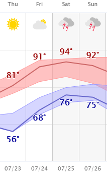
By Friday, the winds increase from the south, and it gets even hotter, with temperatures ranging in the upper 80s to mid-90s. The air flow also elevates the humidity, so that by Friday it turns muggy again with dew points in the 70s.
Showers and storms also push into western Minnesota by late Thursday, and the entire state sees chances for showers and storms Friday, although the activity is most likely in the northern half of the state.
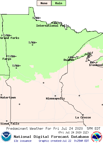
Isolated severe weather is possible from Thursday night through Friday.
Another hot weekend
The heat, humidity, and chances for storms linger throughout the state over the weekend.
Not only will highs be in the upper 80s and 90s across the state, but the overnight lows will stay very warm, providing no relief for those without air conditioning. In fact, most of the state starts Saturday in the 70s.
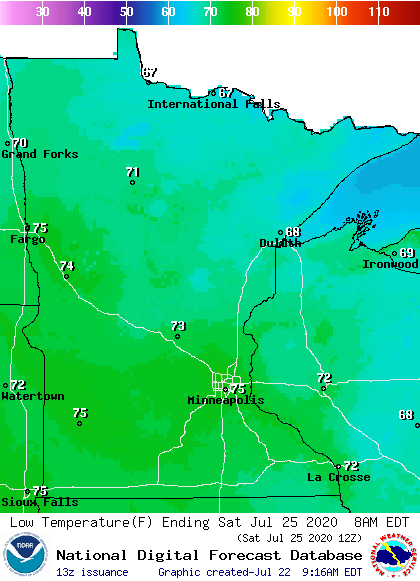
The high humidity is expected to put the heat index for parts of southern Minnesota back above 100 at times, so it is likely there will be heat advisories or even excessive heat warnings issued.
Here is the Twin Cities forecast through Sunday, showing the heat:
Programming note
You can hear my live weather updates on Minnesota Public Radio at 7:48 a.m. Monday through Friday morning.

