
Recent rains improve drought conditions
Mostly dry and comfortable weather prevails the next week
Go Deeper.
Create an account or log in to save stories.
Like this?
Thanks for liking this story! We have added it to a list of your favorite stories.


Other than chances for rain Friday and Saturday, predominantly dry weather continues into late next week. However, the lack of significant rain could erode recent improvements in Minnesota’s drought areas.
Thursday’s forecast
A persistent area of high pressure keeps the weather quiet again Thursday. Morning lows ranged from the 40s to 60s, and other than 70s near the North Shore, most of the state sees afternoon temperatures in the 80s Thursday.

These highs puts southern Minnesota a couple degrees below average and northern Minnesota a couple degrees above average. Skies stay mostly sunny and winds remain light.
A weak cold front
Friday begins quiet, but by afternoon, showers and storms push into the northwestern corner of the state along with a cold front that clears through the state by mid-Saturday.
Turn Up Your Support
MPR News helps you turn down the noise and build shared understanding. Turn up your support for this public resource and keep trusted journalism accessible to all.
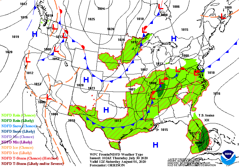
Wet weather with and behind the front moves across Minnesota Saturday, before clearing out Saturday evening. Presently, it looks like the best chance for rain in the Twin Cities comes Saturday afternoon.
The front does not bring significant chances for severe weather. Precipitation is likely to stay lighter, with most of the state seeing under a quarter inch of rain and only isolated higher amounts.

Next week starts cool and dry
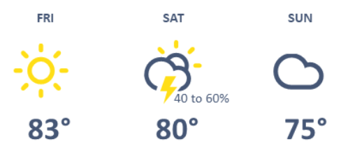
Ahead of the front, most of the state stays in the 80s Friday, then temperatures start to cool some on Saturday with more 70s and 80s. By Sunday, cooler air settles across the state and most highs will be in the 70s.
Here is the extended forecast for the Twin Cities, which shows the cooler, quieter weather beginning on Sunday:
Those highs in the 70s are likely to persist at least through midweek. Overnight temperatures will also run slightly below average, with widespread 50s and some 40s north.
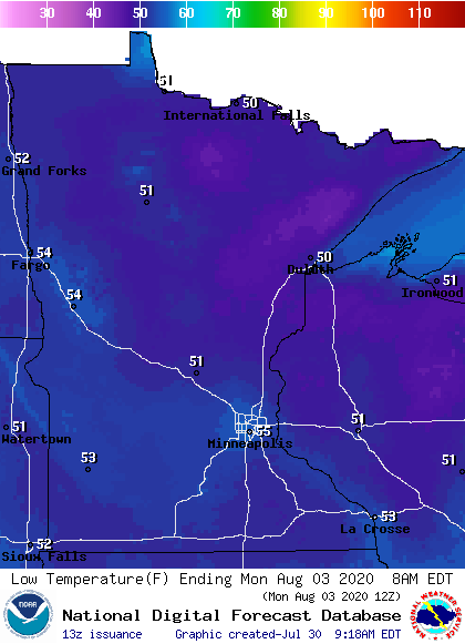
Drier air also returns, with no significant rain chances until late-week.
Drought improvements
Recent heavy rains have significantly eroded drought conditions. In fact, as of the July 30 United States Drought Monitor (using data collected through July 28), Minnesota is now out of any severe drought areas.
Areas considered abnormally dry and in moderate drought have also greatly reduced since the start of July.
Here is a side-by-side comparison of the current drought monitor (left) to drought data from the first week of July (right):
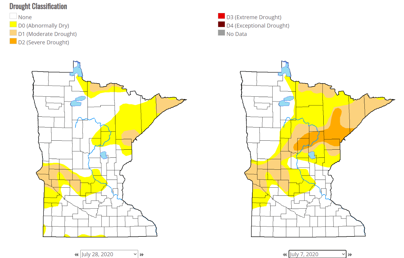
Hopefully the mostly dry stretch Minnesota is currently experiencing doesn’t reverse the trend of improving conditions.
Programming note
You can hear my live weather updates on Minnesota Public Radio at 7:48 a.m. Monday through Friday morning.

