
Weekend forecast: Steamier, with thunderstorm chances
Many rain-free hours too
Go Deeper.
Create an account or log in to save stories.
Like this?
Thanks for liking this story! We have added it to a list of your favorite stories.


While running errands this morning, I heard someone say “this feels like fall.” Our weekend weather should convince most of us that summer isn’t over.
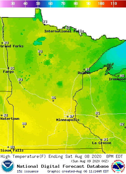
Saturday highs will be in the 80s, and a few spots in far southern Minnesota could be close to 90 degrees:
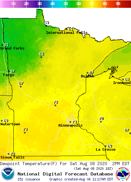
Saturday afternoon dew points will be in the steamy 70s across central and southern Minnesota:
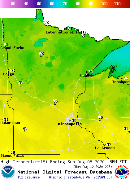
Sunday high temperatures remain in the 80s in most areas, with some 70s in northeastern Minnesota:
Turn Up Your Support
MPR News helps you turn down the noise and build shared understanding. Turn up your support for this public resource and keep trusted journalism accessible to all.
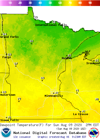
Sunday dew points will be in the upper 60s in central Minnesota, with lower 70 lingering in the Twin Cities metro area and southern Minnesota plus much of western Wisconsin:
Thunderstorm chances
Clusters of thunderstorms are expected to move across Minnesota and western Wisconsin from Friday evening into early Saturday.
The National Oceanic and Atmospheric Administration’s North American Mesoscale (NAM) forecast model shows the potential rain pattern Friday evening through Saturday morning:
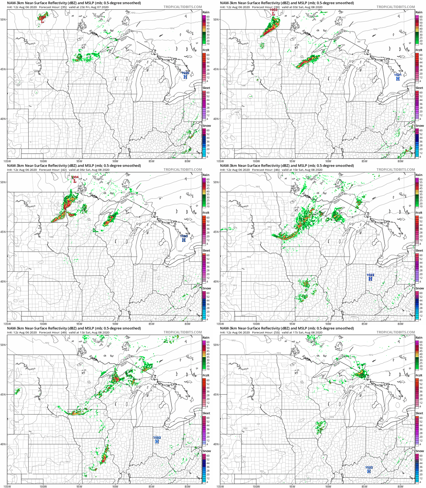
Thunderstorms may redevelop Saturday night into early Sunday.
At this point it looks like northern Minnesota and northwestern Wisconsin will have the best chance of scattered thunderstorms Sunday afternoon, with a smaller thunderstorm chance in the south.
Scattered thunderstorms will be possible in all areas Sunday evening and Sunday night.
You can hear updated weather information on the MPR network, and you’ll see updated weather info on the MPR News live weather blog.

