
A warm and stormy weekend ahead
The storms bring a couple chances for severe weather
Go Deeper.
Create an account or log in to save stories.
Like this?
Thanks for liking this story! We have added it to a list of your favorite stories.


Temperatures, humidity, and storms chances all rise on Friday, leading into a weekend of active weather.
Warm and humid weather returns
Southerly winds Thursday night kept warmer air in place across the state, which had most of Minnesota waking up in the 60s Friday morning. That is milder than many previous mornings this week, and most of the state continues to see warmer mornings through at least early next week.
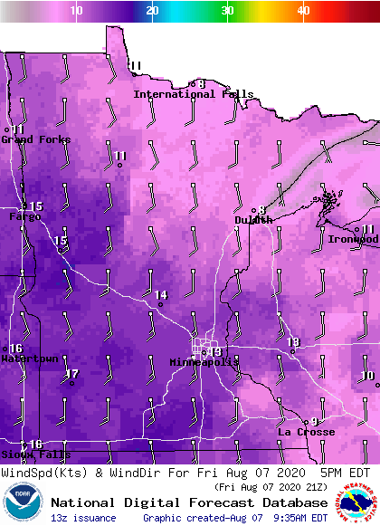
Those southerly winds increase Friday, making it breezy by afternoon, with southern and central Minnesota seeing gusts over 20 mph.
That flow continues to draw in warmer air, putting most of the state in the 80s for highs from Friday through the weekend.
Turn Up Your Support
MPR News helps you turn down the noise and build shared understanding. Turn up your support for this public resource and keep trusted journalism accessible to all.
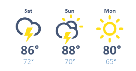
Here is the Twin Cities forecast through Monday, showing the warmer temperatures:
Dew points also rise into the 60s and 70s by Friday afternoon, making for a noticeably more humid afternoon, and that humidity remains higher through Sunday.
Two storm systems
As of Friday morning, there is already an area of showers and storms pushing into west-central Minnesota.
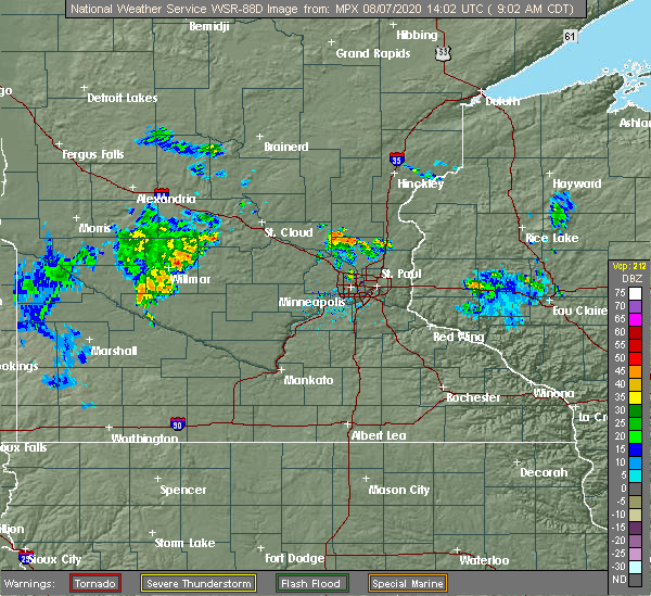
The weather system this is part of will continue to spread showers and storms into central and northern Minnesota by Friday afternoon.
Although spotty storms chances are possible through the day, the wet weather is most likely to expand through the southern edge of the state, including the Twin Cities, Friday evening through the overnight.
Scattered severe weather is possible with the storms, especially a wind and hail threat, but isolated tornadoes are also possible.
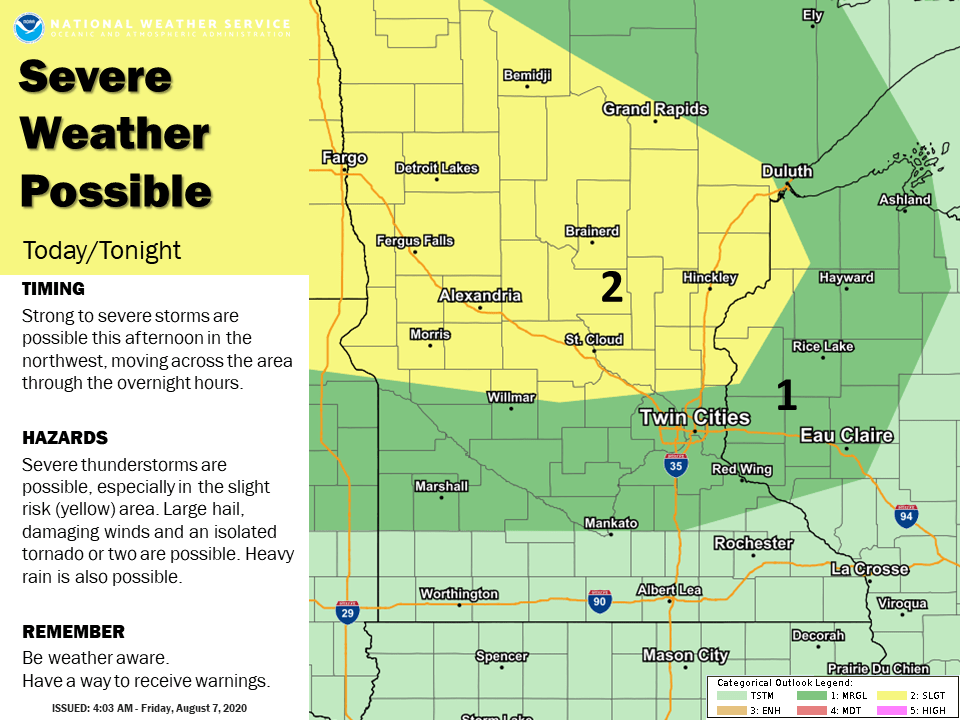
Periods of heavy rain are also likely Friday into early Saturday, especially in central and northern Minnesota, where there could be widespread rain totals over an inch, and localized amounts of a few inches.
That system moves out on Saturday, with only a brief break before another area of low pressure brings more showers and storms in late Saturday through early Monday.
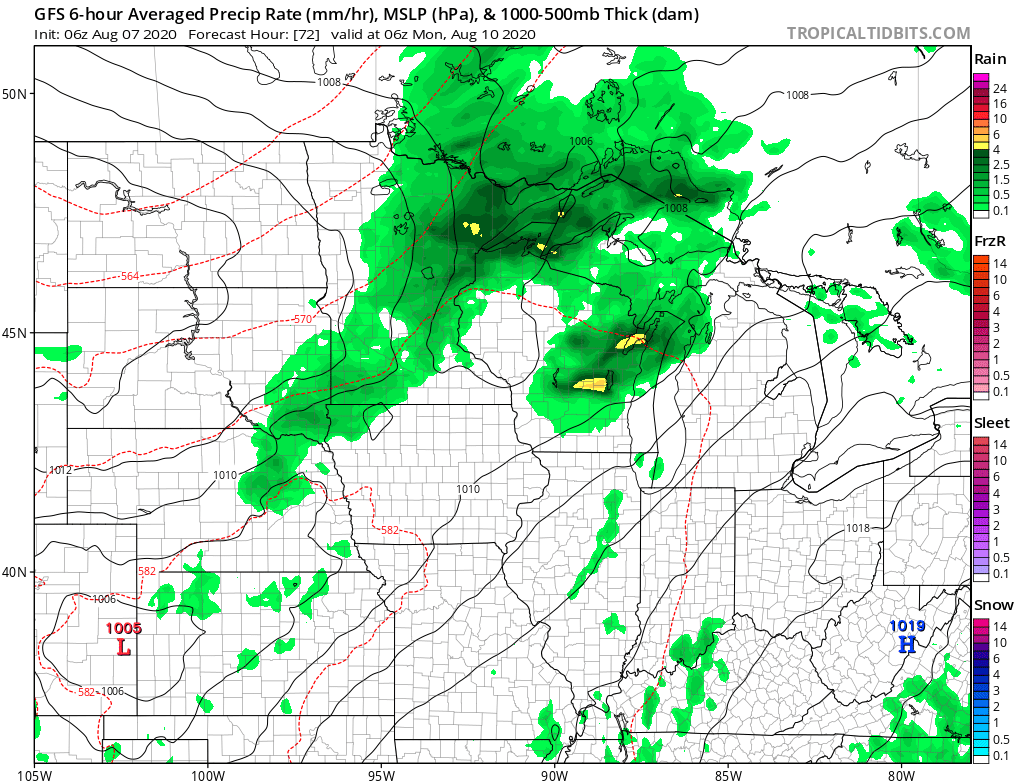
The second storm also brings a severe weather risk to almost all of Minnesota Sunday, and the chance for heavier areas of rain again.
Overall, from Friday to Monday, most of the state can expect at least a half inch of rain, with many parts of central and northern Minnesota getting one to two inches.
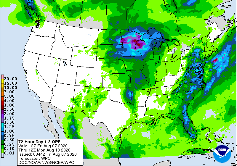
Some totals will be much higher under heavy storms, so we are monitoring for any localized flooding as the storms build.
MPR will also keep you updated on any severe weather as it develops through the weekend.
Programming note
You can hear my live weather updates on Minnesota Public Radio at 7:48 a.m. Monday through Friday morning.

