
Storms roll across Minnesota Wednesday morning
Northern parts of the state remain dry and warm
Go Deeper.
Create an account or log in to save stories.
Like this?
Thanks for liking this story! We have added it to a list of your favorite stories.


Higher humidity and more instability spread across Minnesota Wednesday, and portions of the state will see strong storms with heavy rain.
Wednesday’s forecast
Most of Minnesota is starting off seasonable Wednesday, with lows in the 50s and 60s, and just a few 40s along the northern border. Afternoon highs in the 80s will be close to average for southern Minnesota, but above average north.
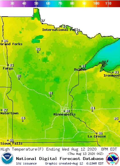
Part of the warm weather is due to a southerly wind flow that turns breezy for western Minnesota by afternoon and also elevates the humidity.
A storm complex that moved across the Dakotas overnight is impacting western Minnesota as of 7 a.m., bringing heavy rain and the potential for isolated severe weather as it moves east.
Turn Up Your Support
MPR News helps you turn down the noise and build shared understanding. Turn up your support for this public resource and keep trusted journalism accessible to all.

Some of these storms should make it to the Twin Cities by late morning, although the activity expected to be less organized by then.

The storms chances Wednesday are likely to miss northern Minnesota, but more widespread showers and storms impact the state Thursday.
That extended forecast will be updated around 9 a.m.
Programming note
You can hear my live weather updates on Minnesota Public Radio at 7:48 a.m. Monday through Friday morning.

