
Weekend forecast: Summery; thunderstorm chances in some areas on Saturday
No all-day rains
Go Deeper.
Create an account or log in to save stories.
Like this?
Thanks for liking this story! We have added it to a list of your favorite stories.


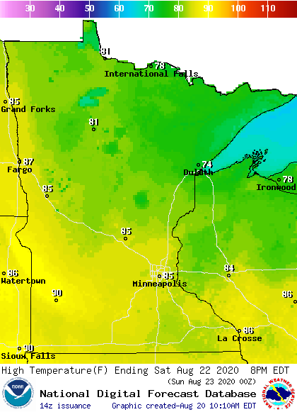
Our average Twin Cities high temperature is 80 degrees this time of year. We’ll probably reach the mid 80s this Saturday. Highs will range from the 70s in northeastern Minnesota to around 90 in southwestern Minnesota Saturday afternoon:
Saturday dew points will be in the sticky 60s:
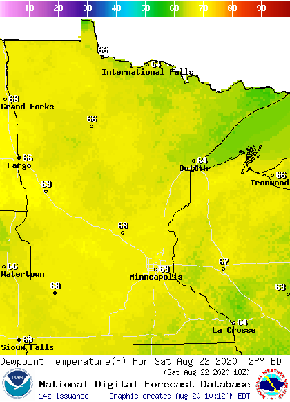
The dew point could touch 70 degrees at times in southern Minnesota.
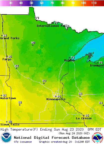
Back to high temperatures, Sunday highs will be mainly in the 80s, with 70s in north-central and northeastern Minnesota:
Turn Up Your Support
MPR News helps you turn down the noise and build shared understanding. Turn up your support for this public resource and keep trusted journalism accessible to all.
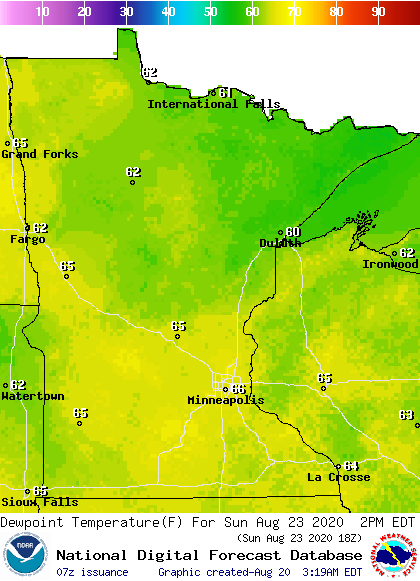
Sunday dew points will be mainly in the 60s:
Thunderstorm chances
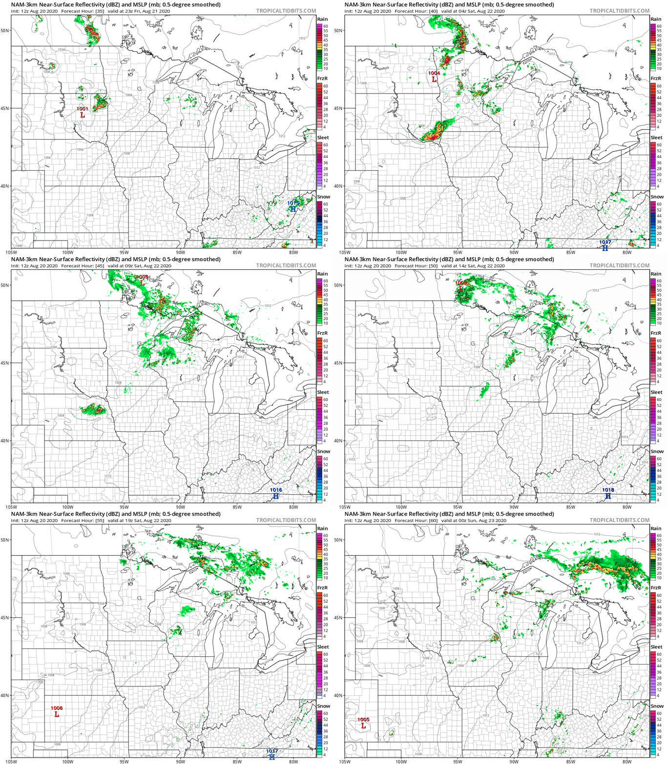
Scattered thunderstorms are expected to spread across Minnesota and western Wisconsin Friday evening and overnight Friday night. During the daylight hours of Saturday, the chance of occasional scattered t-storms will be mainly in northern and eastern Minnesota and on into Wisconsin.
The National Oceanic and Atmospheric Administration’s North American Mesoscale (NAM) forecast model shows the potential rain pattern Friday evening through Saturday afternoon:
You can hear updated weather information on the MPR network, and you’ll see updated weather info on the MPR News live weather blog.

