
Steamy Saturday, with spotty thunderstorms possible
Dense fog Saturday morning in parts of western Minnesota
Go Deeper.
Create an account or log in to save stories.
Like this?
Thanks for liking this story! We have added it to a list of your favorite stories.


We’re starting out our Saturday with dense fog in portions of northwestern and west-central Minnesota, where a dense fog advisory continues until 10 a.m. today:

Thunder chances
Heavy rain fell overnight from around Olivia to Albert Lea. The National Weather Service has this summary of radar rainfall estimates:
Dual pol estimates put rainfall totals from 3 to 6+ inches down from Fairfax down through New Ulm and Mankato into the Mapleton area in southeast Blue Earth county.
A few scattered thunderstorms will continue in parts of eastern Minnesota and western Wisconsin early this morning. Thunderstorms are expected to become more spotty as the day goes on. An isolated shower or thunderstorm is possible at any location in Minnesota/western Wisconsin this afternoon and evening.
Turn Up Your Support
MPR News helps you turn down the noise and build shared understanding. Turn up your support for this public resource and keep trusted journalism accessible to all.
You can hear updated weather information on the MPR network, and you’ll see updated weather info on the MPR News live weather blog.
Steamy
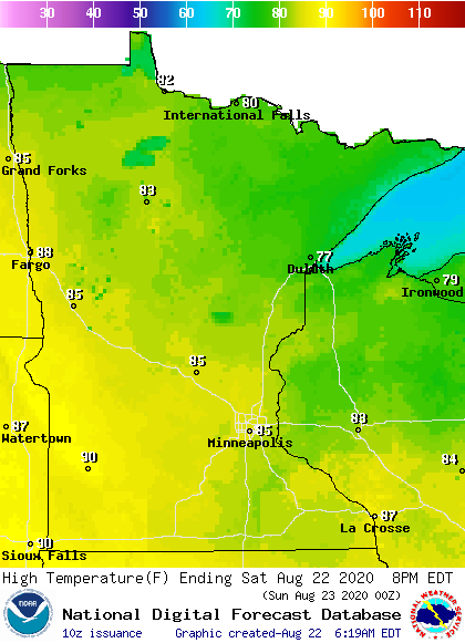
Our average Twin Cities high temperature is 80 degrees this time of year. The metro area will probably reach the middle 80s this Saturday.
Saturday high will range from the 70s in northeastern Minnesota to near 90 in southwestern Minnesota:
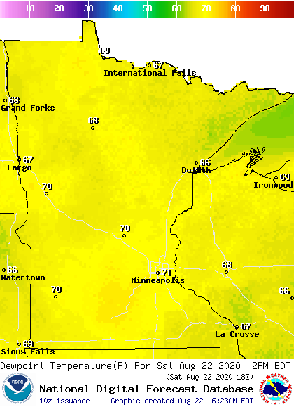
Dew points creep into the steamy lower 70s at times:
This Updraft blog will be updated by around 10 a.m. with updated info on your weekend weather and a look at the week ahead.
Programming note
You can hear my live weather updates on MPR News at 7:35 a.m., 9:35 a.m. and 4:35 p.m. each Saturday and Sunday.

