
Periods of active weather throughout the week
Hot weather prevails for southern Minnesota through Wednesday
Go Deeper.
Create an account or log in to save stories.
Like this?
Thanks for liking this story! We have added it to a list of your favorite stories.


The weather stays active this week, with the possibility of severe weather. Meanwhile, temperatures stay high through Wednesday, then return to more seasonable highs by the weekend.
Monday’s forecast
The state started off warm and humid Monday morning, with temperatures in the 60s and 70s. Because of a front stretching through central Minnesota and expected to move slowly south during the day, there will be a much more noticeable temperature divide by afternoon. On the cooler, drier side of the front, northern Minnesota sees highs near 80 and lower humidity thanks to dew points in the 50s and 60s.
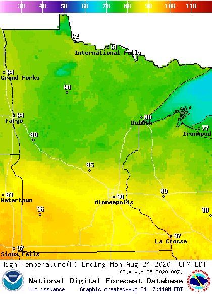
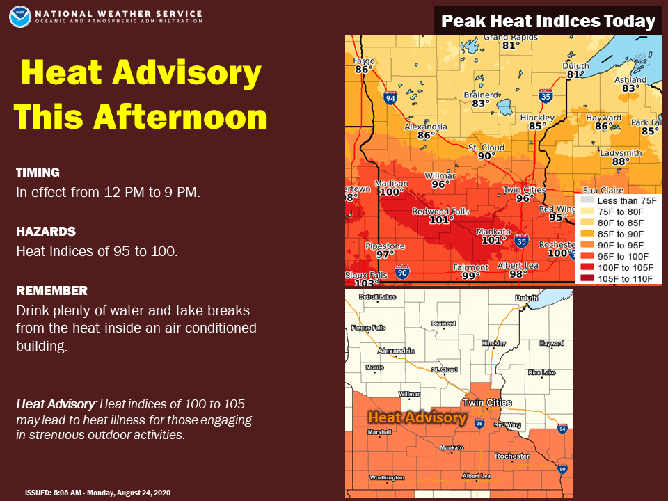
Southern Minnesota can expect temperatures in the low to mid-90s, and dew points in the 70s. That will drive the heat index above 100 for parts of southern Minnesota, putting that part of the state in a heat advisory from 12 p.m. to 9 p.m.
The front is also causing areas of showers and storms in central and southern Minnesota Monday morning.
Turn Up Your Support
MPR News helps you turn down the noise and build shared understanding. Turn up your support for this public resource and keep trusted journalism accessible to all.
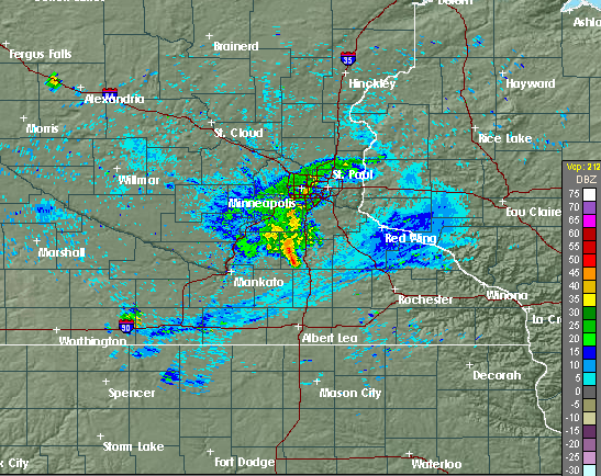
These storms bring a risk for scattered severe weather, especially in the afternoon and evening.
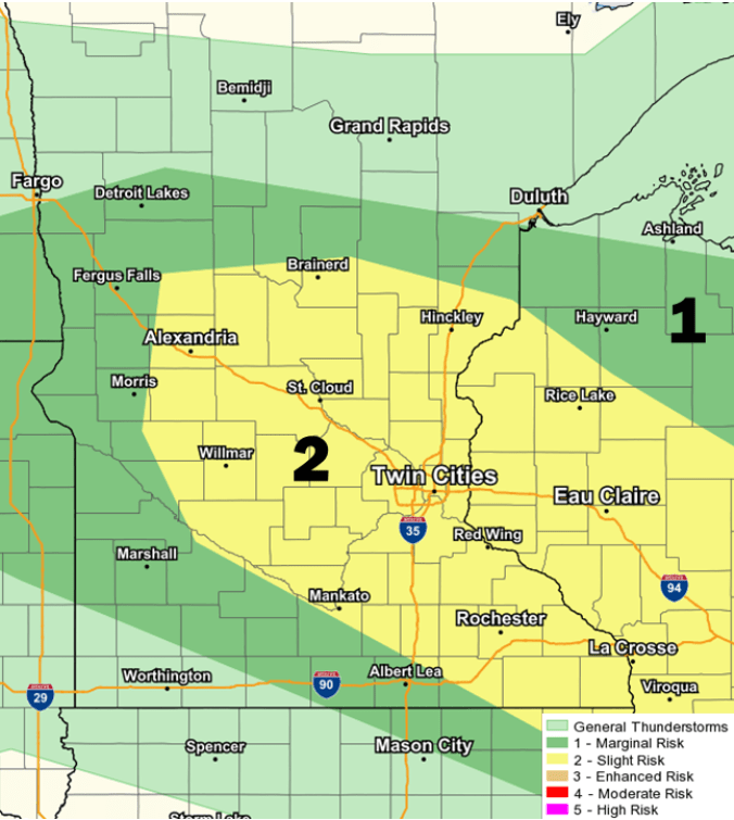
Damaging winds and large hail are the primary threat, but isolated tornadoes are possible, too.
Active weather
Weather throughout the week stays more active, with at least some part of Minnesota seeing a chance for showers or storms each day. This includes likely showers and storms for northern Minnesota that move in Tuesday afternoon and evening, and bring an isolated severe weather risk Tuesday and Wednesday.
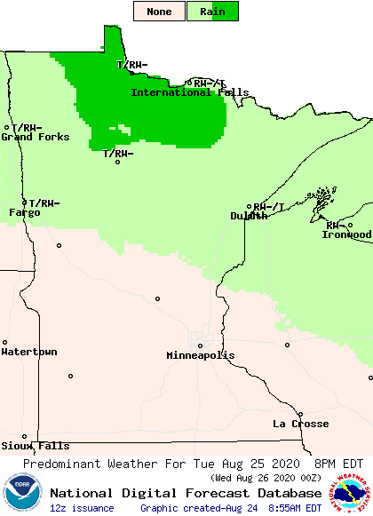
While the entire state sees occasional chances for rain through the week, precipitation amounts should remain limited. Most of Minnesota sees a total rainfall forecast through Saturday of under a half-inch, with isolated higher amounts in areas that see strong storms.
Temperature trend
Highs in northern Minnesota remain fairly consistent, with temperatures in the upper 70s and low 80s through midweek.
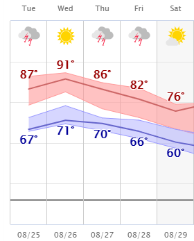
In southern Minnesota, the heat continues, dipping slightly Tuesday behind Monday’s storms, before likely bouncing right back into the 90s Wednesday.
The second half of the week, statewide temperatures return to more seasonable readings, with northern Minnesota in the lower 70s and southern Minnesota in the mid-70s to low 80s by Saturday.
Here is that temperature trend for the Twin Cities:
Programming note
You can hear my live weather updates on Minnesota Public Radio at 7:48 a.m. Monday through Friday morning.

