
Another hot day for southern Minnesota
Storms move in late Tuesday
Go Deeper.
Create an account or log in to save stories.
Like this?
Thanks for liking this story! We have added it to a list of your favorite stories.


Hot weather has portions of Minnesota under a heat advisory again Tuesday, and after a mostly dry day, storms start moving into the state by evening.
Tuesday’s forecast
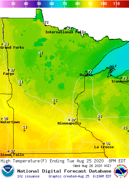
A lingering front in southern Minnesota is causing a big temperature contrast across Minnesota again Tuesday. Morning temperatures range from 50s north to 60s and 70s south. Afternoon temperatures will be near 80 north and mid-80s to low 90s south, but dew points and humidity will be much higher in southern Minnesota again, leading to a high heat index.
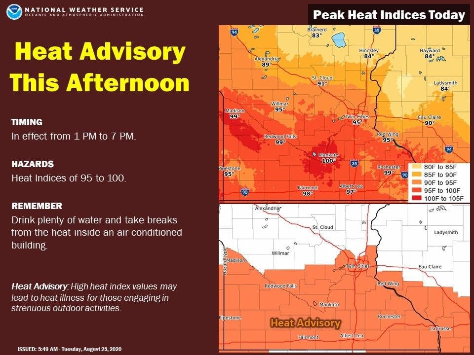
A heat advisory is in effect from 1 p.m. to 7 p.m. for temperatures that will feel like 95 to 100 degrees.
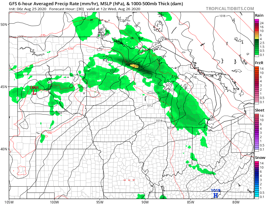
Much of the state sees mostly sunny skies Tuesday, with just a few more clouds north. By Tuesday evening, a disturbance starts moving across the northern edge of the state that brings showers and storms through northern and central Minnesota overnight, along with an isolated risk for severe weather.
After another hot day Wednesday, temperatures turn more seasonable by the end of the week.
That extended forecast will be updated around 9 a.m.
Programming note
You can hear my live weather updates on Minnesota Public Radio at 7:48 a.m. Monday through Friday morning.
Turn Up Your Support
MPR News helps you turn down the noise and build shared understanding. Turn up your support for this public resource and keep trusted journalism accessible to all.

