
Comfy weather lingers; thunder chance western Minn. Sunday PM
Cool start to September
Go Deeper.
Create an account or log in to save stories.
Like this?
Thanks for liking this story! We have added it to a list of your favorite stories.


Our Saturday high temp at Minneapolis-St. Paul International Airport was 77 degrees. That was just one degree shy of our average August 29 high in the Twin Cities. Near-normal temps feel great this time of year, especially when there’s plenty of sunshine.
Sunday highs in the metro will be in the upper 70s to around 80. Many Minnesota and western Wisconsin locations will have Sunday highs in the 70s, with some spots in southern Minnesota touching 80:
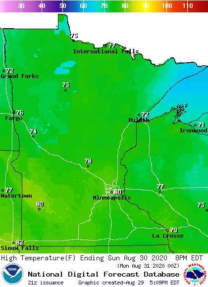
A few 60s are expected in parts of northeastern Minnesota.
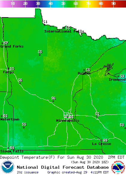
Sunday dew points will be in the comfortable 50s:
Turn Up Your Support
MPR News helps you turn down the noise and build shared understanding. Turn up your support for this public resource and keep trusted journalism accessible to all.
Rain chances start in the northwest Sunday afternoon
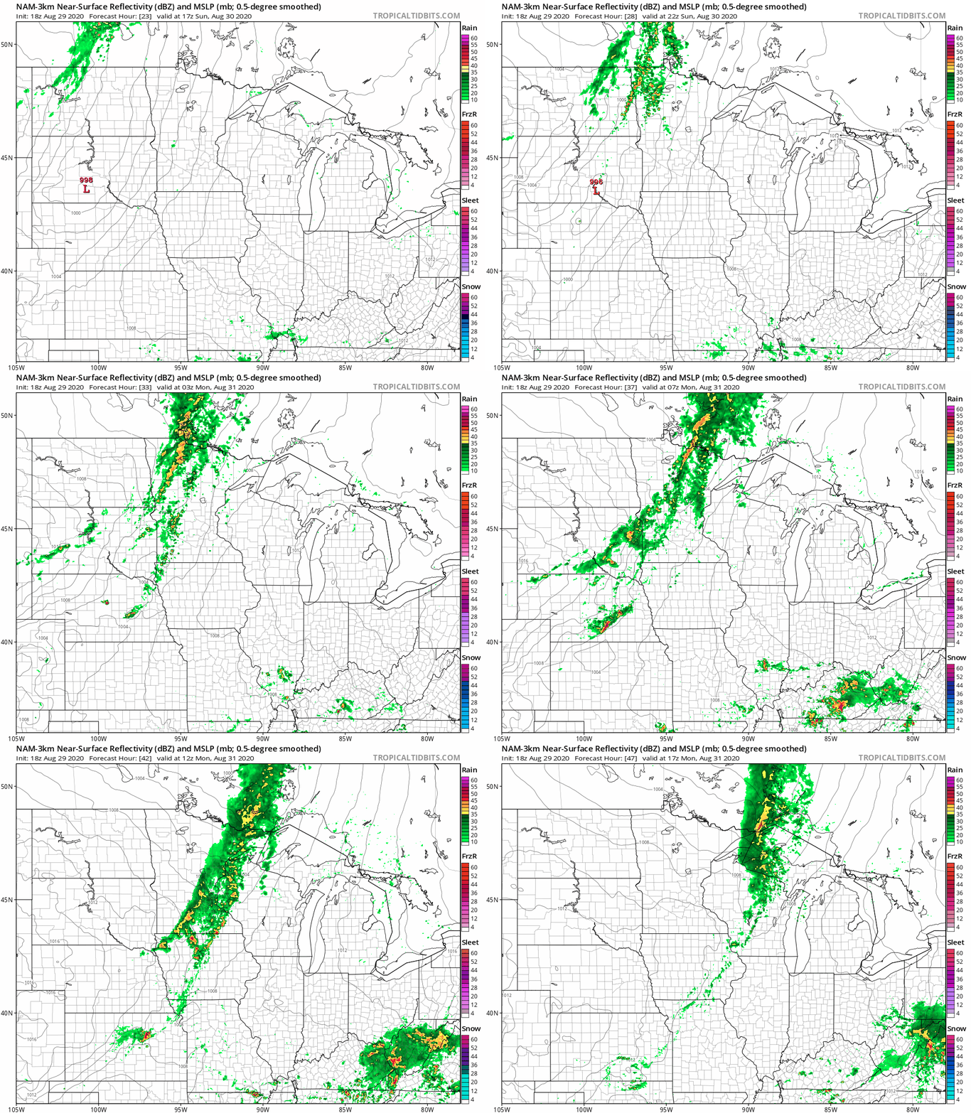
Northwestern Minnesota could see scattered showers/t-storms during the mid-late afternoon hours on Sunday. Showers/t-storms could spread eastward and southward Sunday evening and overnight Sunday night. At this point, it looks like our Sunday thunderstorm chance in the Twin Cities metro area will hold off until after sunset.
The National Oceanic and Atmospheric Administration’s North American Mesoscale (NAM) forecast model shows the potential rain pattern Sunday afternoon through Monday morning:
You can hear updated weather information on the MPR network, and you’ll see updated weather info on the MPR News live weather blog.
Temperature trends
Twin Cities metro area highs are projected to reach the lower 70s on Monday, followed by mid 70s Tuesday, upper 70s Wednesday and lower 70s on Thursday and Friday.
Metro area temps are expected to be cooler than normal next weekend. No big warmups are in sight. The NWS Climate Prediction Center shows a strong tendency for cooler than normal temperatures in Minnesota and Wisconsin from next Sunday through the following week:
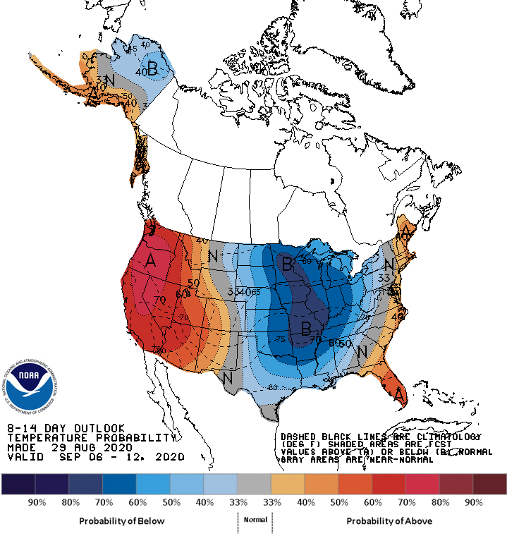
We’ll see if that changes.
Flooding rains Thursday into Friday
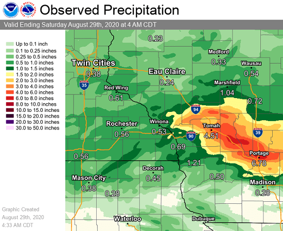
Portions of Wisconsin had flooding rains this past Thursday into Friday.
The NWS La Crosse office posted a summary and rainfall map:
Storms that repeated over parts of west-central Wisconsin from the late evening hours of August 27 into the early morning hours of August 28 resulted in an area of very heavy rainfall and flash flooding. Roughly 4 to 8" fell between La Crosse, WI and Portage, WI. High water over roadways, washed out culverts, and a mudslide were reported by local officials. A thunderstorm complex that moved through later in the morning of August 28 then added an additional 0.5 to 1" to this same area, resulting in some places receiving upwards of 9" of rain.
Programming note
You can hear my live weather updates on MPR News at 7:35 a.m., 9:35 a.m. and 4:35 p.m. each Saturday and Sunday.

