
Comfy temps today; thunder chances increase PM in some areas
No extreme heat in the forecast
Go Deeper.
Create an account or log in to save stories.
Like this?
Thanks for liking this story! We have added it to a list of your favorite stories.


Our average Twin Cities high temp is 78 degrees this time of year. Sunday highs in the metro area are expected to reach at least the upper 70s. A few spots could touch 80.
Most of Minnesota and western Wisconsin will have Sunday highs in the 70s, but a few locations in southern Minnesota could touch 80. There may be a few upper 60s in parts of far northeastern Minnesota. Dew points will be comfortable.
Temperature trends
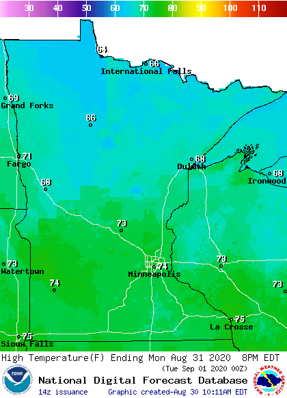
After a cold front swings through overnight, we’ll see Monday afternoon highs in the 60s in northern Minnesota, with 70s elsewhere in Minnesota plus western Wisconsin:
Turn Up Your Support
MPR News helps you turn down the noise and build shared understanding. Turn up your support for this public resource and keep trusted journalism accessible to all.
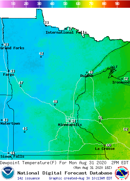
Monday dew points will be very comfortable, mostly in the 40s to low 50s:
Twin Cities metro area highs are projected to reach the mid 70s on Tuesday, followed by 80 Wednesday and lower 70s Thursday and Friday.
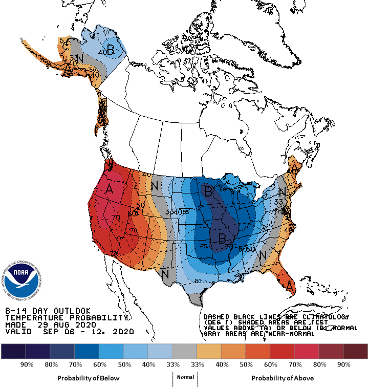
There isn’t any hot weather in our immediate future. The NWS Climate Prediction Center shows a strong tendency for cooler than normal temperatures in Minnesota and Wisconsin from next Sunday through the following week:
Thunderstorm chances
Showers and thunderstorm will move into parts of southwestern Minnesota early Sunday afternoon, then spread eastward. It’s possible that a stray shower or thunderstorm may make it into the Twin Cities metro area later in the afternoon or early in the evening.
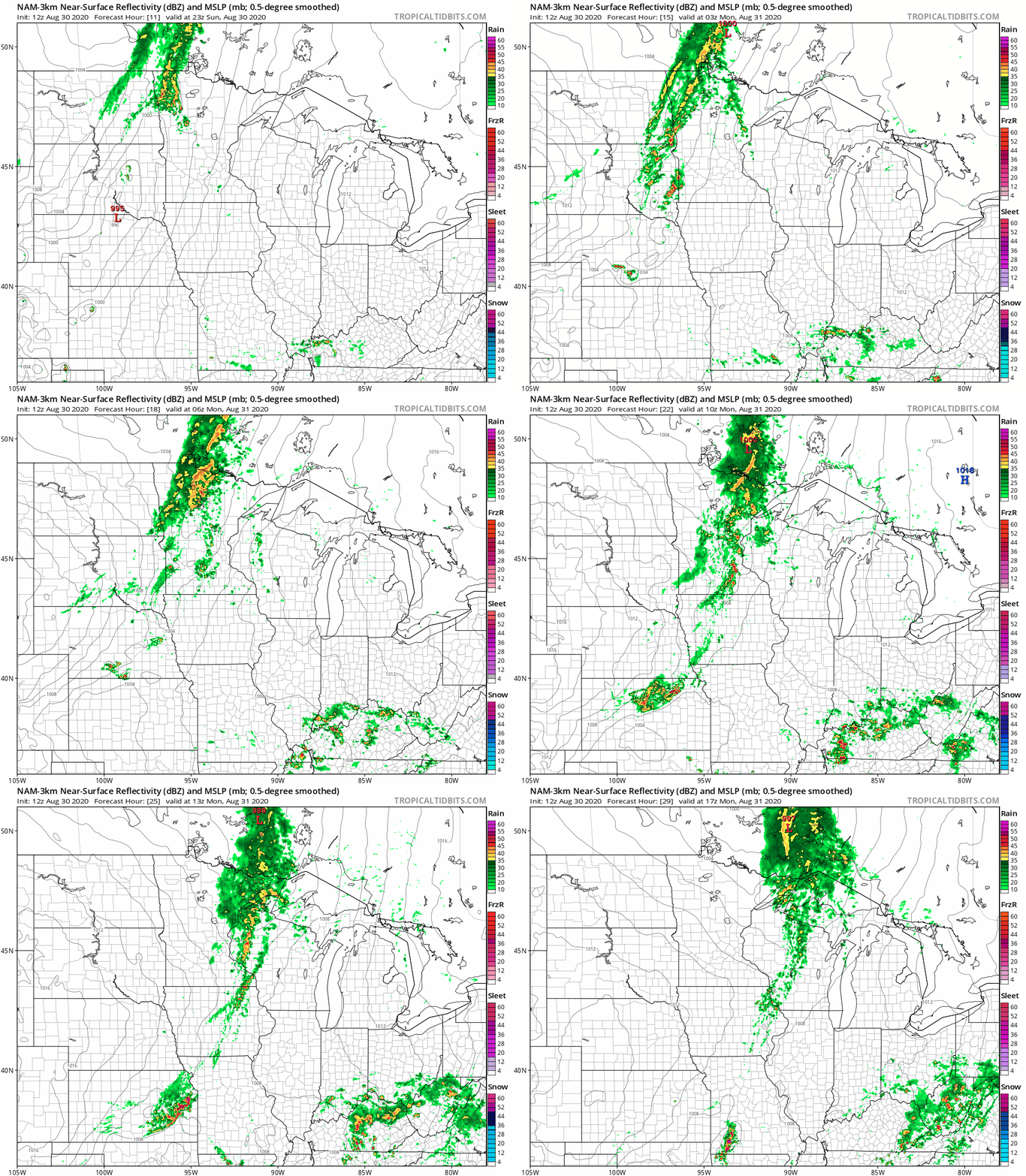
Showers and thunderstorms are also expected to move into parts of northwestern and west-central Minnesota late Sunday afternoon, then spread to the east and southeast Sunday evening and overnight.
The National Oceanic and Atmospheric Administration’s North American Mesoscale (NAM) forecast model shows the potential rain pattern Sunday evening through Monday morning:
The NWS Storm Prediction Center shows a slight risk of severe weather in parts of southwestern Minnesota today and tonight. Here’s the NWS Sioux Falls office depiction of that risk, which is primarily for the Sunday evening/Sunday night period:
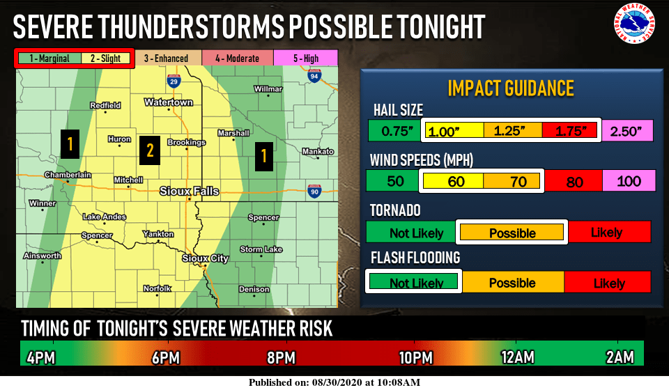
The slight risk area (shaded yellow) indicates where scattered severe thunderstorms are possible. The area shaded dark-green is where an isolated severe thunderstorm is possible.
You can hear updated weather information on the MPR network, and you’ll see updated weather info on the MPR News live weather blog.
Programming note
You can hear my live weather updates on MPR News at 7:35 a.m., 9:35 a.m. and 4:35 p.m. each Saturday and Sunday.

