
Colder weather heads our way for Labor Day
Milder over the weekend, with storms Saturday night
Go Deeper.
Create an account or log in to save stories.
Like this?
Thanks for liking this story! We have added it to a list of your favorite stories.


Quieter weather prevails most of Friday and Saturday, then conditions turn much more active and colder temperatures settle in.
Friday’s Forecast
Mostly clear skies overnight started the state off crisp Friday morning, ranging from lows in the 30s in the Arrowhead to 50s in southern Minnesota.
Under predominantly sunny skies, temperatures warm almost to average highs Friday, with northern Minnesota in the 60s and the southern half of the state in the 70s.
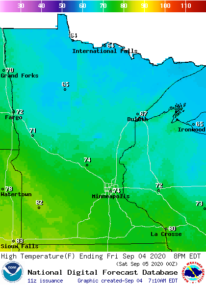
There will likely even be a couple 80s southwest.
Turn Up Your Support
MPR News helps you turn down the noise and build shared understanding. Turn up your support for this public resource and keep trusted journalism accessible to all.
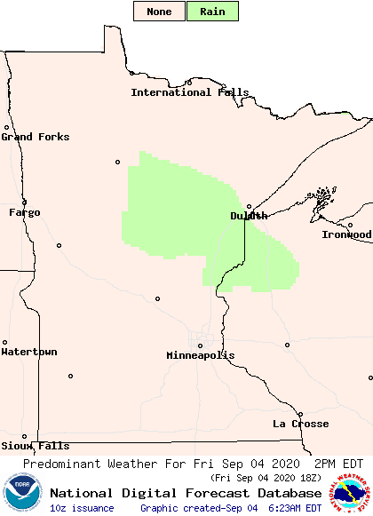
Although sunshine prevails, a very minor disturbance will bring a few more clouds and possibly a couple sprinkles to central Minnesota during the afternoon hours.
The high winds of Thursday have died down significantly, but it will still be somewhat breezy Friday, especially in the Arrowhead where wind gusts will top 20 mph at times.
Weekend forecast
Saturday will also be mostly sunny, and temperatures will be a couple degrees warmer than Friday, putting most of northern Minnesota back into the 70s.
By Saturday evening, a weather system starts bringing showers and storms into southern Minnesota, some of which could be severe through the overnight.
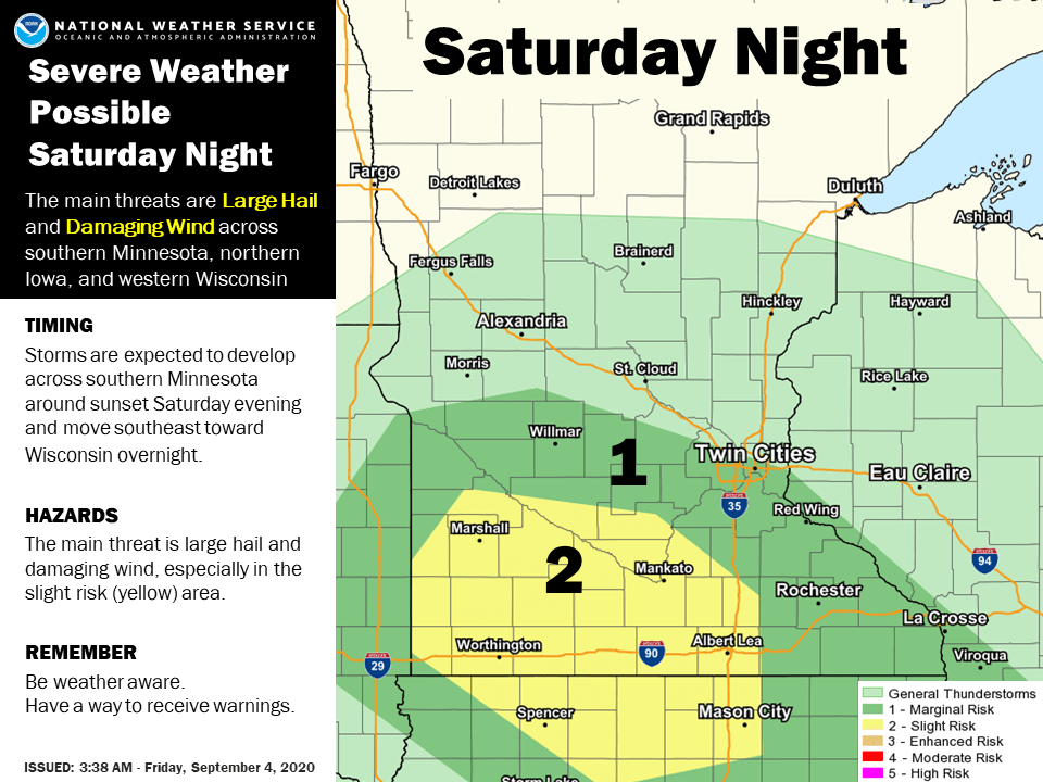
Spotty activity spreads north overnight, and while most of the state clears-out early Sunday, northern Minnesota keeps a chance for isolated wet weather throughout Sunday.
Sunday will likely be the warmest day Minnesota sees for a while, with 70s north and 80s south.
Next week
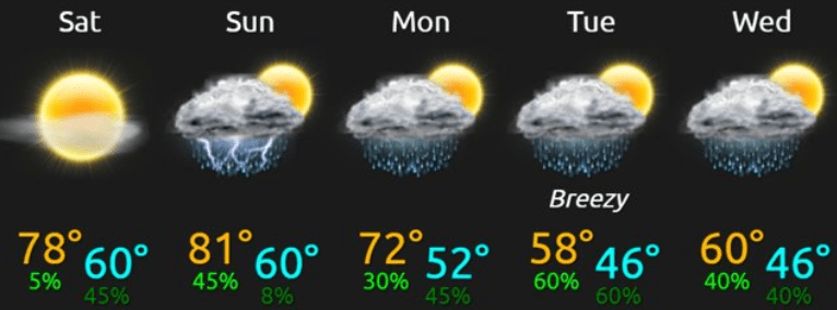
A strong cold front will bring back chances for rain, start dropping temperatures, and increase the winds Monday into Tuesday. It currently looks like temperatures will run at least 5 to 15 degrees below average by Tuesday, when of the state may not make it out of the 50s.
Temperatures should warm back into the 60s for most of the state by the second half of the week, but that still puts temperatures below average for early September.
Here is the forecast for the Twin Cities through Wednesday, showing that chillier turn in the weather:
Programming note
You can hear my live weather updates on Minnesota Public Radio at 7:48 a.m. Monday through Friday morning.

