
Chilly record set in metro; freeze warnings Tuesday night in northern Minn.
Colorado braces for snow
Go Deeper.
Create an account or log in to save stories.
Like this?
Thanks for liking this story! We have added it to a list of your favorite stories.


Our average Twin Cities high temperature on Sept. 8 is 75 degrees. Minneapolis-St. Paul International Airport tallied a high of 52 degrees this Tuesday. That broke the Twin Cities record for our coldest Sept. 8 high temp, which had been 54 degrees, set in 1929:

It was chilly statewide on Tuesday, and northern Minnesota will see low temps in the 30s late Tuesday night and early Wednesday morning.
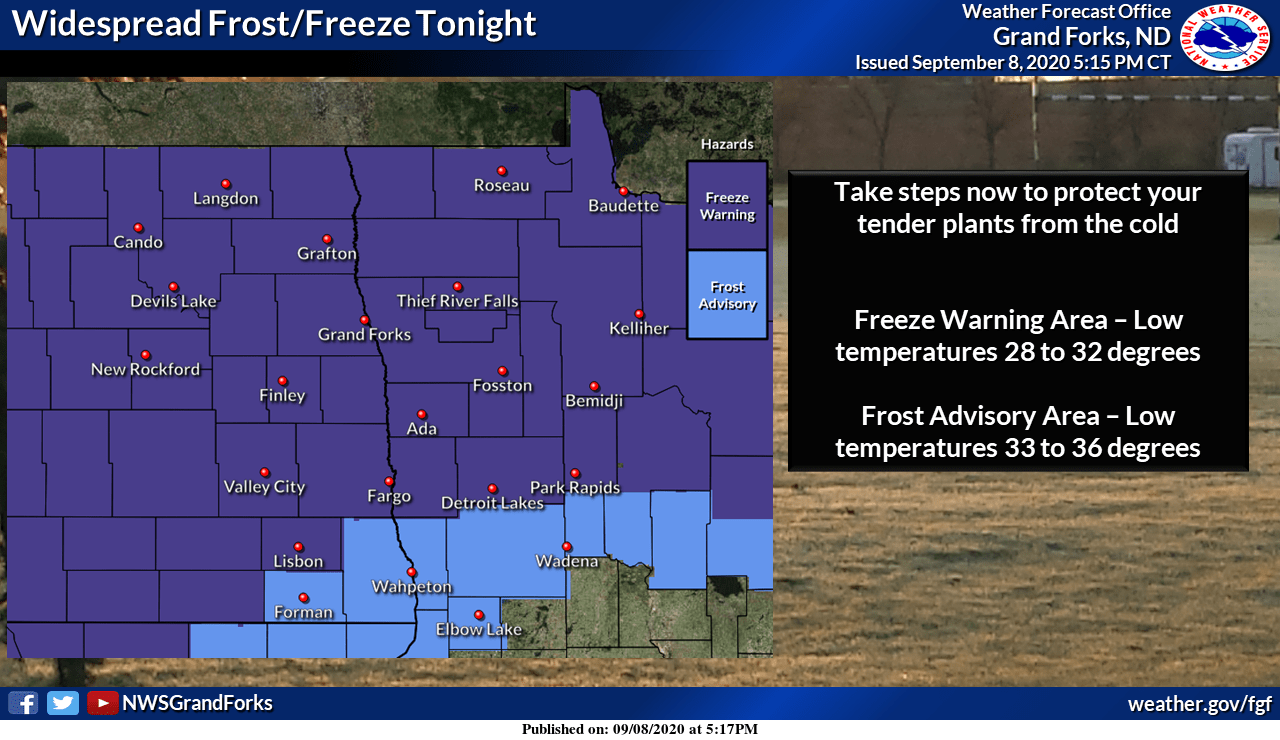
Freeze warnings cover much of the northern third of Minnesota Tuesday night into early Wednesday, with frost advisories (shaded light blue) near the North Shore of Lake Superior and in places like Brainerd, Duluth, Hinckley and parts of northwestern Wisconsin:

Here are the Tuesday night/early Wednesday morning freeze warnings and frost advisories to the northwest:
Turn Up Your Support
MPR News helps you turn down the noise and build shared understanding. Turn up your support for this public resource and keep trusted journalism accessible to all.
Lows in the 40s are expected in the Twin Cities early Wednesday morning.
Wednesday rain chances highest south
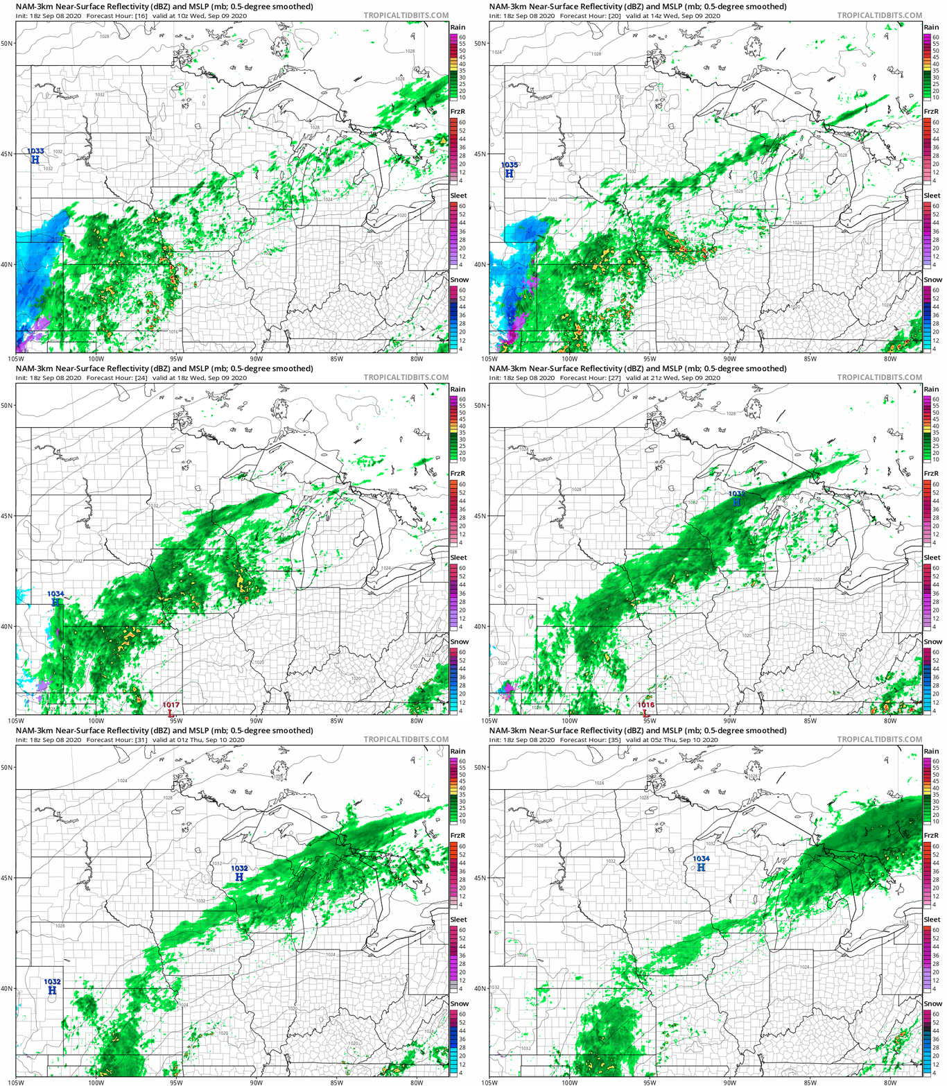
Periods of rain are forecast on Wednesday from southern Minnesota into western Wisconsin. The Twin Cities metro area will ride the northern edge of that rain band, so the south metro is likely to see some rain on Wednesday, with a bit lower rain chance in the north metro.
The National Oceanic and Atmospheric Administration’s North American Mesoscale (NAM) forecast model shows the potential rain pattern Wednesday and Wednesday evening:
You can hear updated weather information on the MPR network, and you’ll see updated weather info on the MPR News live weather blog.
Snow in Colorado
Denver had a new all-time September record high temp on Saturday, when they hit 101. They had highs in the 90s on Sunday and Monday. They’ve been in the 30s most of today, and Denver is expecting 4 to 5 inches of snow Tuesday night:

Double-digit snow totals are expected in some of the higher elevations in Colorado, and winter storm warnings have been issued for many locations:

Updates on the wintry weather will be posted by the Boulder, Colorado NWS office.
Temperature trends
I think that this is the earliest that I’ve ever turned on my furnace in the fall. It’ll be chilly again on Wednesday, with highs in the 50s:
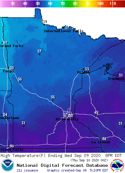
Our temps will gradually rebound. Twin Cities metro area highs are projected to be in the lower 60s on Thursday, followed by mid-60s Friday. We could top out in the upper 60s on Saturday and around 70 this coming Sunday. 70 degrees will feel great!

