
Record cold likely again Wednesday
Milder weather returns by the weekend
Go Deeper.
Create an account or log in to save stories.
Like this?
Thanks for liking this story! We have added it to a list of your favorite stories.


Unseasonable, and in some cases record-setting, cold continues through Thursday morning, then temperatures slowly warm into the weekend. Rain continues for southern Minnesota Wednesday, with more of the state seeing rain chances Friday.
Record cold Tuesday
The cold air gripping Minnesota set numerous records Tuesday (for the date of Sept. 8). While there were some record lows, such as Park Rapids tying a record low of 32, most of the records were for cold high temperatures.
This included the Twin Cities breaking a record that went back to 1929.
Rochester’s high of 49 shattered the old record of 57 set in 2019. Duluth and Brainerd tied previous records for cold high temperatures, both at highs of 52 degrees.
Turn Up Your Support
MPR News helps you turn down the noise and build shared understanding. Turn up your support for this public resource and keep trusted journalism accessible to all.
More records are likely to be set Wednesday for cold high temperatures, especially in southern Minnesota.
Cold Wednesday into Thursday morning
Wednesday started colder than Tuesday across northern Minnesota, with much of the region seeing temperatures below freezing and several locations, including Hibbing, Ely, and Bemidji, that dropped into the upper 20s.
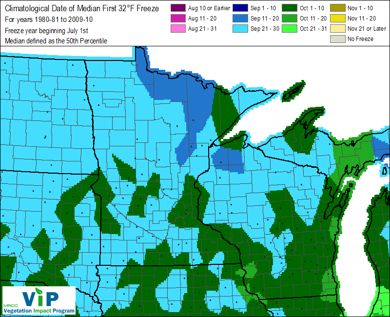
This means most of northern Minnesota has now had its first freeze of the season, which is earlier than the average of mid to late September.
Southern Minnesota began the day in the 40s, thanks to cloud cover keeping temperatures milder.
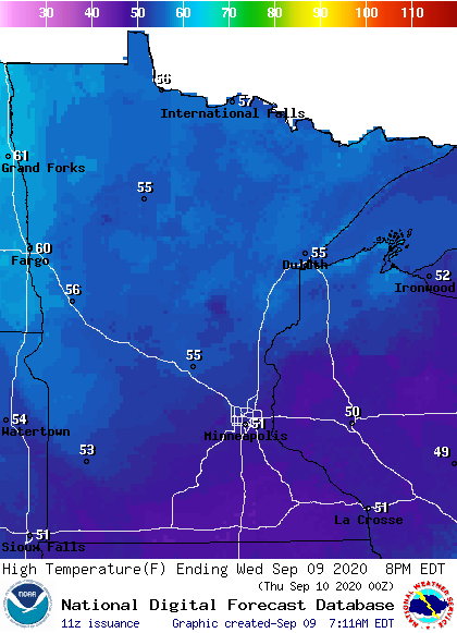
Under more sunshine, northern Minnesota will warm into the mid-50s with a few 60s possible northwest, which is still below average, but will be warmer than the southern edge of the state.
The persistent active weather south of the state keeps clouds in again Wednesday for southern and eastern Minnesota, along with occasional rain showers, especially in the southeastern corner of the state.
That pattern will also keep highs in southern Minnesota slightly colder than the rest of the state, and in the lower 50s.
This is more than 20 degrees below average, and is why more “record low maximum” temperatures could be set, including for the Twin Cities, which will see a high near 51 and the current record for the coldest high temperature on Sept. 9 is 55 degrees, set in 1929.
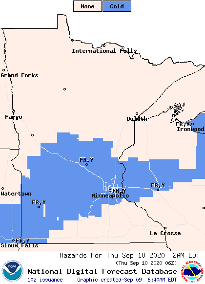
The clouds and moisture finally start to clear out of southern Minnesota by Wednesday evening, but clearing skies mean temperatures will drop into the 30s, even in for many southern parts of the state.
Because of this, central and southern Minnesota are under a frost advisory Thursday morning.
Extended forecast
Under more statewide sunshine, highs Thursday finally make it back into the 60s, then temperatures stay milder into the weekend.
Here is that temperature trend for the Twin Cities:
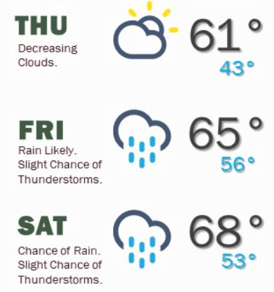
After a sunnier Thursday, another storm starts moving in Friday morning that brings possible rain across the state by Friday afternoon and lingers through Saturday. However, the heavier precipitation targets southern Minnesota again, with one-half inch to an inch of rain possible, while the northern half of the state sees spottier, light precipitation.
Drier and sunny conditions are expected to return by Sunday.
Programming note
You can hear my live weather updates on Minnesota Public Radio at 7:48 a.m. Monday through Friday morning.

