
As summer ends, fall starts off warm
Minnesota sees another week of below average precipitation
Go Deeper.
Create an account or log in to save stories.
Like this?
Thanks for liking this story! We have added it to a list of your favorite stories.


Summer ends and fall begins with above average temperatures that last the entire week. Meanwhile, rain chances stay sparse.
Monday’s forecast
Thanks to southerly winds overnight, Monday started warm for this time of year, with lows in the 50s and 60s. While that was mild for September everywhere, in the northwestern corner of the state that was over 20 degrees above average in some locations.
Afternoon highs continue to be warm, with 70s and a few 80s.

Much of the state sees mostly sunny skies, but southern and central Minnesota can expect a mix of clouds along with a very isolated chance for a light shower or storm. No significant precipitation is expected.
Turn Up Your Support
MPR News helps you turn down the noise and build shared understanding. Turn up your support for this public resource and keep trusted journalism accessible to all.
Although not as windy as Sunday, it remains breezy Monday, particularly across the northern edge of the state.
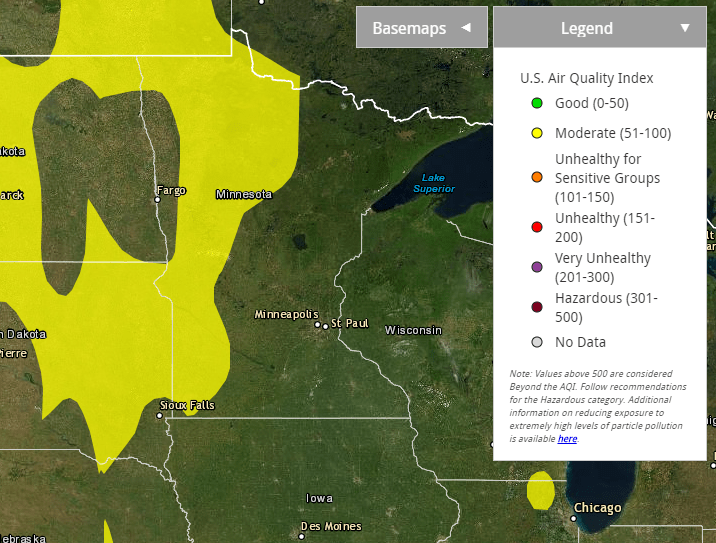
The wind pattern will not only keep some haze in the skies above the state, but some smoke has made it to the surface in western Minnesota, causing air quality to drop into the “moderate” category.
Fall starts warm
The autumnal equinox takes place at 8:30 a.m. Tuesday, and the season starts with even warmer weather than summer ends on.
Much of Minnesota can expect highs to be a couple degrees warmer Tuesday than Monday, meaning a few more 80s for central and southern Minnesota.
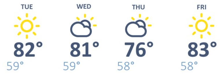
The rest of the week remains above average, with highs in the 70s through the rest of the week, with occasional 80s south and west. Temperatures dip slightly Thursday, which could bring back a few 60s in northern Minnesota, but that is still above average.
Here is the forecast for the Twin Cities through Friday:
Spotty rain chances
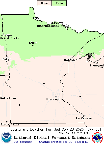
Mostly sunny, although sometimes hazy, skies prevail much of the week as precipitation remains limited. A cold front likely brings some needed, light rain to northern Minnesota Wednesday, and possibly through eastern Minnesota overnight into Thursday morning.
Then it looks like a more widespread area of showers and storms could target the state Saturday into Sunday, but rainfall with that currently also looks light.
So overall, the start of fall will be mostly dry, sunny, and warm.
Programming note
You can hear my live weather updates on Minnesota Public Radio at 7:48 a.m. Monday through Friday morning.

