
A cold weekend, then warm weather returns Monday
Showers on Saturday could have snow mixed in for some areas.
Go Deeper.
Create an account or log in to save stories.
Like this?
Thanks for liking this story! We have added it to a list of your favorite stories.


Temperatures remain cold through the weekend, and northern Minnesota even sees a chance for light snow. Then highs rebound into the 60s next week.
Friday’s forecast
Behind a cold front Thursday, Friday started off cold with temperatures in the 20s and 30s bringing frost and freeze conditions to much of the state.
Even under partly sunny skies, most of the state makes it only into the 40s for highs, which is 10 to 15 degrees below average for early October.
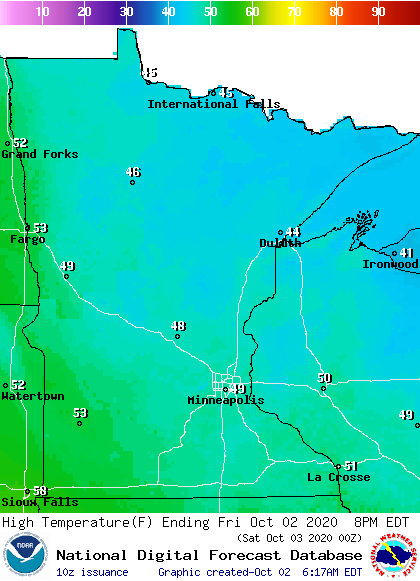
However, unlike the past two days, winds remain very light Friday, so there will not be a wind chill to make it feel even colder.
Turn Up Your Support
MPR News helps you turn down the noise and build shared understanding. Turn up your support for this public resource and keep trusted journalism accessible to all.
Weekend Forecast
Already Friday evening, more clouds move in and showers start spreading across the state overnight.
While most of the precipitation Saturday will be light rain showers, light snow could mix in for northern and possibly central Minnesota early Saturday morning, when temperatures are at their coldest.
The showers move out by late Saturday, bringing dry skies and more sunshine fore Sunday.
Temperatures remain below average, with highs predominantly in the 40s Saturday and more 50s Sunday thanks to the sunshine.
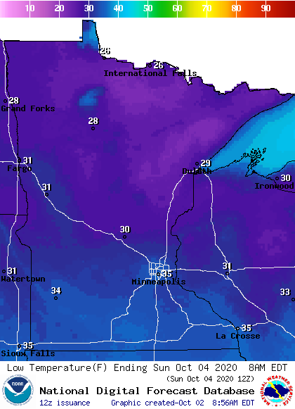
Lows also remain cold, with more frost and freeze concerns, especially on Sunday morning because of the mostly clear skies expected overnight Saturday.
Warm weather returns
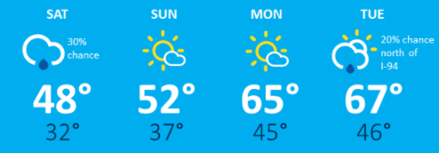
By Sunday, the pattern begins to shift and winds start coming out of the south. This warmer flow brings much of Minnesota back into the 60s Monday.
The rest of the week remains mostly above average, with highs predominantly in the 60s. There will be occasional 50s north, and possibly even a couple 70s south over the course of the week.
Here is the forecast trend for the Twin Cities, showing the dramatic warm-up after the chillier weekend:
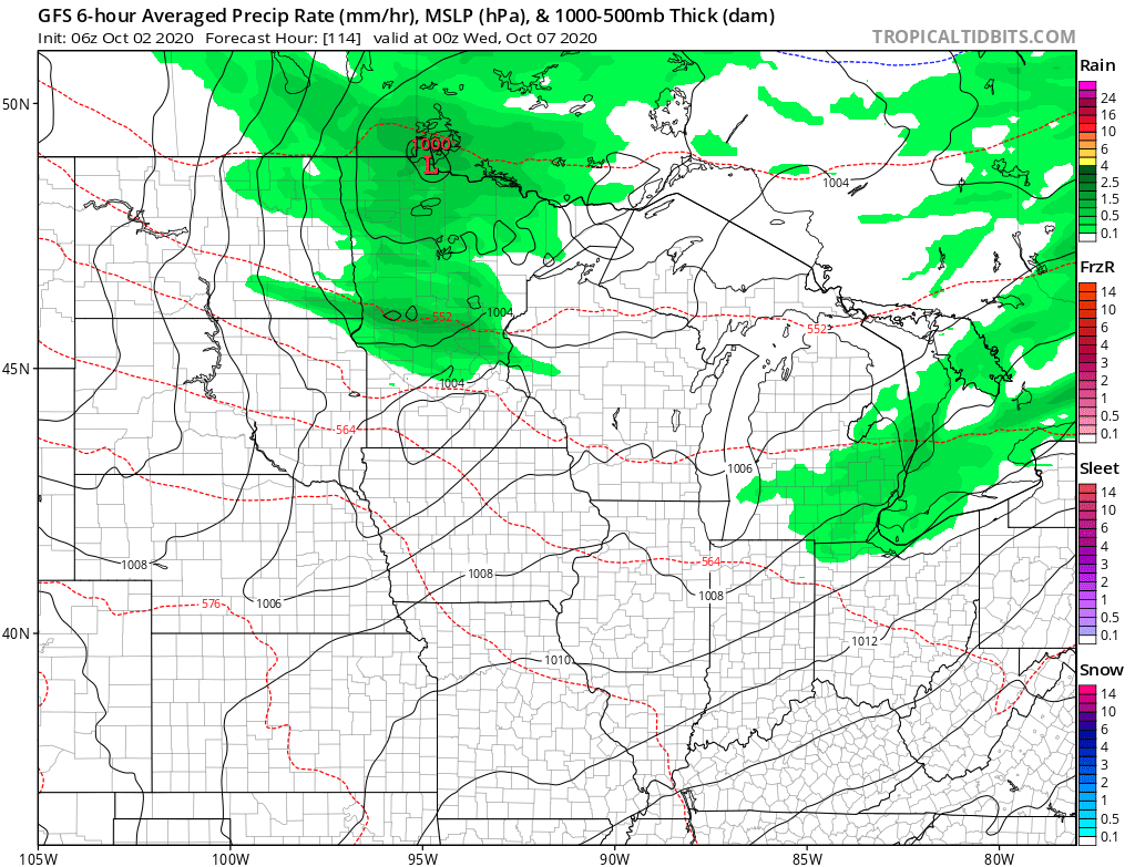
Sunny skies prevail much of next week. The best chance for rain currently looks like Tuesday, especially for northern Minnesota.
Programming note
You can hear my live weather updates on Minnesota Public Radio at 7:48 a.m. Monday through Friday morning.

