
From heat to strong storms over the weekend
Needed rain targets Minnesota by Sunday night
Go Deeper.
Create an account or log in to save stories.
Like this?
Thanks for liking this story! We have added it to a list of your favorite stories.


After what will likely be record warmth Friday, temperatures cool slightly over the weekend. By Sunday, a strong storm brings not only needed rain, but a risk for severe weather.
Friday and Saturday
Under the influence of a warm front, Friday morning started very mild for October, ranging from 40s north to 60s south.
Thanks to the warm wind flow plus widespread sunshine, Friday afternoon temperatures will soar 15 to 25 degrees above average, with most of northern Minnesota in the 70s and 80s south.
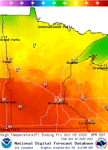
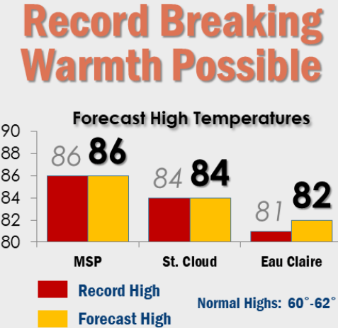
This weather is so warm for October, much of central and southern Minnesota will have near-record warmth, and a few record highs will likely be set.
Turn Up Your Support
MPR News helps you turn down the noise and build shared understanding. Turn up your support for this public resource and keep trusted journalism accessible to all.
A dry cold front starts moving north to south through Minnesota Friday afternoon and evening, which brings cooler weather back by Saturday.
Highs Saturday will be in the 50s north and 60s south, which is still slightly above average. It also stays sunny, making it a pleasant fall day.
Stormy weather returns
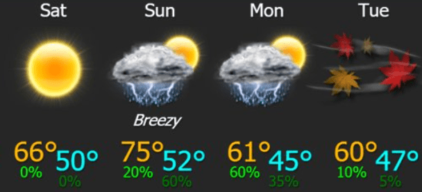
Another weather system starts pushing into Minnesota by Sunday, and under the influence of a warm front, Sunday turns warmer again, with 60s north, 70s south, and maybe even a few 80s in the southwestern corner of the state.
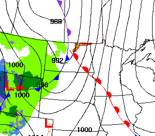
However, as the cold front approaches and starts moving through the second half of Sunday, showers and storms start moving across the state. This brings statewide rain chances by Sunday evening, and some of the storms will likely be severe.
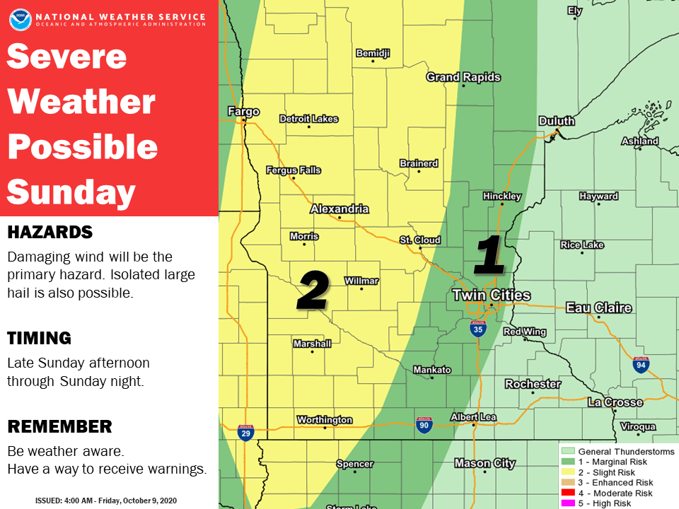
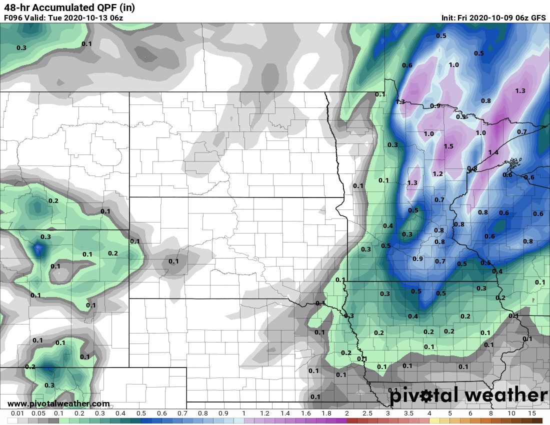
Parts of Minnesota will also see periods of heavy rain late Sunday in to early Monday, then rain tapers off through the rest of Monday.
The western edge of the state may not see as much rain, but portions of central and eastern Minnesota can expect one-half to over an inch in some spots.
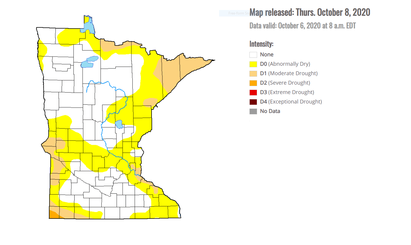
This is needed rain, as Minnesota had been exceptionally dry since September, and almost half of the state is now considered “abnormally dry” or even in drought conditions.
Behind that storm, temperatures turn much more seasonable than the recent warm trend. Highs return to the 50s and 60s, with possible 40s north later in the week.
Here is that temperature trend for the Twin Cities through Tuesday:
Programming note
You can hear my live weather updates on Minnesota Public Radio at 7:48 a.m. Monday through Friday morning.

