
Sunday night thunderstorms; breezy and cooler on Monday
Much cooler later this week
Go Deeper.
Create an account or log in to save stories.
Like this?
Thanks for liking this story! We have added it to a list of your favorite stories.


A line of thunderstorms continues to move through Minnesota this Sunday night. The line of thunderstorms is expected to advance into western Wisconson later Sunday night. We’re getting some much-needed rain, but some areas could see wind gusts of 40 to 50 mph as the storms move through.
You can hear updated weather information on the MPR network, and you’ll see updated weather info on the MPR News live weather blog.
Updates on the storms will also be posted by the NWS offices in the Twin Cities, La Crosse and Duluth.
Some showers could linger beyond sunrise Monday morning in parts of eastern Minnesota and western Wisconsin.
Turn Up Your Support
MPR News helps you turn down the noise and build shared understanding. Turn up your support for this public resource and keep trusted journalism accessible to all.
Cooler Monday
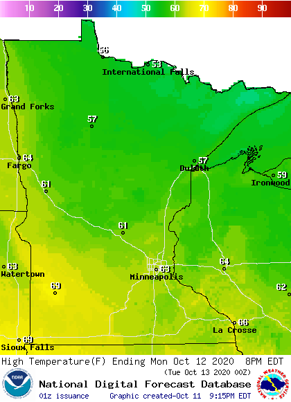
Monday high will be in the 60s in most areas, with some 50s in far northern Minnesota:
It’ll be breezy on Monday, with gusts of 20 to 28 mph:
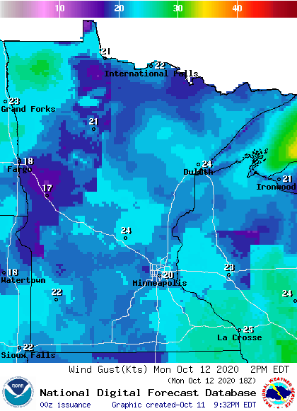
Plotted values are in knots, with 20 knots equal to around 23 mph and 24 knots equal to around 28 mph.
Temperature trends
Twin Cities metro area highs are projected to reach the lower 60s on Tuesday and Wednesday, then colder air moves in and we’ll see highs around 50 on Thursday and Friday.
It looks like cool temps will linger into next wekend and the start of the following week. The NWS Climate Prediction Center temperature outlook for Oct. 17 through Oct. 21 shows a strong tendency for below-normal temperatures in Minnesota and Wisconsin:
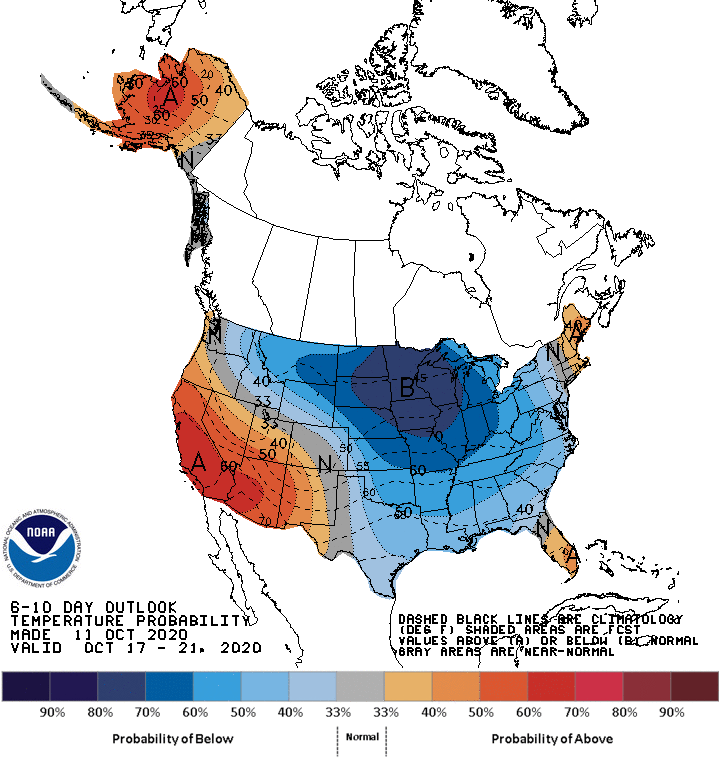
We’ll see if that pans out.

