
Highs in the 70s return this week
Sunny skies prevail through Saturday
Go Deeper.
Create an account or log in to save stories.
Like this?
Thanks for liking this story! We have added it to a list of your favorite stories.


After a cold and snowy October, the first week of November turns warm and is likely to stay dry.
October of 2020 ended up as one for the record books. Not only were many daily records for cold and snow set, but the month as a whole also set records.
Much of central and southern Minnesota saw one of the snowiest Octobers ever, including St. Cloud and the Twin Cities taking the top ranking.

Other impressive snow rankings included Duluth and Moorhead having their second snowiest October on record.
Turn Up Your Support
MPR News helps you turn down the noise and build shared understanding. Turn up your support for this public resource and keep trusted journalism accessible to all.
The cold was also notable, with much of the state running five or more degrees below average for the month, even when factoring the warm weather at the start of October. Cold rankings included Duluth and Rochester having their fifth coldest October ever.
Monday’s forecast
Temperatures Monday started in the 20s and 30s, which was very close to average for early November.
Skies are predominantly clear, with mostly just a few high clouds. This means plenty of sunshine through the day, helping the state warm to slightly above average highs in the 40s and 50s.
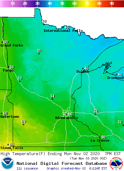
Winds also stay fairly light, so between the mild temperatures, sunshine and light winds, it will be a pleasant day.
Extended forecast
By Tuesday, winds shift to more of a flow from the southwest, which will draw even warmer air across the state, putting highs in the 50s and 60s.
That warmer air lasts through the rest of the week. In fact, by the end of the week, southern Minnesota is likely to see a few 70s.
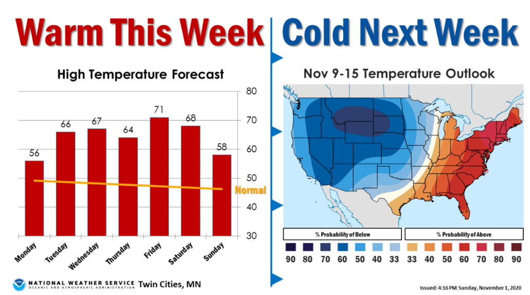
Then, a storm that brings a strong cold front Sunday is likely to turn temperatures colder again by early next week.
Meanwhile, the pattern across Minnesota stay very dry through the end of the week, with no significant precipitation chances on the horizon.
Here is the precipitation forecast through Saturday, showing that dry trend:
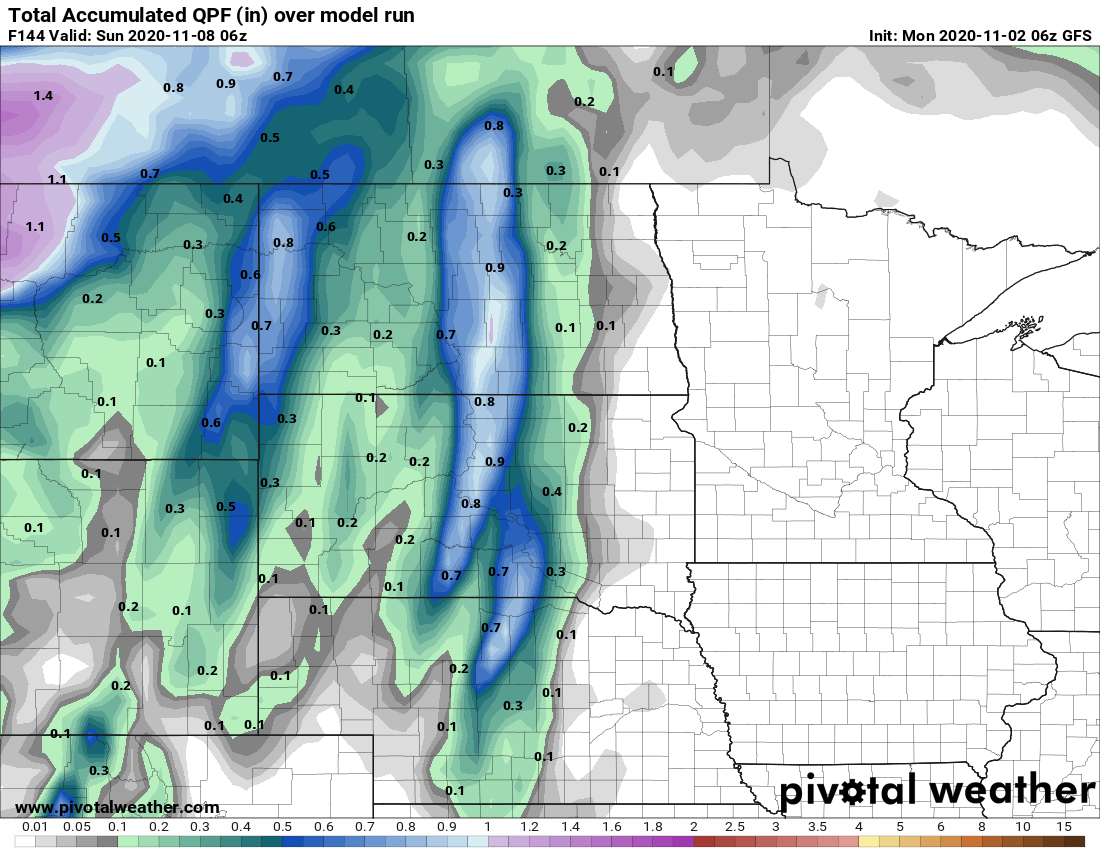
The outlook next week does turn more active again, starting with the storm that moves through Sunday bringing rain chances back across the state and possible snow north.
Programming note
You can hear my live weather updates on Minnesota Public Radio at 7:48 a.m. Monday through Friday morning.

