
More records in jeopardy as 60s and 70s continue
Much colder weather returns next week
Go Deeper.
Create an account or log in to save stories.
Like this?
Thanks for liking this story! We have added it to a list of your favorite stories.


Many record highs could be set again Wednesday as temperatures remain over 20 degrees above average. After warm weather through Sunday, temperatures plunge next week.
Much of Minnesota saw 70s on Tuesday, which was 20 to 30 degrees above average highs for early November.
Places around the state that set record highs for Nov. 3 included the Twin Cities at 75 degrees, Moorhead at 71, and International Falls at 70 shattered the previous record of 66.
Wednesday’s forecast
Despite the record warmth Tuesday, most of Minnesota started only slightly above average Wednesday morning, with temperatures ranging from the 20s north to 40s south.
Turn Up Your Support
MPR News helps you turn down the noise and build shared understanding. Turn up your support for this public resource and keep trusted journalism accessible to all.
However, thanks to plenty of sunshine and warm winds out of the southwest and west, highs again shoot 20 to almost 30 degrees above average by Wednesday afternoon.
Central and southern Minnesota will see temperatures in the 70s.
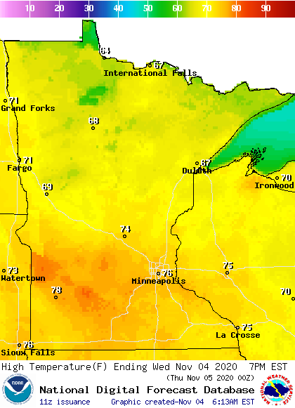
More record highs are likely to be set. This includes the Twin Cities, where the Nov. 4 record of 74 degrees has a good chance of being broken.
Warm, dry weather continues
By Thursday, the warmest of the weather breaks slightly, and more of the state will see highs in the 60s, which is still very mild for November.
Temperatures in the 60s and low 70s then continue to Sunday.
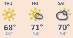
Although records may not be as widespread as Tuesday and Wednesday, a few more records highs are likely to be seen in parts of Minnesota through the end of the week. There are also no significant rain chances until at least Sunday.
Big changes next week
By Sunday afternoon, light rain is likely to start moving across the state ahead of a strong storm that moves through Monday. That system will bring rain Monday and may bring some snow mixing in as the system clear and temperatures drop.
The storm ushers in much colder air, plunging highs into only the 30s by Tuesday.
Below average highs are expected the rest of the week.
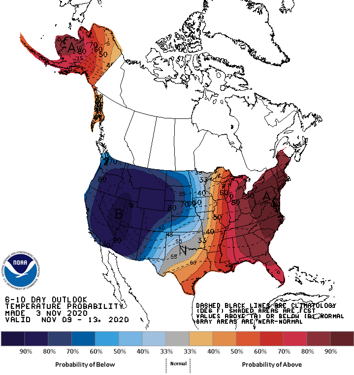
That will be a major temperature reversal after the current warm weather, so enjoy the warm weather while it lasts!
Programming note
You can hear my live weather updates on Minnesota Public Radio at 7:48 a.m. Monday through Friday morning.

