
Record warmth less likely Thursday
Dry and sunny skies still prevail across the state
Go Deeper.
Create an account or log in to save stories.
Like this?
Thanks for liking this story! We have added it to a list of your favorite stories.


Thursday remains mild, but not quite as warm as the past two days, with less of a chance for setting record highs.
Thursday’s forecast
Thanks to record-setting warmth Wednesday, temperatures stayed milder than average overnight despite clear skies and light winds (conditions that allow temperatures to drop quickly). Morning lows are starting in the 30s north and 40s south.
A weak boundary has moved through Minnesota, shifting winds that have recently been mostly west and southwest to a more northwesterly component, especially through the morning.
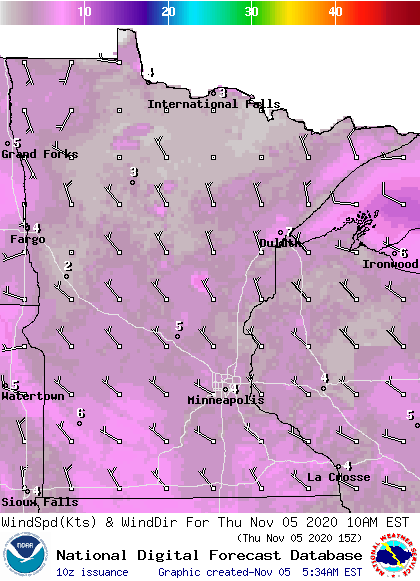
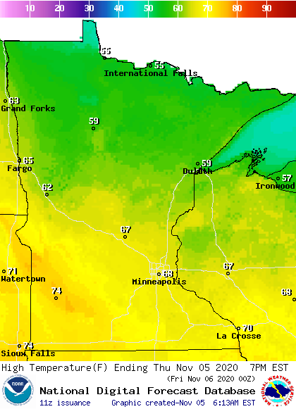
This slightly cooler wind pattern means temperatures will not be quite as warm as the past two days. Highs in the 50s and 60s, with a few 70s southwest, are still 15 to 20 degrees above average, but widespread records are less likely than the past two days.
Mostly sunny skies prevail again.
Temperatures nudge higher again Friday, then cold weather returns next week. That extended forecast will be updated around 9 a.m.
Programming note
You can hear my live weather updates on Minnesota Public Radio at 7:48 a.m. Monday through Friday morning.
Turn Up Your Support
MPR News helps you turn down the noise and build shared understanding. Turn up your support for this public resource and keep trusted journalism accessible to all.

