
Changing weather as a storm brings cold and snow
Minnesota goes from record warmth to highs in the 30s
Go Deeper.
Create an account or log in to save stories.
Like this?
Thanks for liking this story! We have added it to a list of your favorite stories.


After our recent trend of record November warmth, a potent storm is impacting Minnesota with rain, snow, and colder temperatures that are here to stay.
Storm impacts
As of Monday morning, a cold front moving predominantly northwest to southeast across the state has made it through all but the eastern and southern edge of Minnesota.
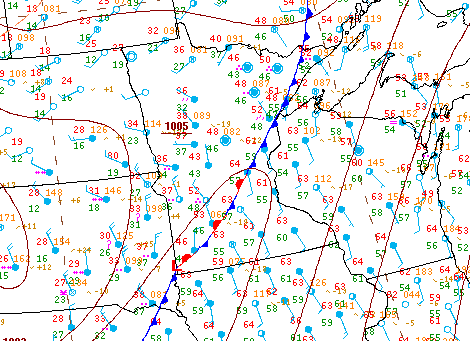
The highest winds are ahead of the front, so especially southeastern Minnesota, including the Twin Cities, will still see gusty winds through the morning.
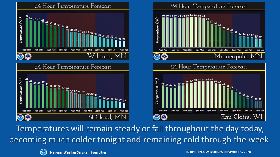
When the front passes through, temperatures start plummeting, which has morning temperatures ranging from 20s and 30s in northwestern Minnesota, where the cold air started moving in first, to 60s southeast, ahead of the front.
Turn Up Your Support
MPR News helps you turn down the noise and build shared understanding. Turn up your support for this public resource and keep trusted journalism accessible to all.
As the cold air filters across the state, much of Minnesota will see temperatures either hold steady or fall during the day, depending on location.
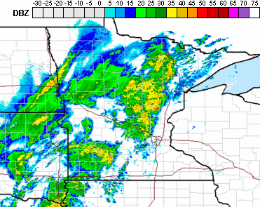
The storm is also bringing a widespread area of rain and possibly a few thunderstorms along with it.
Because of the temperature drop, the rain turns to snow as the system starts to move out late Monday. Although northwestern Minnesota is likely to clear out by Monday night, enough moisture lingers Tuesday to bring accumulating snow across most of the state.
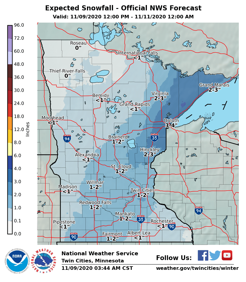
Most places can expect trace amounts to 2 inches through Tuesday evening, with slightly higher amounts in the Arrowhead, where the snow could linger overnight Tuesday.
Extended forecast
By Veteran’s Day (Wednesday), skies clear, and temperatures in the 30s and 40s put the state near average for mid-November.
A disturbance moves through Thursday, with a slight chance for precipitation, and a reinforcement of cooler air that brings most of Minnesota highs only in the 30s Thursday and Friday. Then, much of the state sees 40s again by Saturday.
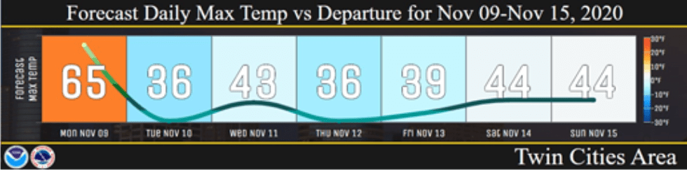
Although this trend is much colder than the recent warm spell, those temperatures were 20 to 30 degrees above average, whereas the rest of this week will be more seasonable for this time of year, staying at or slightly below average.
Programming note
You can hear my live weather updates on Minnesota Public Radio at 7:48 a.m. Monday through Friday morning.

