
Temperatures dive Monday
Rain turning to snow spreads across the state
Go Deeper.
Create an account or log in to save stories.
Like this?
Thanks for liking this story! We have added it to a list of your favorite stories.


A strong cold front is carving its way across Minnesota bringing gusty winds, rain, and falling temperatures Monday.
Monday’s forecast
As of Monday morning, a cold front moving predominantly from northwest to southeast across the state has made it through all but the eastern and southern edge of Minnesota.
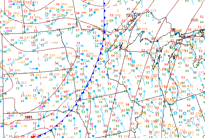
The highest winds are ahead of the front, which means especially southeastern Minnesota, including the Twin Cities, will still see gusty winds through the morning.
As the front moves through, temperatures start plummeting, so morning temperatures range from 20s and 30s in northwestern Minnesota, where the cold air started moving in first, to 60s southeast, ahead of the front.
Turn Up Your Support
MPR News helps you turn down the noise and build shared understanding. Turn up your support for this public resource and keep trusted journalism accessible to all.
As the cold air filters across the state, much of Minnesota will see temperatures either hold steady or fall during the day, depending on location.
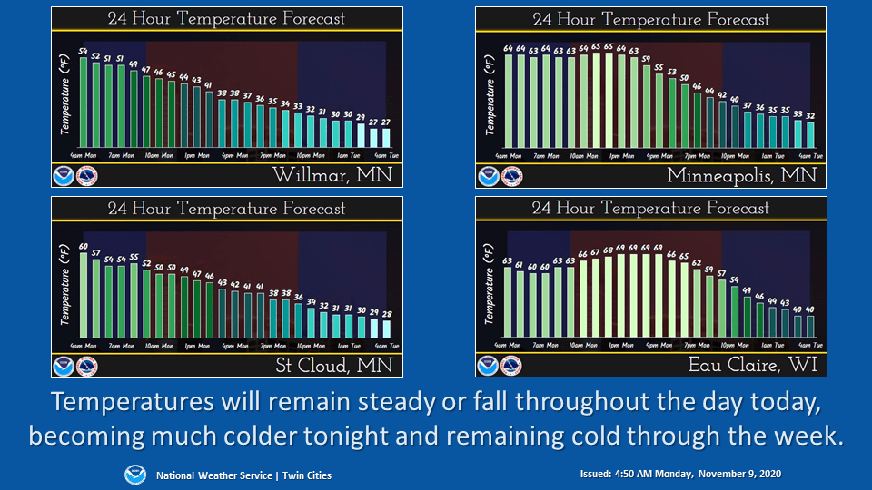
The storm is also bringing a widespread area of rain and possibly a few thunderstorms along with it.

As temperatures drop, some of the rain will turn to snow as the system starts to clear west to east late Monday.
Some of that snow is likely to linger in southern Minnesota into Tuesday, and lower temperatures stay in place the rest of the week. That extended forecast will be updated around 9 a.m.
Programming note
You can hear my live weather updates on Minnesota Public Radio at 7:48 a.m. Monday through Friday morning.

