
Ice, heavy snow target Minnesota: 4-6 inches in Twin Cities, Duluth, Mankato
Sunshine returns by Veterans Day

Go Deeper.
Create an account or log in to save stories.
Like this?
Thanks for liking this story! We have added it to a list of your favorite stories.


Warnings and advisories are up across most of Minnesota Tuesday, thanks to a broad area of snow and some ice moving into the state. Then sunshine returns by Veterans Day.
Tuesday’s forecast
In the wake of Monday’s storm, much colder air returned to Minnesota, bringing a colder start Tuesday in the teens and 20s for most of the state, with a few 30s in southeastern Minnesota.
Temperatures only rise into the 20s in the north and low 30s in the south south all day.
Behind the storm, there was already lingering precipitation in southeastern Minnesota, which is mostly rain as of 9 a.m. but which has a history of snow and ice mixing in because of the temperatures near freezing.
Turn Up Your Support
MPR News helps you turn down the noise and build shared understanding. Turn up your support for this public resource and keep trusted journalism accessible to all.

Although the precipitation with that storm initially cleared, now a disturbance rotating around the storm, combined with the storm picking up additional moisture, is pushing more wet weather back into southern Minnesota. It will bring and expanding area of rain, some ice, and widespread snow south to northeast through Tuesday.
For the Twin Cities, snow is anticipated particularly in the afternoon and evening hours before winding down late Tuesday.
A wide swath of the state can expect 4 to 6 inches of snow through the day, and ice accumulation could occur in southern Minnesota, including around the Albert Lea and Rochester areas.
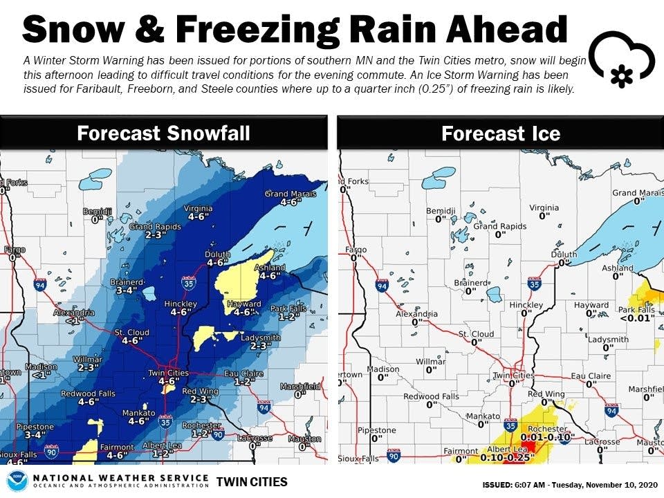
Because of this, much of Minnesota is under at least a winter weather advisory, with areas expected to see heavier snow or ice under winter storm and ice storm warnings.

Northwestern Minnesota dodges most of Tuesday’s snow, and even sees a little sunshine.
Extended forecast
By Veteran’s Day (Wednesday), skies clear, and highs will be a couple degrees warmer, from the mid-30s north to a couple 40s south.
Another weather disturbance moves through Thursday, bringing a light snow and rain chances while reinforcing the cooler air.
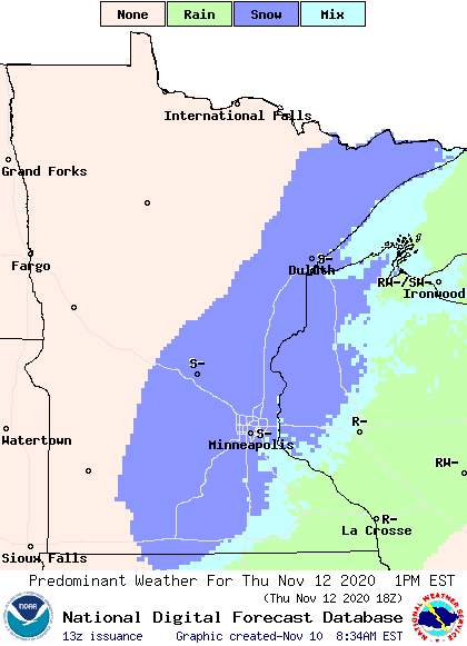
This keeps highs only in the 30s through at least Friday.
By the weekend, southern Minnesota could see a few 40s again, which would be closer to average for mid-November.
Programming note
You can hear my live weather updates on Minnesota Public Radio at 7:48 a.m. Monday through Friday morning.

