
Thursday snow slows traffic; weekend forecast includes normal temps, some rain and snow

Go Deeper.
Create an account or log in to save stories.
Like this?
Thanks for liking this story! We have added it to a list of your favorite stories.


Before I jump into the weekend forecast, here’s an update on our Thursday afternoon snowy mess.
A band of heavy snow has severely reduced visibilities in parts of eastern and south-central Minnesota the past few hours.
The Twin Cities National Weather Service office issued it’s first snow squall warning Thursday morning for portions of east-central Wright County and north-central Hennepin County:
Portions of eastbound and westbound Interstate 94 near Monticello, Minn., were closed due to multiple crashes this morning:
Turn Up Your Support
MPR News helps you turn down the noise and build shared understanding. Turn up your support for this public resource and keep trusted journalism accessible to all.
Eastbound Interstate 94 is now open at Monticello:
As of 1:30 p.m., snow continues over the eastern and southern portions of the Twin Cities metro area plus south-central Minnesota and parts of western Wisconsin. Visibilities have been very low and roads are slick due to the snow. The snow is expected to move out of the metro area by late Thursday afternoon, but it may linger into early Thursday evening in parts of southeastern Minnesota and western Wisconsin.
You can hear updated weather information on the MPR network, and you’ll see updated weather info on the MPR News live weather blog.
Updates on Minnesota road conditions can be found here.
The weekend
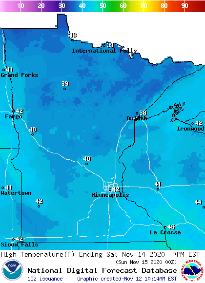
Our average Twin Cities high temperature is 42 degrees on Nov. 14. Most spots in the metro area will top out in the lower 40s on Saturday.
Southern Minnesota and western Wisconsin will also reach the lower 40s, with 30s in northern Minnesota:
Saturday will be breezy, with afternoon gusts of 16-25 mph:
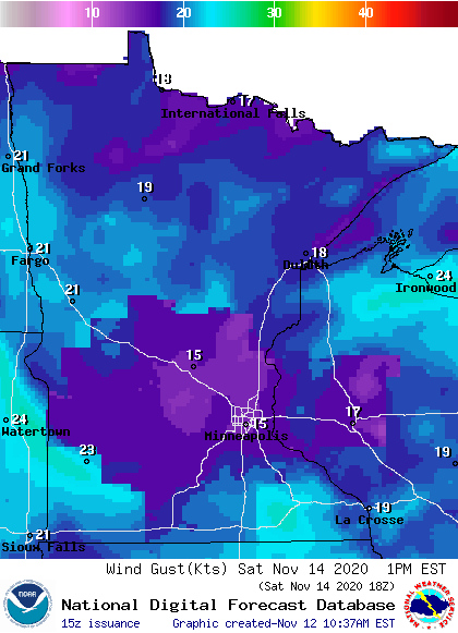
Plotted values are in knots, with 15 knots equal to around 17 mph and 23 knots equal to around 26 mph.
Back to temps, Sunday highs will be mainly in the 30s, with some lower 40s in southeastern Minnesota:
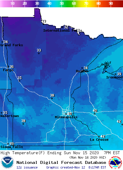
Our average Twin Cities high temp is 41 degrees on Nov. 15, so the 40 showing on the Sunday forecast map is close to average.
Rain and snow chances
Southern and central Minnesota could see some rain showers at times on Saturday, with a mix of rain and snow north.
The National Oceanic and Atmospheric Administration’s North American Mesoscale (NAM) forecast model shows this potential precipitation pattern on Saturday:
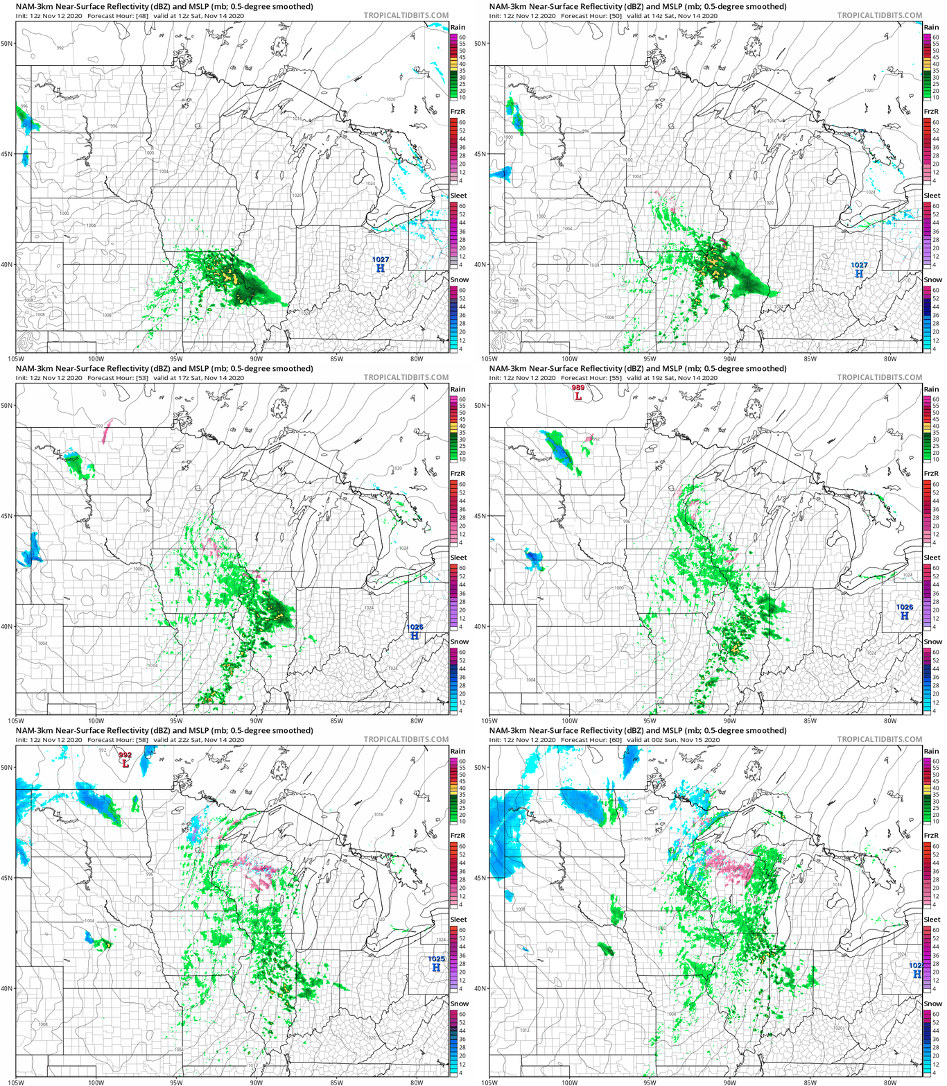
The Twin Cities metro area may see some flakes mixed with rain showers Saturday night. Sunday snow showers are possible in northern Minnesota.
You can hear updated weather information on the MPR network, and you’ll see updated weather info on the MPR News live weather blog.
Programming note
You can hear my live weather updates on MPR News at 7:35 a.m., 9:35 a.m. and 4:39 p.m. each Saturday and Sunday.

