
Light rain and snow over the weekend
Next week brings more sunshine and less active weather
Go Deeper.
Create an account or log in to save stories.
Like this?
Thanks for liking this story! We have added it to a list of your favorite stories.


After a chilly start Friday, temperatures return close to average by Saturday. The weekend also brings another round of light rain and snow.
Friday’s forecast
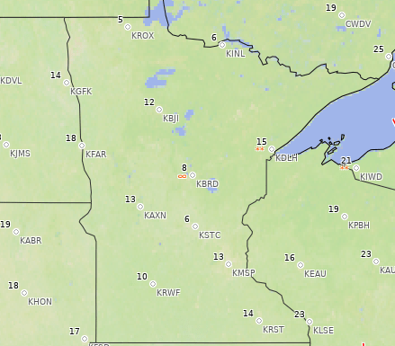
Between the colder air that moved in Thursday, and clearing skies overnight meaning no insulation, temperatures plummeted Friday morning. Most of Minnesota dipped into the teens, with numerous spots in the single digits.
For many locations in central and southern Minnesota, this was the coldest air so far this season. This includes the Twin Cities, which previously had its coldest morning Oct. 27 at 16 degrees dropped to 13 Friday morning.
Here are the readings from 7 a.m., when much of the state was at its coldest:
Turn Up Your Support
MPR News helps you turn down the noise and build shared understanding. Turn up your support for this public resource and keep trusted journalism accessible to all.
Thanks to a southerly wind flow and plentiful sunshine, temperatures warm up significantly, with afternoon highs in the 30s.
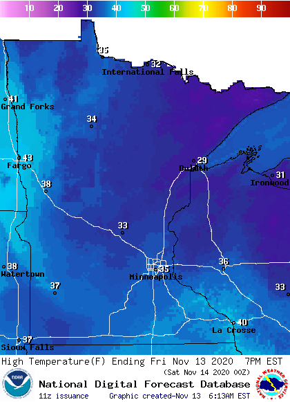
This is still slightly below average for this time of year.
Weekend storm
By Saturday, much of Minnesota could see the lower 40s again, which is closer to average for mid-November.
A new weather system moves in Saturday, although the brunt of that system stays east of the state.

It brings light rain chances to all but western Minnesota starting Saturday afternoon, and some snow mixes in, especially north.
Most of the precipitation clears out by early Sunday. However, the northern edge of the state could see a little light snow linger into Sunday afternoon. No significant snow accumulation is currently expected, and rain totals will be light.
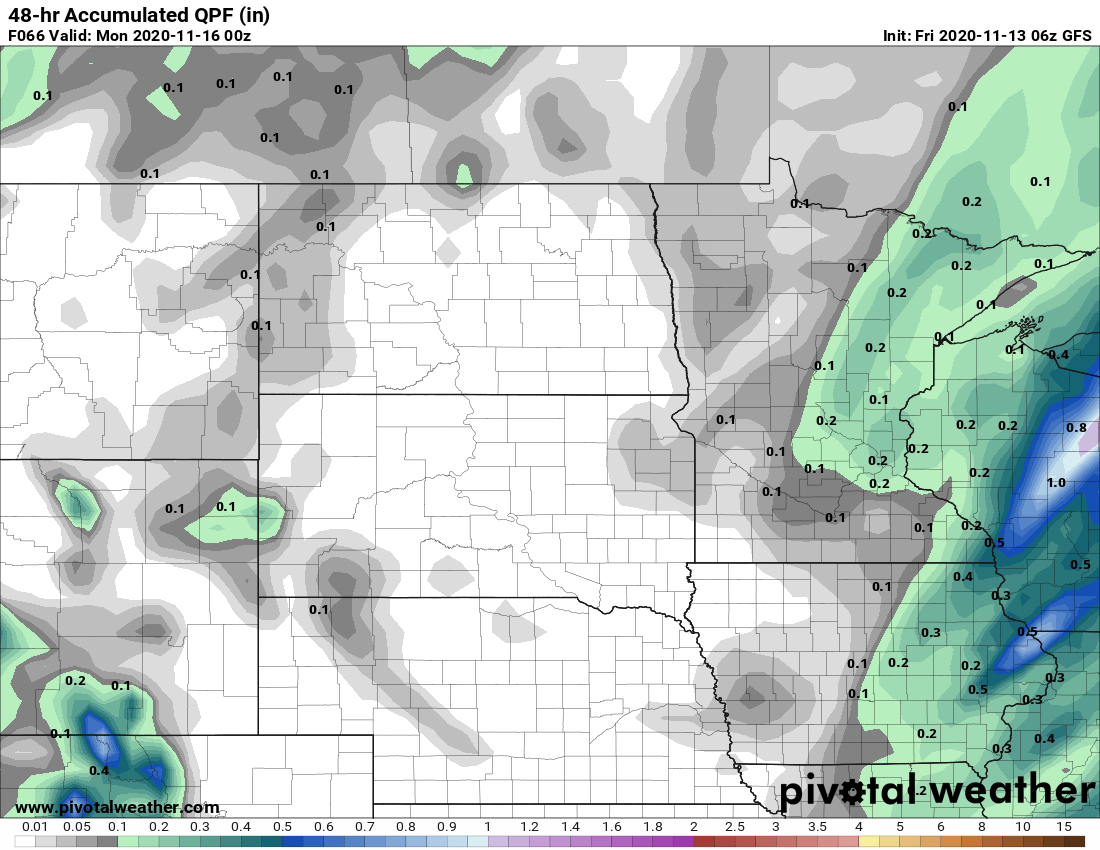
That system drops temperatures slightly, so most of the state will see highs back in the 30s on Sunday.
Extended forecast
Next week turns far less active, with only isolated precipitation chances until late in the week.
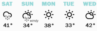
Highs remain mostly in the 30s, with occasional 20s north through the first half of the week, which is slightly below average. Temperatures turn milder mid-week, with a few more 40s returning.
Here is that forecast for the Twin Cities:
Programming note
You can hear my live weather updates on Minnesota Public Radio at 7:48 a.m. Monday through Friday morning.

