
Sunshine and possible snow for the weekend
Northern Minnesota sees slick roads Thursday evening
Go Deeper.
Create an account or log in to save stories.
Like this?
Thanks for liking this story! We have added it to a list of your favorite stories.


A cold front Thursday returns more seasonable temperatures across Minnesota. Meanwhile, precipitation chances through the weekend stay light, but could still produce slick roads.
Thursday’s forecast
The state started off very mild for November, with most of the morning temperatures in the 30s, and several spots in central and southern Minnesota in the 40s. That meant much of the state saw morning lows that were warmer than our average highs this time of year.
However, there will be much more of a contrast when it comes to our afternoon temperatures because of a cold front moving across the state.
As of 9 a.m. Thursday morning, the front is already through northwestern Minnesota and will advance south, finally clearing southern Minnesota by late afternoon. Where the cold front has already moved through, temperatures remain colder, with 30s northwest.
Turn Up Your Support
MPR News helps you turn down the noise and build shared understanding. Turn up your support for this public resource and keep trusted journalism accessible to all.
Meanwhile southern Minnesota stays in the warmer air most of the day and makes it into the 50s again.
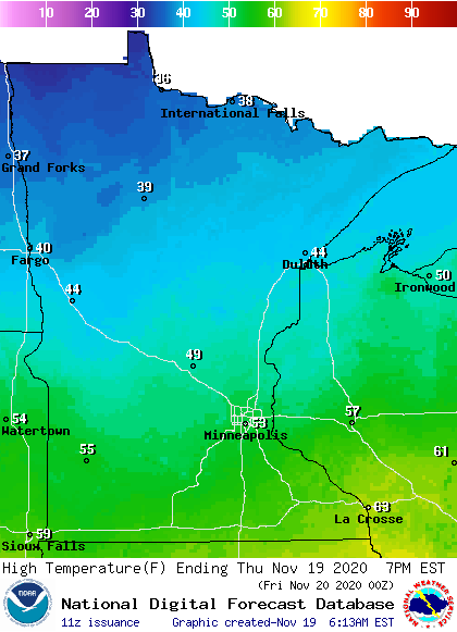
Behind the system, a disturbance moves through northern Minnesota during the afternoon and evening hours, bringing a mix of precipitation.
While central Minnesota, including as far southern as the Twin Cities, could see a little light rain or drizzle, most of the impacts stay farther north. There, it will be cold enough for freezing precipitation and a snow to mix in.
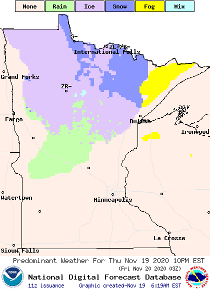
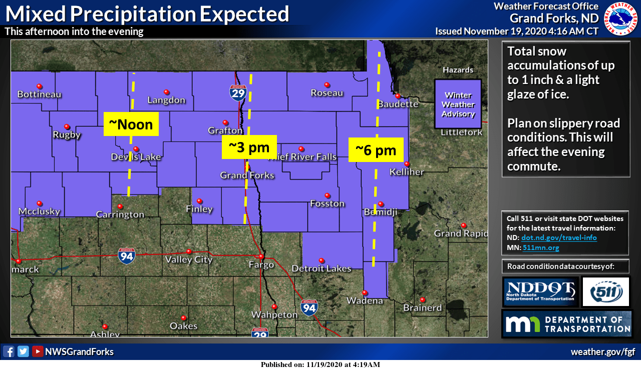
Although any precipitation would be very light, including snow totals under an inch, there are likely to be slick spots on the roads from Thursday evening into Friday morning.
Because of this, a winter weather advisory has already been issued in northwestern Minnesota for Thursday evening.
Extended forecast
By Friday, cooler air settles across the entire state, with highs ranging from the upper 20s north to low 40s south. Those highs are close to average for this time of year, and the seasonable temperatures linger through the weekend.
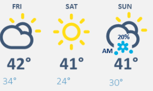
After a mostly sunny Saturday, a disturbance moves in bringing a wintry mix along with it from Saturday night into Sunday morning.
Because of overnight timing, and the colder weather overnight, it is currently expected most of the precipitation will come as snow, with some rain or light freezing rain mixing in.
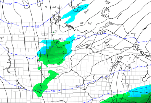
Precipitation also stays light, with most places forecast to see snow totals under an inch.
Next week, also stays relatively quiet, with below average precipitation and temperatures near to slightly above average. This includes Thanksgiving, which currently looks dry with highs in the 30s and 40s.
Programming note
You can hear my live weather updates on Minnesota Public Radio at 7:48 a.m. Monday through Friday morning.

