
Bright and warm Saturday; windy and much cooler Sunday
A look at November snowfall
Go Deeper.
Create an account or log in to save stories.
Like this?
Thanks for liking this story! We have added it to a list of your favorite stories.


It’s nice to see sunshine and mild temps on a Saturday!
Our average Twin Cities high temperature is 34 degrees on Nov. 28. Many spots in the metro area will probably top out in the lower 50s this Saturday. Roughly the southern half of Minnesota, plus west-central and southwestern Wisconsin, could reach the 50s Saturday afternoon. Highs in the 40s are expected across much of northern Minnesota, with some upper 30s near the Canadian border.
Far north may see some flakes Saturday night into early Sunday
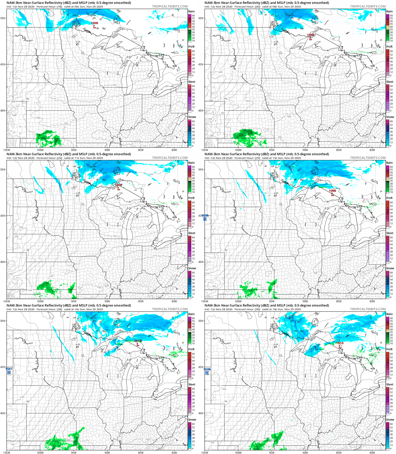
There’s a chance of scattered light snow showers in far northern Minnesota after midnight Saturday night and into Sunday morning.
Turn Up Your Support
MPR News helps you turn down the noise and build shared understanding. Turn up your support for this public resource and keep trusted journalism accessible to all.
The National Oceanic and Atmospheric Administration’s North American Mesoscale (NAM) forecast model shows the potential precipitation pattern from midnight Saturday night through noon on Sunday:
You can hear updated weather information on the MPR network, and you’ll see updated weather info on the MPR News live weather blog.
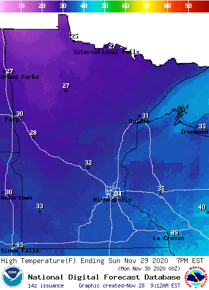
Colder and windy on Sunday
Highs on Sunday will be mainly in the 30s, with some 20s in far northwestern Minnesota:
Sunday will be a bit windy, with wind gusts generally in the 25-35 mph range:
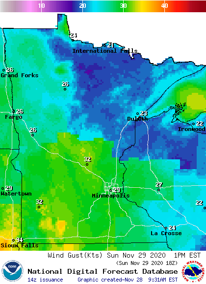
Plotted values are in knots, with 29 knots equal to around 33 mph.
Temperature trends
No big storms are expected in Minnesota or western Wisconsin this coming week. Twin Cities metro area highs are projected to be around 30 on Monday, followed by mid 30s Tuesday through Thursday and upper 30s on Friday.
Temps may rebound by next weekend and into the start of the following week. The NWS Climate Prediction Center shows a good chance of above-normal temperatures in Minnesota and western Wisconsin from Dec. 3 through Dec. 7:

November snowfall
We’ve been looking at bare ground in the Twin Cities metro area the past few days. It’s easy to forget that we’ve seen a decent amount of snow this month.
Our official Twin Cities snowfall total (measured at MSP airport) sits at 8.8 inches this November. 5.5 inches of that total was on Nov. 10. Our long-term average is 9.3 inches of snow for the entire month of November. MSP airport tallied 14.3 inches of snow last November.
November 1991 was the snowiest November in Twin Cities weather records, with a whopping 46.9 inches of snow:
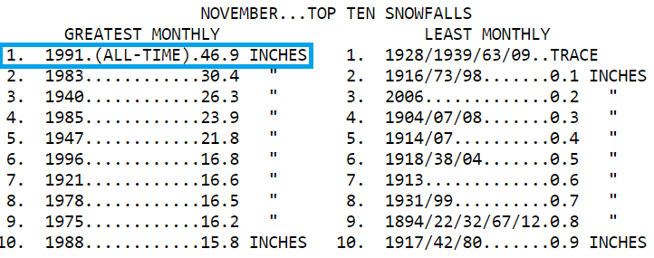
Roughly 20 inches of that total fell in the first couple of days of Nov. 1991, as part of the blizzard that started on Halloween.
Programming note
You can hear my live weather updates on MPR News at 7:35 a.m., 9:35 a.m. and 4:39 p.m. each Saturday and Sunday

