
Mild Sunday temps; Dense fog advisory western Minn. until noon
Light winds again
Go Deeper.
Create an account or log in to save stories.
Like this?
Thanks for liking this story! We have added it to a list of your favorite stories.


Light winds and lack of clouds allowed temperatures in western Minnesota to drop to the dew point overnight. That led to some dense fog this morning in much of western Minnesota. A dense fog advisory has been extended to noon today in the grey-shaded areas on the following maps:
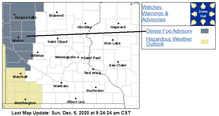
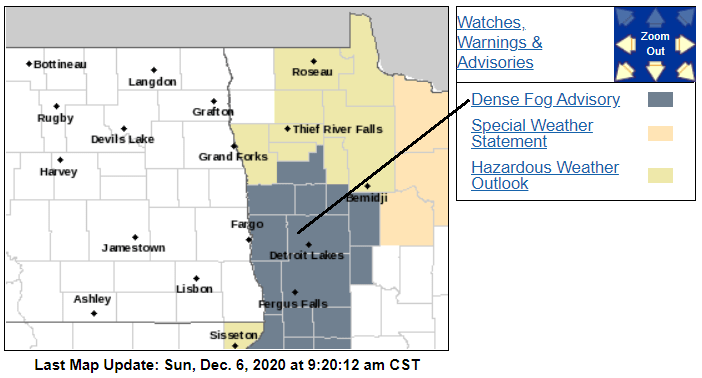
Visibilities will be low in the advisory areas, and some icy patches are possible on roadways, especially on bridges.
You can hear updated weather information on the MPR network, and you’ll see updated weather info on the MPR News live weather blog.
Temps and winds today
Turn Up Your Support
MPR News helps you turn down the noise and build shared understanding. Turn up your support for this public resource and keep trusted journalism accessible to all.
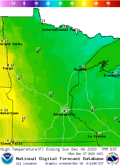
Our average Twin Cities high is 30 degrees on Dec. 6. We’re shooting for a high in the upper 30s in the metro area this Sunday. There will be a lot of 30s in Minnesota and western Wisconsin today, but parts of west-central and southwestern Minnesota will top out in the 40s:
Winds will be fairly light, only gusting to 8-12 mph in most areas:
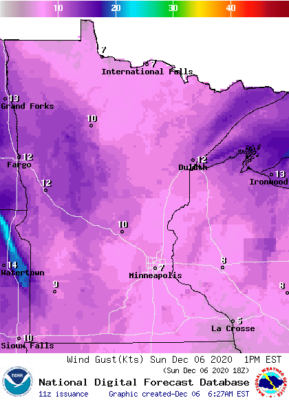
Plotted values are in knots, with 7 knots equal to about 8 mph.
This Updraft blog will be updated around 10:45 a.m. with details on the warmup that’s expected this week.
Programming note
You can hear my live weather updates on MPR News at 7:35 a.m., 9:35 a.m. and 4:39 p.m. each Saturday and Sunday.

