
Mild temps continue; maybe a rain/snow mix on Friday
Light winds today and tomorrow
Go Deeper.
Create an account or log in to save stories.
Like this?
Thanks for liking this story! We have added it to a list of your favorite stories.


A dense fog advisory continues until noon today in parts of west-central and northwestern Minnesota.
You can hear updated weather information on the MPR network, and you’ll see updated weather info on the MPR News live weather blog.
Our average Twin Cities high temperature is only 30 degrees on Dec. 6. That’s why I’m saying “mild” when describing today’s forecast highs in the metro of upper 30s to around 40.
Most of Minnesota and western Wisconsin will have highs in the 30s today, with 40s possible in parts of west-central and southwestern Minnesota. Winds will be fairly light.
Turn Up Your Support
MPR News helps you turn down the noise and build shared understanding. Turn up your support for this public resource and keep trusted journalism accessible to all.
Temperature trends
Monday highs will be mainly in the 30s, with 40s in portions of west-central and southwestern Minnesota:
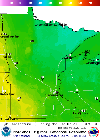
We’ll flirt with 40 degrees in the Twin Cities Monday afternoon.
Winds will be fairly light on Monday:
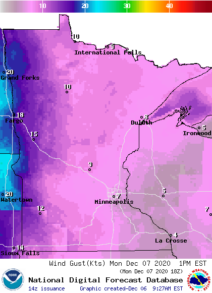
Plotted values are in knots, with 7 knots equal to about 8 mph.
Temperature trends
Twin Cities metro area highs are projected to reach the mid 40s Tuesday and around 50 on Wednesday. We could top out in the mid 40s Thursday, followed by upper 30s on Friday.
Rain or snow Friday and early Saturday?
Forecast models haven’t reached agreement on our rain/snow chances Friday and Saturday. Yesterday’s run of the GFS model showed precipitation passing to our southeast late Friday into Saturday, just clipping far southeastern Minnesota.
Here’s the Sunday morning run of the National Oceanic and Atmospheric Administration’s Global Forecast System (GFS) model, showing the potential precipitation pattern from Friday morning through Saturday afternoon:
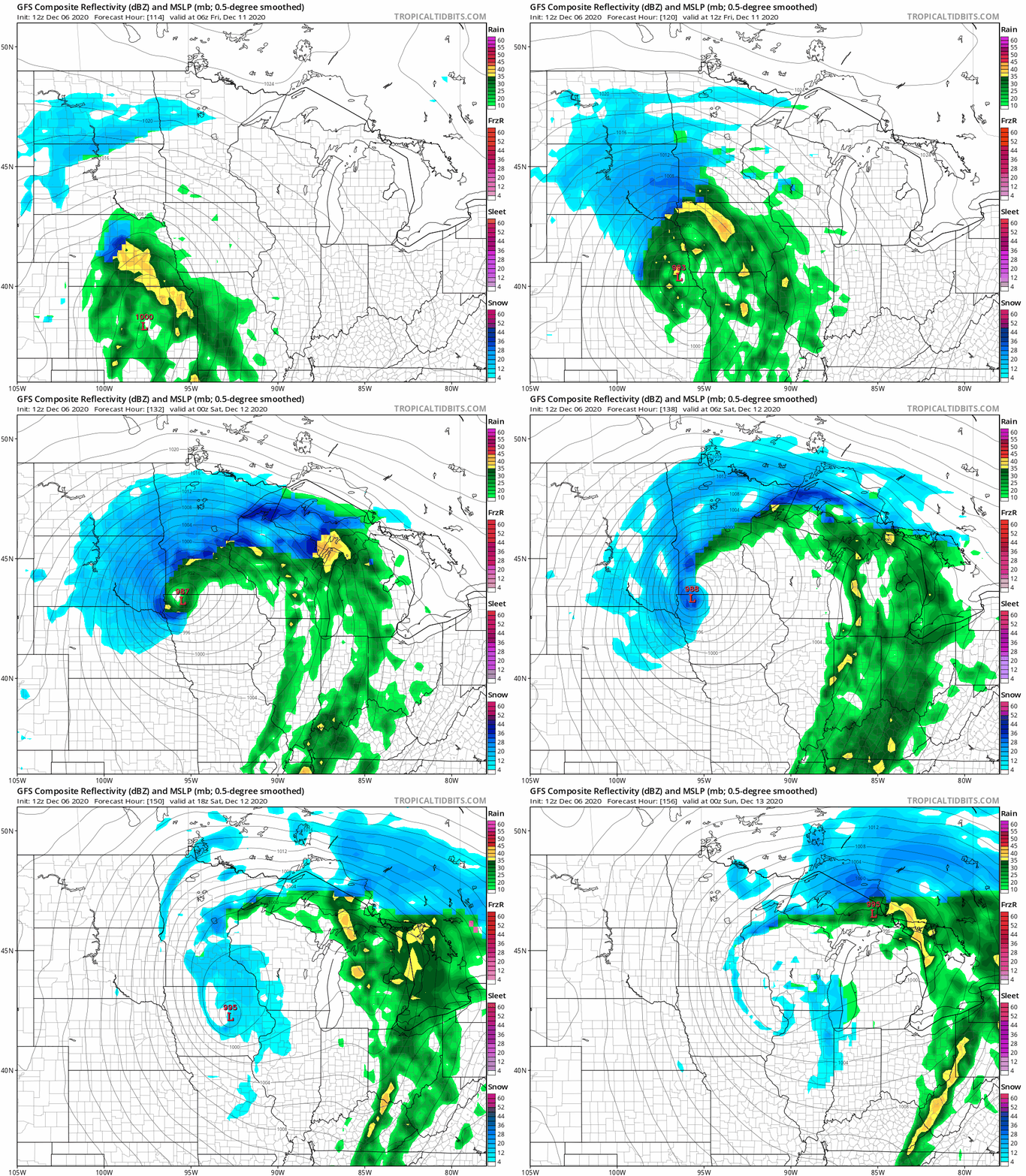
This track would give the Twin Cities metro area a mix of rain and snow early Friday, then mainly rain until the system pulls away on Saturday. Southwestern and central Minnesota would see the highest snow amounts in that scenario. Some other forecast models keep the accumulating snow well to our southeast, missing most of Minnesota.
Bottom line, it’s way too early to forecast who will get accumulating snow this Friday into early Saturday, but it will be a good idea to check forecast updates as we get closer to Friday.
Snow season so far
Minneapolis-St. Paul International Airport reported two-tenths of an inch of new snow early Saturday evening. It was our first measurable snow at MSP airport this month, and it brought our season total to 18.3 inches:
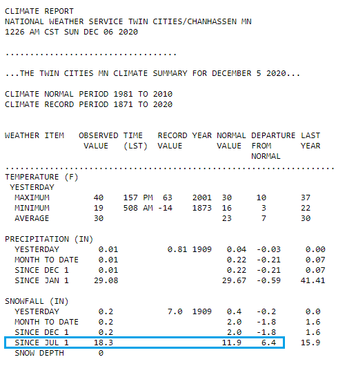
We’re running 6.4 inches above normal for this point in our Twin Cities snow season. In case you’ve forgotten, our biggest daily snowfall totals at MSP airport so far this season have been 7.9 inches on Oct. 20 and 5.5 inches on Nov. 10.
Programming note
You can hear my live weather updates on MPR News at 7:35 a.m., 9:35 a.m. and 4:39 p.m. each Saturday and Sunday.

