
Areas of dense fog Monday morning
Contrasting temperatures as some parts of the state stay cloudy
Go Deeper.
Create an account or log in to save stories.
Like this?
Thanks for liking this story! We have added it to a list of your favorite stories.


A pattern that is dividing the state with clouds is causing both a big difference in temperatures across the state and is impacting who is seeing fog Monday morning.
Monday’s forecast
A persistent area of clouds has settled over the eastern half of Minnesota and the contrast of western Minnesota getting more sun already caused big temperature disparities Sunday. For example, Moorhead saw a high of 52 under the sunshine, while the Twin Cities only hit 35.
That cloud divide also meant that under clearer skies, portions of western and central Minnesota saw temperatures fall more quickly overnight (into the 20s), dropping to the level of the dew point temperatures.
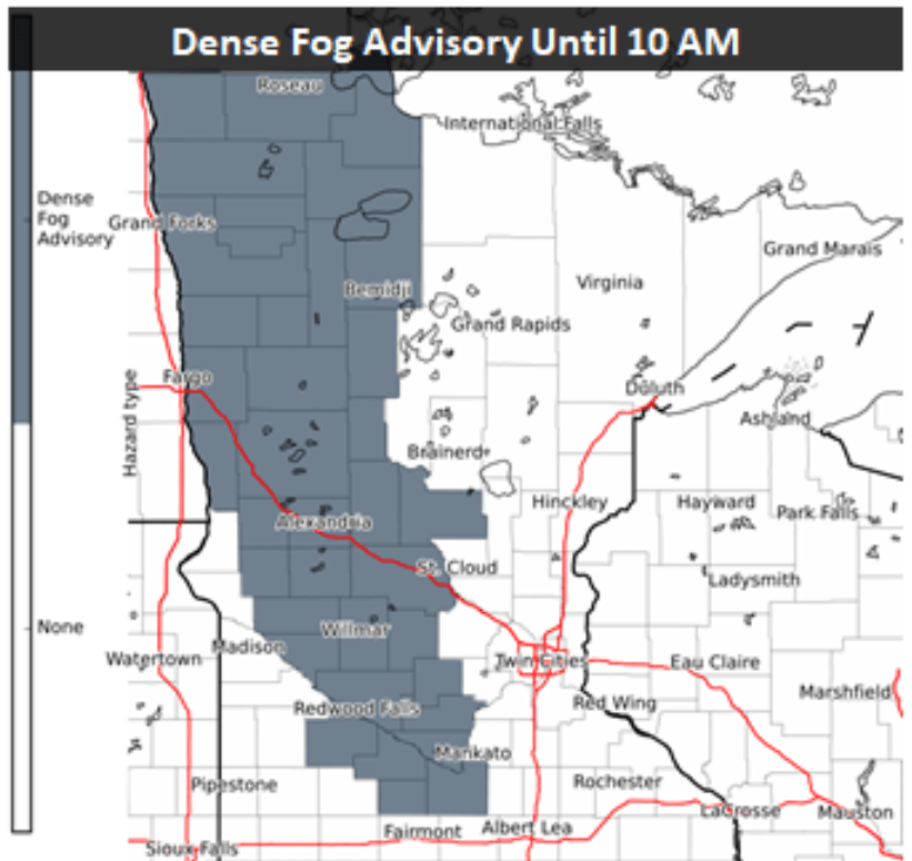
The combination of 100 percent humidity and light winds created widespread areas of fog Monday morning, and much of the state is under a dense fog advisory. Eastern Minnesota is mostly seeing lighter fog, or no fog at all, because the clouds kept temperatures slightly milder.
Fog will clear out by late morning, at which point western Minnesota goes back to seeing more sun, while eastern Minnesota stays cloudier.
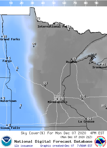
This results in another afternoon with the higher temperatures west, although 30s and 40s put the entire state above average.
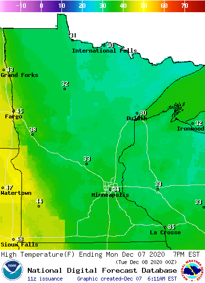
Temperatures stay above average most of the week, then cooler weather and a chance for snow return by the weekend. That extended forecast will be updated around 9 a.m.
Programming note
You can hear my live weather updates on Minnesota Public Radio at 7:48 a.m. Monday through Friday morning.
Turn Up Your Support
MPR News helps you turn down the noise and build shared understanding. Turn up your support for this public resource and keep trusted journalism accessible to all.

