
Mild weather continues most of the week
Colder temperatures and snow chances return late-week
Go Deeper.
Create an account or log in to save stories.
Like this?
Thanks for liking this story! We have added it to a list of your favorite stories.


Clouds are the big forecast influence the first part of the week, then our mild pattern shifts and a storm brings back cooler weather and snow by the end of the week.
A persistent area of clouds settled over the eastern half of Minnesota over the weekend. The contrast of western Minnesota getting more sun already caused big temperature differences Sunday. For example, Moorhead saw a high of 52 under the sunshine, while the Twin Cities only hit 35.
Monday’s forecast
That cloud divide also meant portions of western and central Minnesota saw temperatures fall more quickly overnight (into the 20s), dropping to the level of the dew point temperatures.
The combination of 100 percent humidity and light winds created widespread areas of dense fog early Monday that will lift through the morning. Meanwhile, eastern Minnesota saw lighter fog or no fog at all because the clouds kept temperatures slightly milder.
As the fog clears, western Minnesota goes back to seeing more sun, while eastern Minnesota stays cloudier.
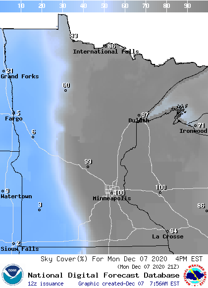
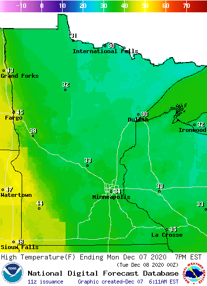
This results in another afternoon with more 40 west and 30s elsewhere, although this is still above average for the entire state.
Turn Up Your Support
MPR News helps you turn down the noise and build shared understanding. Turn up your support for this public resource and keep trusted journalism accessible to all.
Warmer weather
By Tuesday, the clouds start to erode some in eastern Minnesota, and with a bit more sunshine, temperatures nudge warmer, from the 30s north to 40s south. The western edge of the state remains the warmest spot with a few highs in the 50s.
With much more widespread sunshine Wednesday, it will be the warmest day of the week for most of the state, ranging from the upper 30s north to 50s south.
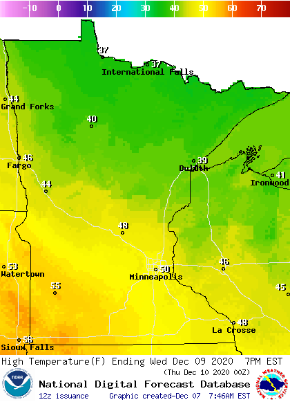
The return of more clouds drops highs back into the 30s and 40s Thursday. A late week storm brings the return of seasonable cold by the weekend, with highs only in the teens and 20s by Sunday.
Rain and snow return
The same system bringing the colder air also beaks our recent trend of limited precipitation.
Although there is still uncertainty with the exact track of the storm, it looks likely to pass south of Minnesota Friday.

With temperatures still above freezing part of Friday, there will be a rain and snow mix across much of the state. Colder temperatures Saturday mean the precipitation is likely to turn to all snow as the storm departs.
As the week progresses, we will get a better idea of the exact storm track, the timing of the switch from rain to snow, and the projected snow totals.
In the meantime, it does look as though much of the state can expect at least some snow accumulation.
Programming note
You can hear my live weather updates on Minnesota Public Radio at 7:48 a.m. Monday through Friday morning.

