
Temperatures stay mild through midweek
Snow chances return, but are spotty
Go Deeper.
Create an account or log in to save stories.
Like this?
Thanks for liking this story! We have added it to a list of your favorite stories.


Temperatures stay well above average through the middle of the week. Seasonably cold weather returns by the weekend, along with snow chances.
Tuesday’s forecast
The low-level moisture that has kept Minnesota under low clouds and morning fog the past couple days is still lingering Tuesday.
Most of the state is started off under cloudy skies, with light fog in central and eastern Minnesota which dissipates by midmorning.
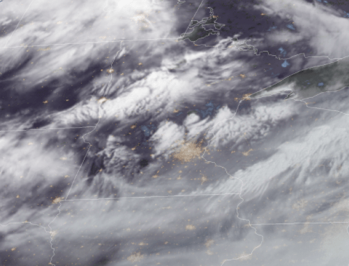
That low-level moisture clears east Tuesday, taking the lower clouds with it. However, there are still enough higher clouds to keep the skies mostly cloudy, but with a few more breaks of sun that allow eastern Minnesota to finally see some sunshine after the past couple cloudy days.
Turn Up Your Support
MPR News helps you turn down the noise and build shared understanding. Turn up your support for this public resource and keep trusted journalism accessible to all.
The clouds kept temperatures very mild overnight, so most of the state is began the day with temperatures in the mid and upper 20s. With westerly winds and a little sun, highs vary from the upper 30s in northern Minnesota, to a few 50s west. This is 10 to 20 degrees average.
Warmer weather
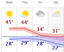
Temperatures Wednesday look similar to Tuesday, with 30s north, 40s south, and a couple 50s west, but it will likely feel a bit more pleasant under mostly sunny skies.
Thursday is also expected to have highs in the 30s north and 40s south, including for western Minnesota, and more cloud cover returns.
By Friday, colder air starts moving in, and temperatures drop back to much more seasonable highs in the 20s and 30s.
Here is that temperature trend for the Twin Cities:
Light snow chances return
The same shift in the pattern that brings back more clouds and cooler weather also brings a couple snow chances.
A minor disturbance brings northern Minnesota a light snow chance late Thursday into Friday. Most places would see under an inch of snow.
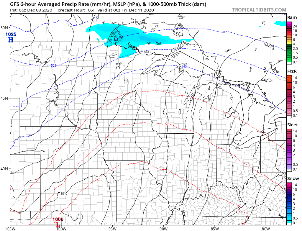
Then comes a storm tracking south and east of Minnesota that could clip the state with light snow (particularly southeastern Minnesota), and maybe a little rain Friday into Saturday.
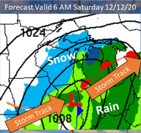
Compared to Monday’s outlook, that storm track looks farther south, so the exact track will determine how much snow Minnesota gets, and it could miss the state entirely.
Programming note
You can hear my live weather updates on Minnesota Public Radio at 7:48 a.m. Monday through Friday morning.

