
Above average temperatures return Wednesday
Northern Minnesota sees another round of light snow
Go Deeper.
Create an account or log in to save stories.
Like this?
Thanks for liking this story! We have added it to a list of your favorite stories.


Milder weather returns Wednesday, along with another light snow chance across northern Minnesota.
Wednesday’s forecast
A southerly wind flow has returned across Minnesota, and it is already leading to milder temperatures Wednesday morning, with nearly all the state in the teens and even warmer 20s in the northwestern corner of the state.
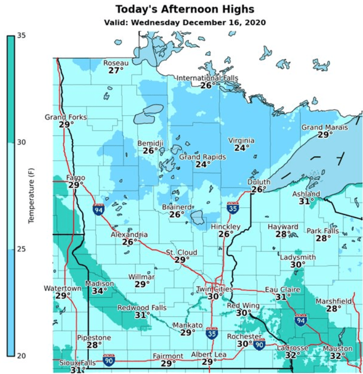
Afternoon high will also be slightly above average with most places in the 20s and a few 30s south.
A disturbance brings very light snow across northern Minnesota Wednesday into Thursday morning. The northwestern corner of the state is most likely to see the snow during the day Wednesday, then it shifts east toward the Arrowhead late.
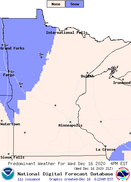
Accumulation will stay very light, with most totals under half an inch. That will also keep northern Minnesota cloudy, while the southern half of the state sees a mix of sunshine and clouds.
A statewide chance for snow and a little rain moves in on Friday. That extended forecast will be updated around 9 a.m.
Programming note
You can hear my live weather updates on Minnesota Public Radio at 7:48 a.m. Monday through Friday morning.
Turn Up Your Support
MPR News helps you turn down the noise and build shared understanding. Turn up your support for this public resource and keep trusted journalism accessible to all.

