
Another major snowstorm misses Minnesota
A persistent weather pattern keeps precipitation chances sparse
Go Deeper.
Create an account or log in to save stories.
Like this?
Thanks for liking this story! We have added it to a list of your favorite stories.


Temperatures have returned above average across Minnesota and now stay mild into next week. Meanwhile, the pattern that has limited our precipitation for the last month continues.
That pattern, which has been dominating our weather and keeping snow totals very low since mid-November, is a split flow in the jet stream.
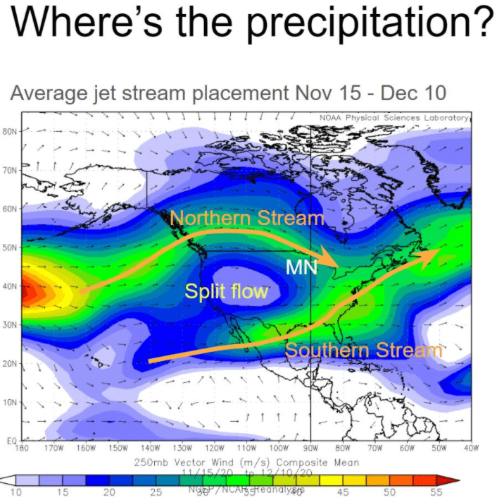
It has driven most of the active weather away from Minnesota, either to our north or south.
For example, a major storm is crossing the country right now that moved in from the West Coast, then brought the Southern Plains heavy snow Tuesday. In fact, almost all of Oklahoma currently has snow on the ground, while the majority of Minnesota does not.
That storm now pushes rain and snow from the southeast, moving up the coastline Wednesday.
Turn Up Your Support
MPR News helps you turn down the noise and build shared understanding. Turn up your support for this public resource and keep trusted journalism accessible to all.
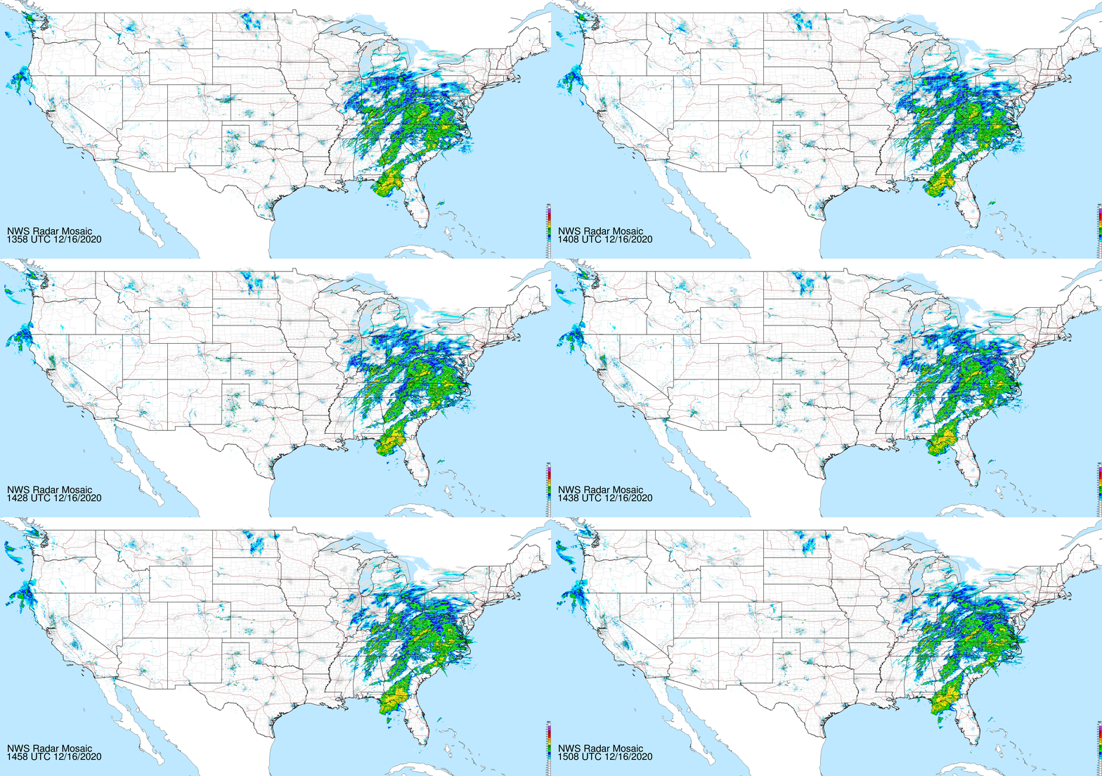
As it moves into the northeastern United States, some locations could see 1 to 2 feet of snow, putting most of the region under a winter storm warning Wednesday into Thursday.
So, it’s a weather system leaving impacts across most of the country by the time it moves out, and yet another storm that completely steered around Minnesota.
Wednesday’s forecast
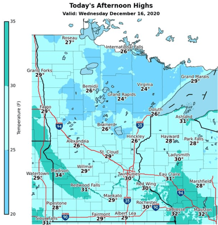
A southerly wind flow has returned across Minnesota, and it led to milder temperatures Wednesday morning, with nearly all the state in the teens and even warmer 20s in the northwestern corner of the state.
Afternoon high will also be slightly above average with most places in the 20s and a few 30s south.
A disturbance brings very light snow across northern Minnesota, Wednesday into Thursday morning. The northwestern corner of the state is most likely to see the snow during the day Wednesday, then it shifts east toward the Arrowhead late.
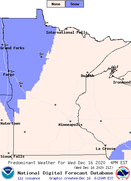
Accumulation will stay very light, with most totals under half an inch. That will also keep northern Minnesota cloudy, while the southern half of the state sees a mix of sunshine and clouds.
Extended forecast
Under the influence of the atmospheric pattern described above, any significant weather continues to miss Minnesota for the next week, leaving only light snow chances.
A widespread precipitation chance comes Friday, associated with a cold front, but moisture will again be limited. Most of the state has a chance to see light snow, but it should stay under an inch in most locations, and in southern Minnesota some light rain could mix in.
That rain chance is because temperatures remain mild for December through at least the middle of next week.
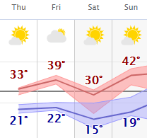
There will be a brief temperature dip Saturday, behind Friday’s cold front that returns temperatures to near-average. Other than that, most days the coming week will stay 5 to 15 degrees above average, with highs in the 20s and 30s, with occasional 40s south.
Here is that trend for the Twin Cities:
Programming note
You can hear my live weather updates on Minnesota Public Radio at 7:48 a.m. Monday through Friday morning.

