
Only chances for light snow into next week
Temperatures stay above average, with a few 40s possible
Go Deeper.
Create an account or log in to save stories.
Like this?
Thanks for liking this story! We have added it to a list of your favorite stories.


Mild weather continues over the next week, with a couple possibilities for light snow leading up to Christmas.
Thursday’s forecast
The state started very mild again for December, thanks to mostly cloudy skies overnight and a predominant wind flow from the south.
Morning temperatures were mostly in the teens and 20s, with only the Arrowhead seeing single digits because clear skies and calm winds allowed temperatures to drop more.
Under a mix of clouds and sunshine and winds staying southerly, highs will be 5 to 10 degrees above average for most of the state, with afternoon temperatures in the upper 20s to mid-30s.
Turn Up Your Support
MPR News helps you turn down the noise and build shared understanding. Turn up your support for this public resource and keep trusted journalism accessible to all.
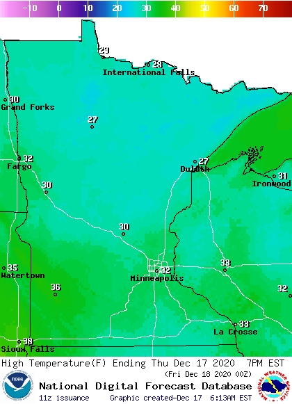
Winds will be a breezy Thursday, especially in western Minnesota, which keeps wind chill temperatures in the teens much of the day.
Snow Friday
Friday also remains mild, with most of Minnesota in the 30s for highs, putting temperatures about 10 degrees above average. This is despite a cold front moving across the state that brings light snow to the northern half of the state.
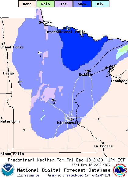
There may be a couple isolated snow totals over and inch near the northern border, but most locations can expect under an inch of snow.
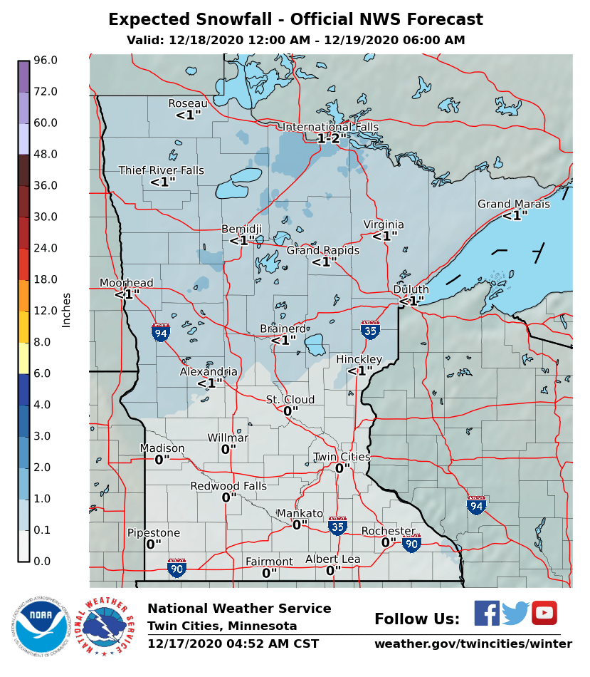
A little of that precipitation is likely to make it into southern Minnesota, including the Twin Cities. However, moisture will be sparse and with daytime temperatures above freezing, it is most likely to bring only a few sprinkles and flurries.
Extended forecast
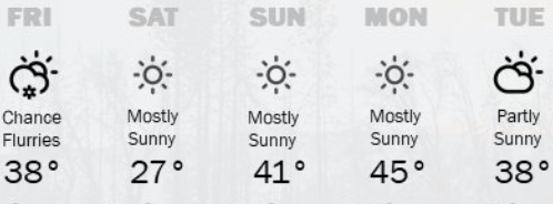
There will be a brief temperature dip Saturday behind Friday’s cold front. That returns temperatures to near-average, but under mostly sunny skies, highs rebound back above average again Sunday.
The first half of next week remains 5-15 degrees above average, with highs predominantly in the 20s and 30s, with a few 40s south.
Here is that trend for the Twin Cities:
Precipitation chances stay sparse, with only spotty light snow chances, mostly in northern Minnesota through the middle of next week.
It does look like a system may pass through the state Wednesday that could bring a fresh coat of snow, especially to northern Minnesota, right before Christmas.
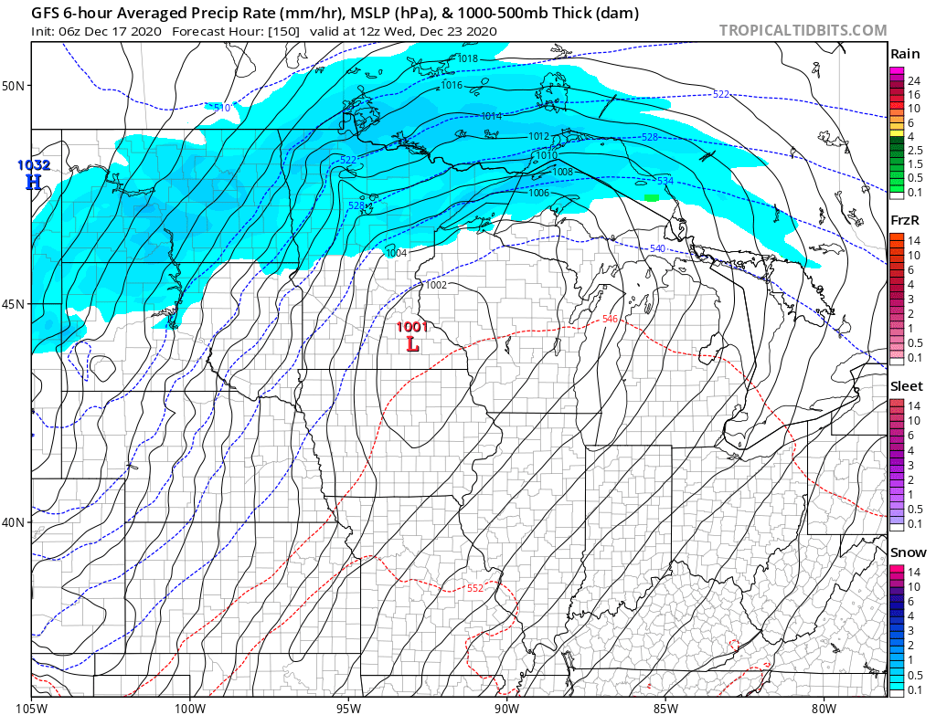
There is still some uncertainly with how much snow it may bring. We will update that forecast as the system approaches!
Programming note
You can hear my live weather updates on Minnesota Public Radio at 7:48 a.m. Monday through Friday morning.

