
Near-normal weekend temps; Sunday flakes
Potential for heavier snow mid-week
Go Deeper.
Create an account or log in to save stories.
Like this?
Thanks for liking this story! We have added it to a list of your favorite stories.


Do you like being average? Our average Twin Cities high temp is 25 degrees this time of year, and Twin Cities metro area highs will be mainly in the mid 20s this Saturday. Highs in the 20s will be very common across Minnesota and western Wisconsin. Some spots in northeastern Minnesota may top out in the upper teens.
Running warm
Despite very cold temperatures the past couple of days, our average temp this month is running 6.9 degrees warmer than normal in the Twin Cities:
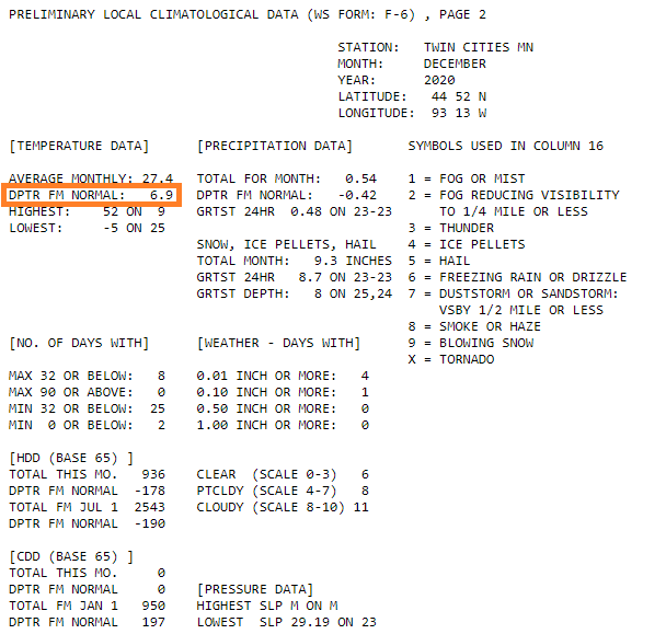
The average monthly temp is the average of all the daily high temps and low temps.
Turn Up Your Support
MPR News helps you turn down the noise and build shared understanding. Turn up your support for this public resource and keep trusted journalism accessible to all.
This table of Twin Cities climate data shows that our average daily temp has been warmer than normal on 21 out of 25 days this December:
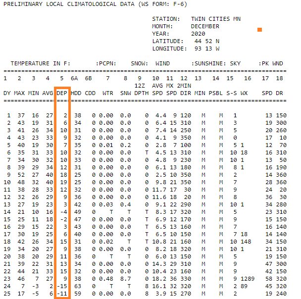
Our 9.3 inches of snow this December is one-half inch below average for this point in the month. So far this snow season, our Twin Cities snowfall is 7.7 inches above average:

We’ll probably be adding to our snow total on Sunday and Tuesday/Wednesday.
Sunday snow
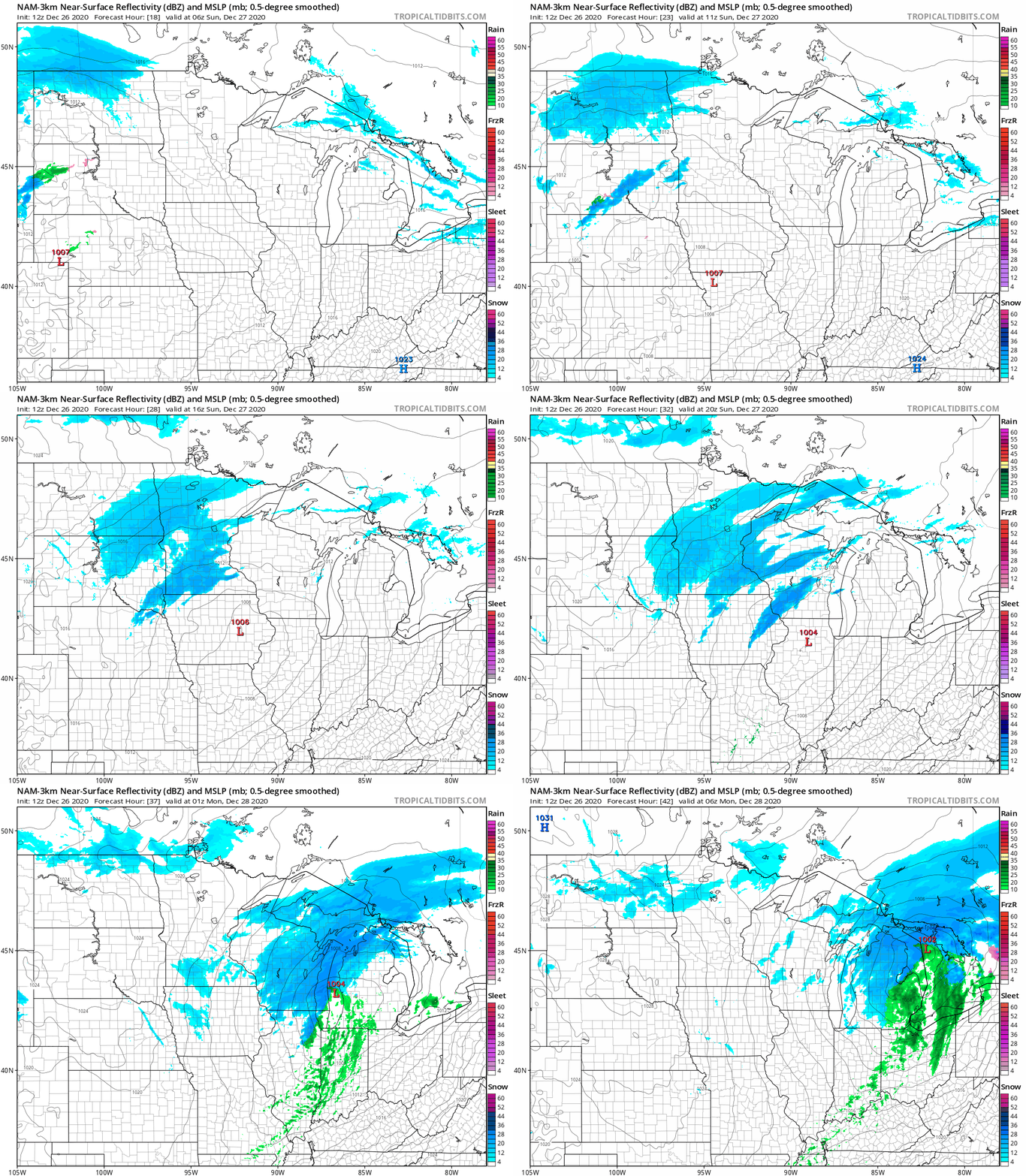
Snow is expected to move into western Minnesota late Saturday night and spread eastward on Sunday. Most of Minnesota plus western Wisconsin will see snow on Sunday, with 1 to 2 inches of accumulation possible.
The National Oceanic and Atmospheric Administration’s North American Mesoscale (NAM) forecast model shows the potential precipitation pattern from midnight Saturday night through Sunday and Sunday evening:
You can hear updated weather information on the MPR network, and you’ll see updated weather info on the MPR News live weather blog.
Temperature trends
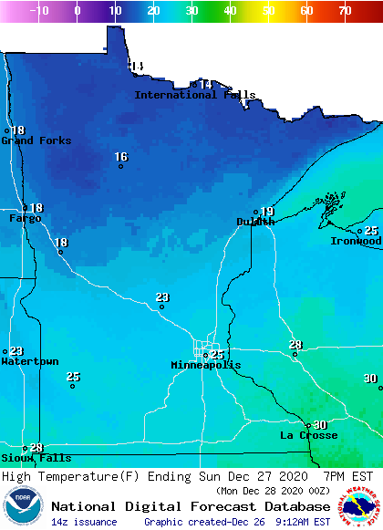
Sunday highs will range from the 20s in southern and central Minnesota to the teens in far northern Minnesota:
Sunday wind gusts are expected to be in the 10 to 18 mph range in most areas:
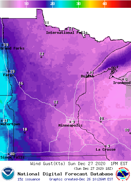
Plotted values are in knots, with 9 knots equal to about 10 mph and 16 knots equal to 18 mph.
Back to temperatures, Twin Cities metro area highs are projected to reach the mid-teens on Monday, followed by lower 20s Tuesday and mid 20s Wednesday. Metro high slip back to the mid-teens on Thursday, followed by around 20 on New Year’s Day.
Midweek snowstorm?
A low pressure system is expected to develop in Colorado on Monday, then track to the east-northeast on Tuesday and Wednesday.
Forecast models don’t agree on the track of that low pressure system, so the areas that receive the heaviest snow Tuesday afternoon into Wednesday vary quite a bit between the forecast models. At this point, it looks like much of Minnesota plus portions of Wisconsin will see a plowable snow Tuesday afternoon into Wednesday. Check forecast details over the next few days, especially if you have mid-week travel plans.
Programming note
You can hear my live weather updates on MPR News at 7:35 a.m., 9:35 a.m. and 4:39 p.m. each Saturday and Sunday.

