
Sunday snow; potential winter storm on Tuesday
No extreme cold in the next few days
Go Deeper.
Create an account or log in to save stories.
Like this?
Thanks for liking this story! We have added it to a list of your favorite stories.


We had plenty of snow on Wednesday, and the fierce winds caused a lot of drifting. I noticed generous snow cover in most areas during my Saturday afternoon walk, with some grass peeking through the snow in some spots.
We know how to enjoy our winter snows. This was the Saturday scene at the sledding hill at Highland National Golf Course in St. Paul:

Sunday snow
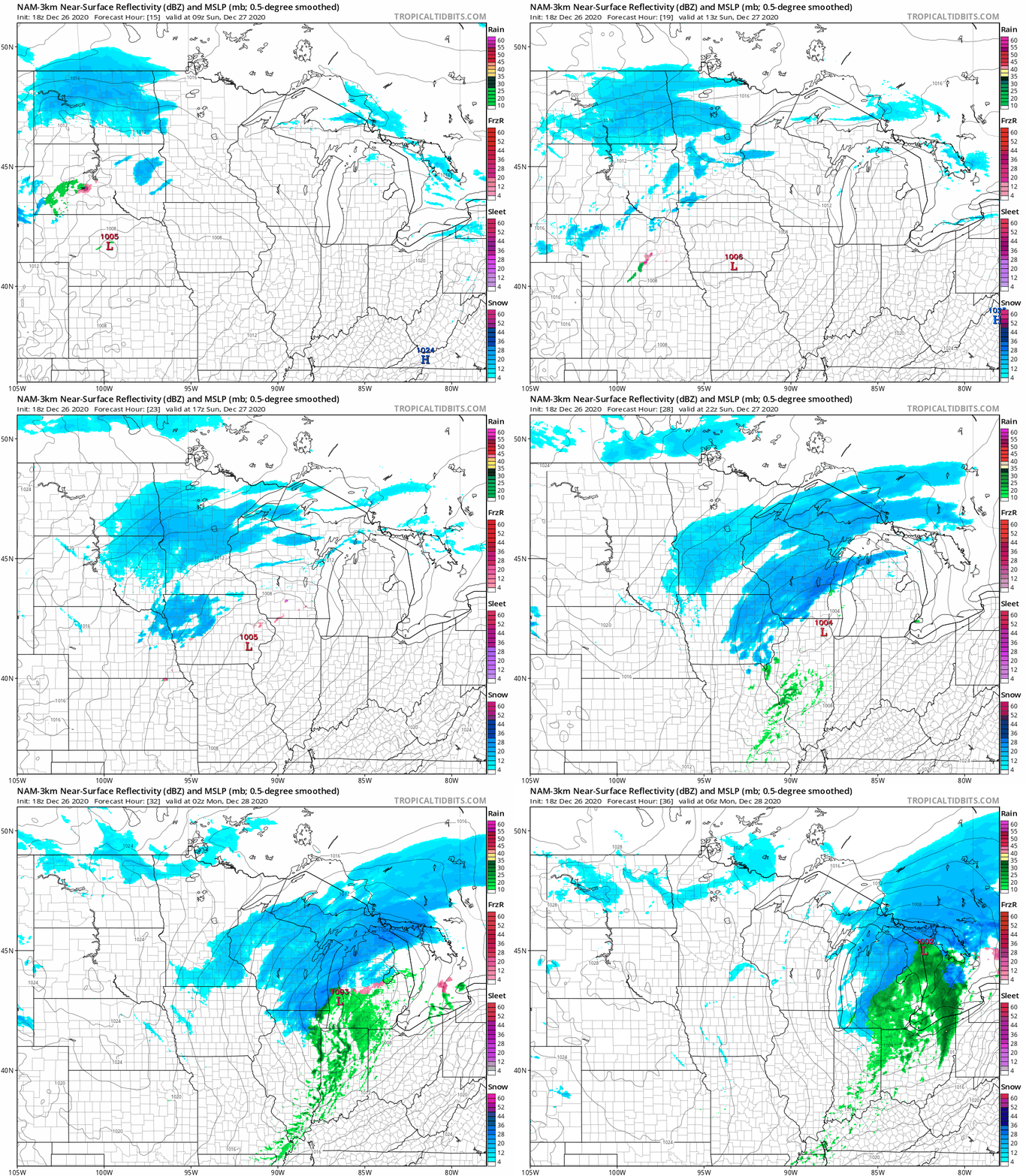
Far western Minnesota could see some light snow after midnight Saturday night. Most of Minnesota and western Wisconsin will have periods of snow on Sunday. Accumulations are expected to be around one inch in most areas, with some spotty two inch amounts possible.
Turn Up Your Support
MPR News helps you turn down the noise and build shared understanding. Turn up your support for this public resource and keep trusted journalism accessible to all.
The National Oceanic and Atmospheric Administration’s North American Mesoscale (NAM) forecast model shows the potential precipitation pattern Sunday and Sunday evening:
You can hear updated weather information on the MPR network, and you’ll see updated weather info on the MPR News live weather blog.
Sunday temps and winds
Sunday highs will range from the 20s in southern and central Minnesota to the teens in the northern third of Minnesota:

Wind gusts are expected to be in the 12 mph to 20 mph range by Sunday afternoon:
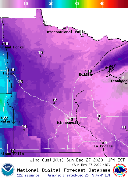
Plotted values are in knots, with 10 knots equal to 11.5 mph and 16 knots equal to 18 mph.
Back to temperatures, Twin Cities metro area highs are projected to reach the upper-teens on Monday, followed by lower 20s Tuesday and mid 20s Wednesday. Metro highs slip back to the upper-teens on Thursday, followed by around 20 degrees on New Year’s Day.
Next winter storm?
A low pressure system is expected to develop in Colorado on Monday, then track to the east-northeast on Tuesday and Wednesday.
Forecast models don’t agree on the track of that low pressure system, so the areas that receive the heaviest snow Tuesday afternoon into Wednesday vary quite a bit in the various forecast models.
NOAA’s Global Forecast System (GFS) model shows this precipitation pattern Tuesday morning into Wednesday morning:

At this point, it looks like much of Minnesota plus portions of Wisconsin will see a plowable snow Tuesday afternoon into Wednesday. Check forecast details over the next few days, especially if you plan to be out on the roads.
Programming note
You can hear my live weather updates on MPR News at 7:35 a.m., 9:35 a.m. and 4:39 p.m. each Saturday and Sunday.

