
Sunday flakes, with near-normal temps
A bit breezy this afternoon
Go Deeper.
Create an account or log in to save stories.
Like this?
Thanks for liking this story! We have added it to a list of your favorite stories.


If you’d like some fresh snow to fill in the thin spots in our snow cover, you’re in luck. Periods of light snow are expected today in most of Minnesota and western Wisconsin. Snow totals will generally be less than one inch, but parts of west-central Minnesota could see between one and two inches.
You can hear updated weather information on the MPR network, and you’ll see updated weather info on the MPR News live weather blog.
Sunday temps and winds
Sunday highs will range from the 20s in southern and central Minnesota to the teens in the northern third of Minnesota:
Turn Up Your Support
MPR News helps you turn down the noise and build shared understanding. Turn up your support for this public resource and keep trusted journalism accessible to all.
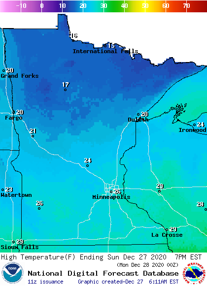
Our average Twin Cities high temperature is 24 degrees on Dec. 27. We’ll top that by a few degrees today.
Wind gusts are expected to be in the 12 mph to 20 mph range by Sunday afternoon:
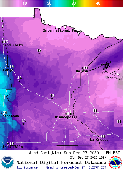
Plotted values are in knots, with 10 knots equal to 11.5 mph and 16 knots equal to 18 mph.
This Updraft blog will be updated around 1015 a.m. with your updated Sunday forecast and a look at the week ahead. We may see a plowable snow on Tuesday.
Programming note
You can hear my live weather updates on MPR News at 7:35 a.m., 9:35 a.m. and 4:39 p.m. each Saturday and Sunday.

