
Snow moves out by Wednesday morning
Quiet weather returns the second half of the week

Go Deeper.
Create an account or log in to save stories.
Like this?
Thanks for liking this story! We have added it to a list of your favorite stories.


Snow is making its way across Minnesota, and parts of the state could see up to 6 inches of accumulation. The snow moves out quickly overnight Tuesday, with improving conditions Wednesday.
Snowstorm update
As forecast, a storm moving south of Minnesota is bringing the northern edge of its snow into the state. The snow moved from the southwest toward the northeast during the day Tuesday, and as of 6 p.m., it has spread across all of Minnesota except the Arrowhead.
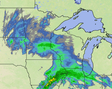
Because of the track of the storm, the heaviest snow is staying south of Minnesota. Storm totals within Minnesota will range from the southeastern edge of the state possibly getting 4 to 6 inches, with snow getting lighter father north.
Northern Minnesota may only see 1 to 3 inches, although totals will be higher near Lake Superior, with a few totals near 6 inches possible. For the Twin Cities, snow amounts will likely very from 3 to 5 inches.
Turn Up Your Support
MPR News helps you turn down the noise and build shared understanding. Turn up your support for this public resource and keep trusted journalism accessible to all.
Winds are relatively light with the storm, so blowing snow is not a concern, but some of the moderate to heavy snow bands are reducing visibility, making travel more difficult in addition to slick spots caused by snow.
Snow moves out
Much like the snow pushed across Minnesota from southwest to northeast, snow will move out in a similar pattern. Southwestern Minnesota can expect the snow to end by late Tuesday evening. For the Twin Cities, the snow winds down quickly after midnight and ends overnight.
By the Wednesday morning commute, only northern Minnesota is likely to have a little lingering light snow, which keeps clearing east and exits the Arrowhead by the afternoon.
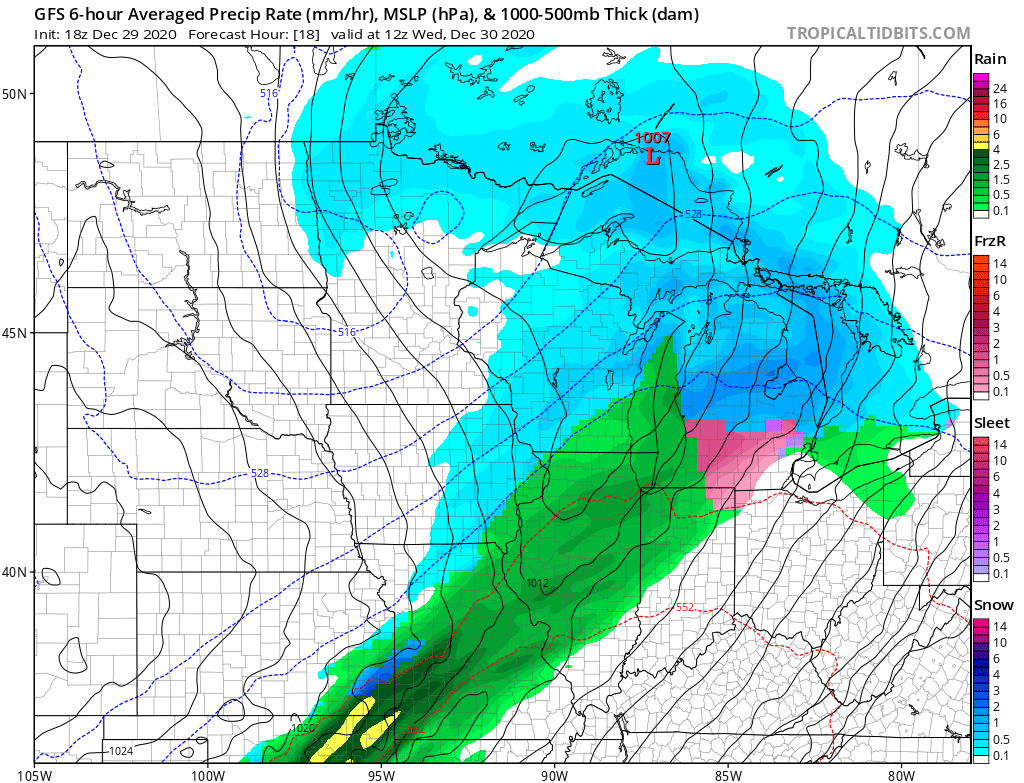
However, although snow will be over for most places, including the Twin Cities, by Wednesday morning, the snow on the ground is likely to cause lingering travel problems during the morning commute.
Extended forecast
After the snow clears early Wednesday, the state stays stuck under mostly cloudy skies, with the clouds slowly clearing late day. Highs will be seasonable with teens north and 20s south.
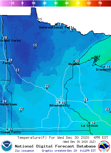
There will actually be little temperature variation from Tuesday evening through Wednesday afternoon because cloud cover plus southeast winds keep Tuesday night temperatures predominately steady.
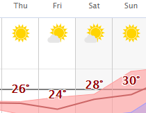
More widespread sunshine returns by Thursday, and most of the state can expect highs in the 20s from Thursday through the weekend, which is above average for northern Minnesota. There could even be a couple highs in the low 30s by Sunday.
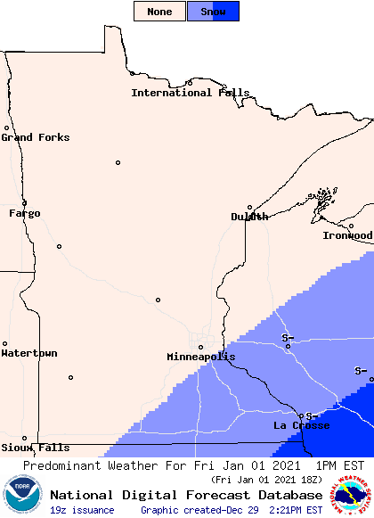
Skies also stay mostly dry, although a storm tracking south of Minnesota will bring back a few more clouds Friday and may clip the southeastern corner of the state with light snow.
Here is the Twin Cities forecast through Sunday:
Programming note
You can hear my live weather updates on Minnesota Public Radio at 7:48 a.m. Monday through Friday morning.

