
Snow chances remain sparse all week
Dense fog is likely again Tuesday morning
Go Deeper.
Create an account or log in to save stories.
Like this?
Thanks for liking this story! We have added it to a list of your favorite stories.


Following a few bands of light snow Monday morning, snow chances stay limited the rest of the week. Meanwhile, temperatures remain very mild for January.
Monday’s forecast
Much like the past few mornings, Monday began with areas of dense fog, with the thickest of it in the southeastern corner of the state. Morning lows were mild for January, mostly in the 20s, with a few 30s northwest.
Skies throughout the state stay mostly cloudy Monday morning, with a minor disturbance moving across Minnesota bringing light snow and flurries through about midday. As that moves off in the afternoon, skies begin to clear west to east, returning more sunshine to the state.
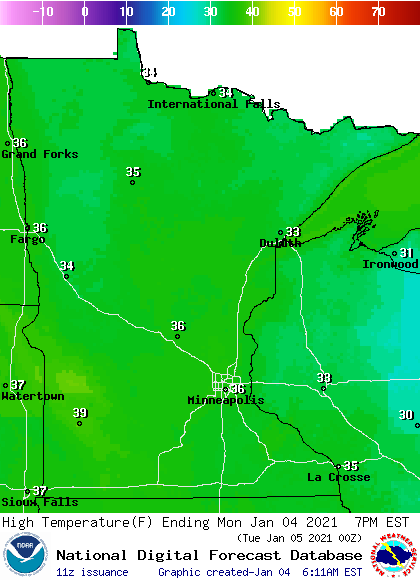
Temps rise into the 30s for almost the entire state, putting temperatures 10 to 20 degrees above average for early January, and making it the warmest day of the week for most of the state.
Turn Up Your Support
MPR News helps you turn down the noise and build shared understanding. Turn up your support for this public resource and keep trusted journalism accessible to all.
Extended forecast
Tuesday starts off with areas of freezing fog again.
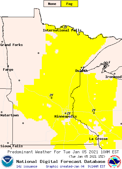
The pattern shifts enough that fog is likely less of a concern by Wednesday morning.
Part of that shift is due to a storm that moves south of Minnesota Wednesday, bringing a light snow chance across the state from Tuesday evening through Wednesday.
Moisture will be very limited, with most of the precipitation staying west of the state, although an inch or two is possible along the western edge of Minnesota, with a dusting or flurries elsewhere.
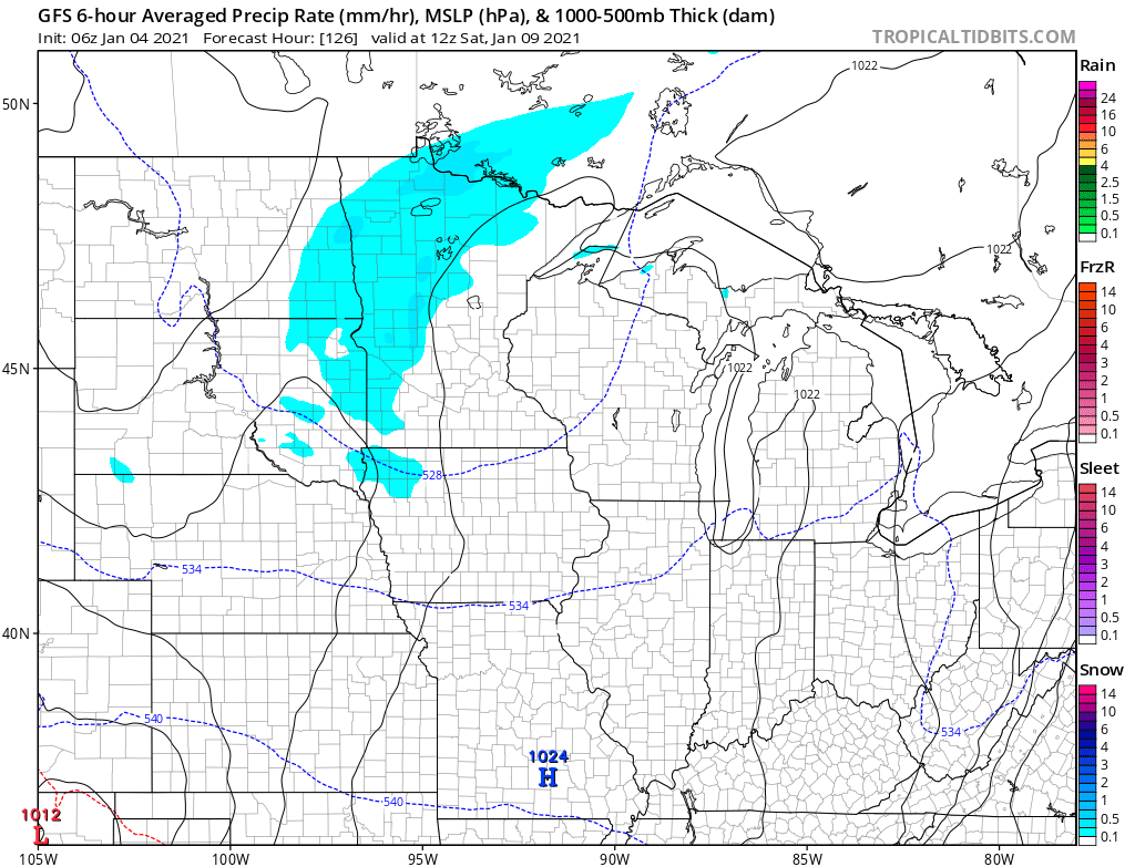
Dry skies dominate the second half of the week, with another light snow possible again on Saturday.
Although Monday will be the warmest day for most of the state, temperatures remain above average all week. Lows will be mostly in the teen, with a few 20s Tuesday and Wednesday nights under more clouds. Highs stay predominantly in the 20s, with a few more 30s expected mid week. This keeps temperatures across the state from 5 to 20 degrees above average through Saturday.
Programming note
You can hear my live weather updates on Minnesota Public Radio at 7:48 a.m. Monday through Friday morning.

