
Southwestern Minnesota gets snow Tuesday night
After record temperatures Monday, the rest of the week stays mild
Go Deeper.
Create an account or log in to save stories.
Like this?
Thanks for liking this story! We have added it to a list of your favorite stories.


Although not as mild as Monday, temperatures remain above average through the weekend. Snow chances stay slim for most of the state.
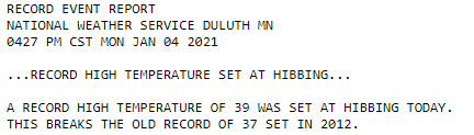
The entire state was at least 10 degrees above average Monday, with portions of central and northern Minnesota over 20 degrees above average. Many spots in central Minnesota made it into the 40s, including Brainerd at 42, which was just shy of the Jan. 4 record high of 44. International Falls was well above the average high of 15 and did tie a record by hitting 38 degrees, and Hibbing broke the previous record high by reaching 39.
Tuesday’s forecast
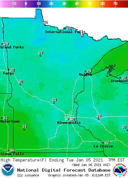
Much like the past few days, Tuesday started with areas of dense fog, especially in central Minnesota. The fog lifts by late morning, then much of the state sees mostly sunny skies through the afternoon.
Morning lows were chillier than Monday, ranging from single digits north to a couple 20s south. This was still slightly above average. Afternoon highs will also be 5 to 10 degrees above average, with the majority of Minnesota in the 20s, and a few 30s south.
Turn Up Your Support
MPR News helps you turn down the noise and build shared understanding. Turn up your support for this public resource and keep trusted journalism accessible to all.
Clouds increase in western Minnesota late Tuesday, as a storm that clips southwestern Minnesota brings light snow and possible freezing rain across that corner of the state overnight through Wednesday afternoon.
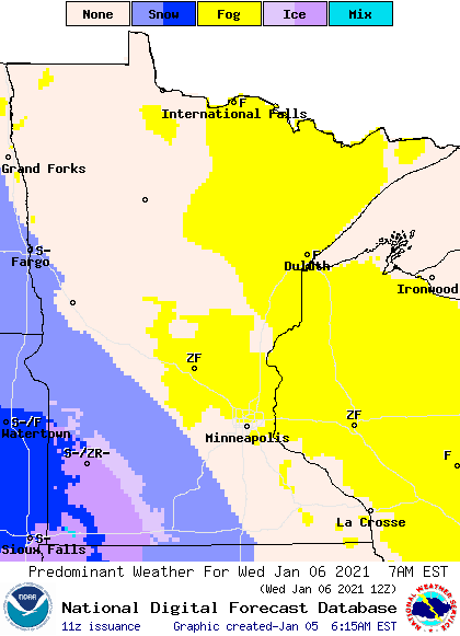
Snow accumulation is expected to stay under 2 inches. A few flurries are also possible for other parts of southern and central Minnesota.
Outside of the snow areas, morning fog is likely again Wednesday, then skies remain cloudy the rest of the day for all but northern Minnesota. Highs Wednesday stay mild in the 20s and 30s.
Extended forecast
Snow chances stay sparse after Wednesday. There is a chance for light snow Friday evening into Saturday, but at this time, it looks like that system may bring little or no snow to most of the state, with northern and western Minnesota seeing a dusting.
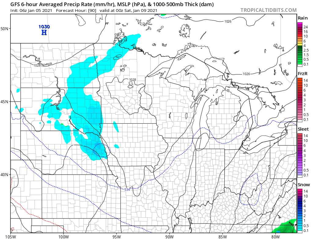
Another storm in the middle of next week currently looks similarly devoid of significant snow, but we will monitor it as it approaches.
Meanwhile, highs stay mostly above average for the next week, with the majority of Minnesota seeing 20s and occasional 30s.
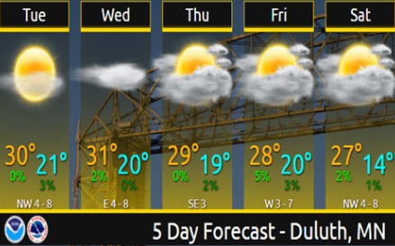
Here is that forecast for the Duluth area, where the average high and low is currently 19 and 2:
Programming note
You can hear my live weather updates on Minnesota Public Radio at 7:48 a.m. Monday through Friday morning.

