
Tuesday starts foggy, followed by afternoon sunshine
Temperatures are starting off chillier, but still above average
Go Deeper.
Create an account or log in to save stories.
Like this?
Thanks for liking this story! We have added it to a list of your favorite stories.


Tuesday brings another day of morning fog and above average afternoon temperatures, with more sunshine likely in the afternoon.
Tuesday’s forecast
Once again, like the past few days, there are areas of dense fog Tuesday morning.
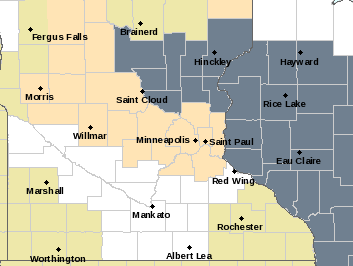
Although the thickest of it is into Wisconsin, there is a corridor of low visibilities north of the Twins Cities and into central Minnesota, prompting a dense fog advisory until 10 a.m. (highlighted in gray on the map). After the fog lifts by late morning, much of the state will see mostly sunny skies through the afternoon.
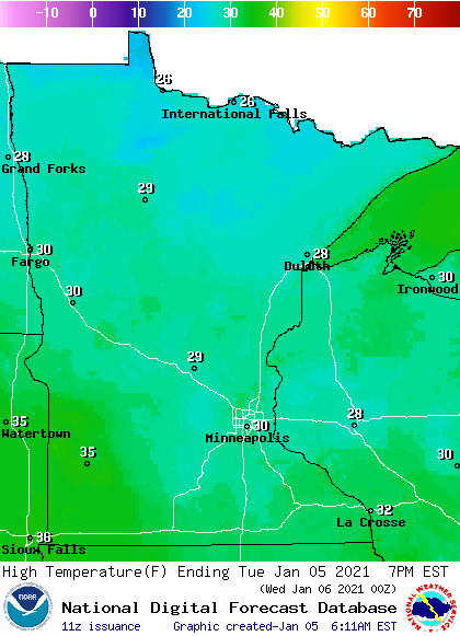
Morning lows are chillier than Monday, ranging from single-digits north to a couple 20s south. This is still slightly above average. Afternoon highs will also be 5 to 10 degrees above average, with the majority of Minnesota in the 20s, and a few 30s south.
Clouds increase in western Minnesota late Tuesday, as a storm that clips southwestern Minnesota brings light snow and possible freezing rain across that corner of the state overnight and into early Wednesday. Otherwise, snow chances stay limited the rest of the week.
That extended forecast will be updated around 9 a.m.
Programming note
You can hear my live weather updates on Minnesota Public Radio at 7:48 a.m. Monday through Friday morning.
Turn Up Your Support
MPR News helps you turn down the noise and build shared understanding. Turn up your support for this public resource and keep trusted journalism accessible to all.

